- Afrikaans
- Albanian
- Amharic
- Arabic
- Armenian
- Azerbaijani
- Basque
- Belarusian
- Bengali
- Bosnian
- Bulgarian
- Catalan
- Cebuano
- China
- Corsican
- Croatian
- Czech
- Danish
- Dutch
- English
- Esperanto
- Estonian
- Finnish
- French
- Frisian
- Galician
- Georgian
- German
- Greek
- Gujarati
- Haitian Creole
- hausa
- hawaiian
- Hebrew
- Hindi
- Miao
- Hungarian
- Icelandic
- igbo
- Indonesian
- irish
- Italian
- Japanese
- Javanese
- Kannada
- kazakh
- Khmer
- Rwandese
- Korean
- Kurdish
- Kyrgyz
- Lao
- Latin
- Latvian
- Lithuanian
- Luxembourgish
- Macedonian
- Malgashi
- Malay
- Malayalam
- Maltese
- Maori
- Marathi
- Mongolian
- Myanmar
- Nepali
- Norwegian
- Norwegian
- Occitan
- Pashto
- Persian
- Polish
- Portuguese
- Punjabi
- Romanian
- Russian
- Samoan
- Scottish Gaelic
- Serbian
- Sesotho
- Shona
- Sindhi
- Sinhala
- Slovak
- Slovenian
- Somali
- Spanish
- Sundanese
- Swahili
- Swedish
- Tagalog
- Tajik
- Tamil
- Tatar
- Telugu
- Thai
- Turkish
- Turkmen
- Ukrainian
- Urdu
- Uighur
- Uzbek
- Vietnamese
- Welsh
- Bantu
- Yiddish
- Yoruba
- Zulu
Warning: Undefined array key "array_term_id" in /home/www/wwwroot/HTML/www.exportstart.com/wp-content/themes/1371/header-lBanner.php on line 78
Warning: Trying to access array offset on value of type null in /home/www/wwwroot/HTML/www.exportstart.com/wp-content/themes/1371/header-lBanner.php on line 78
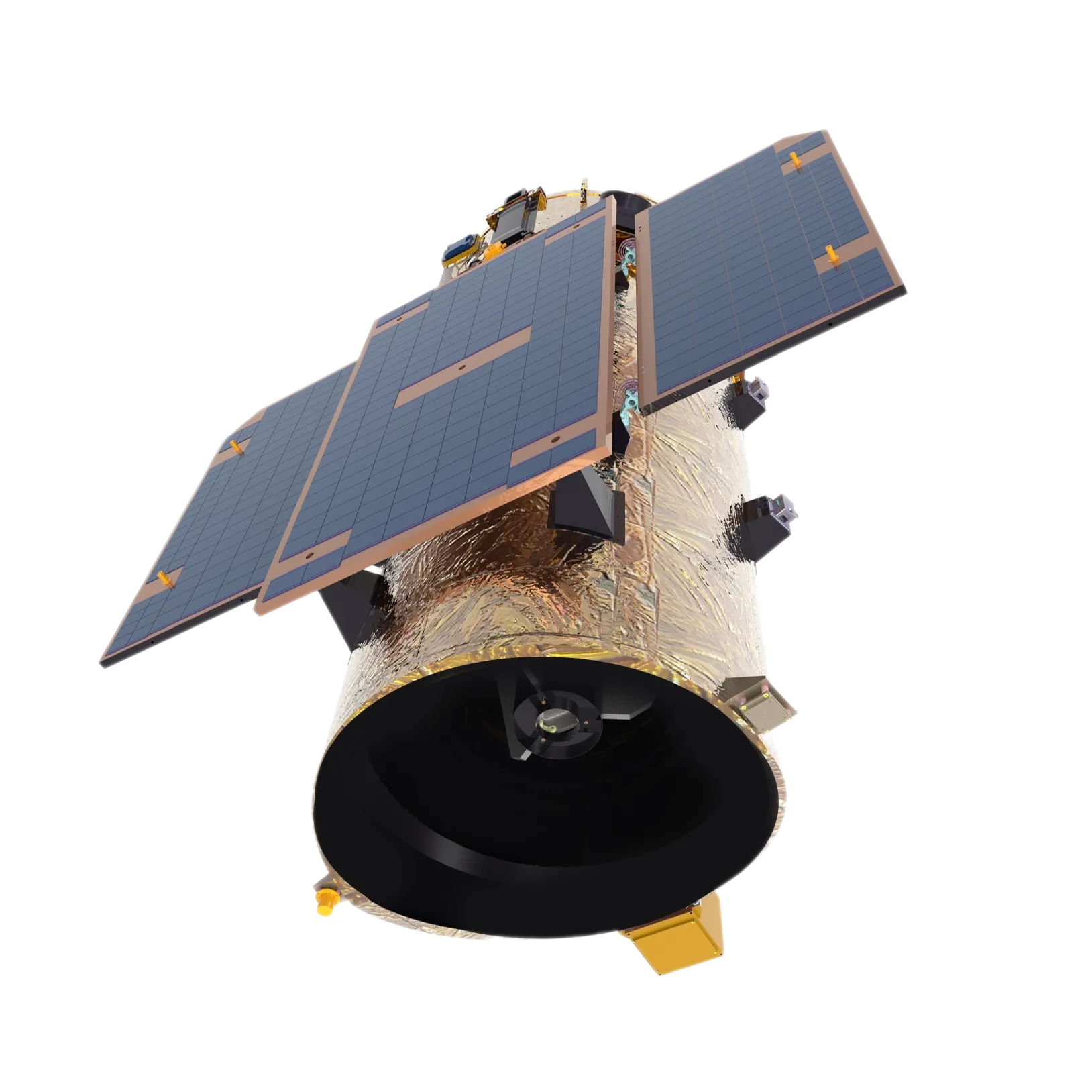
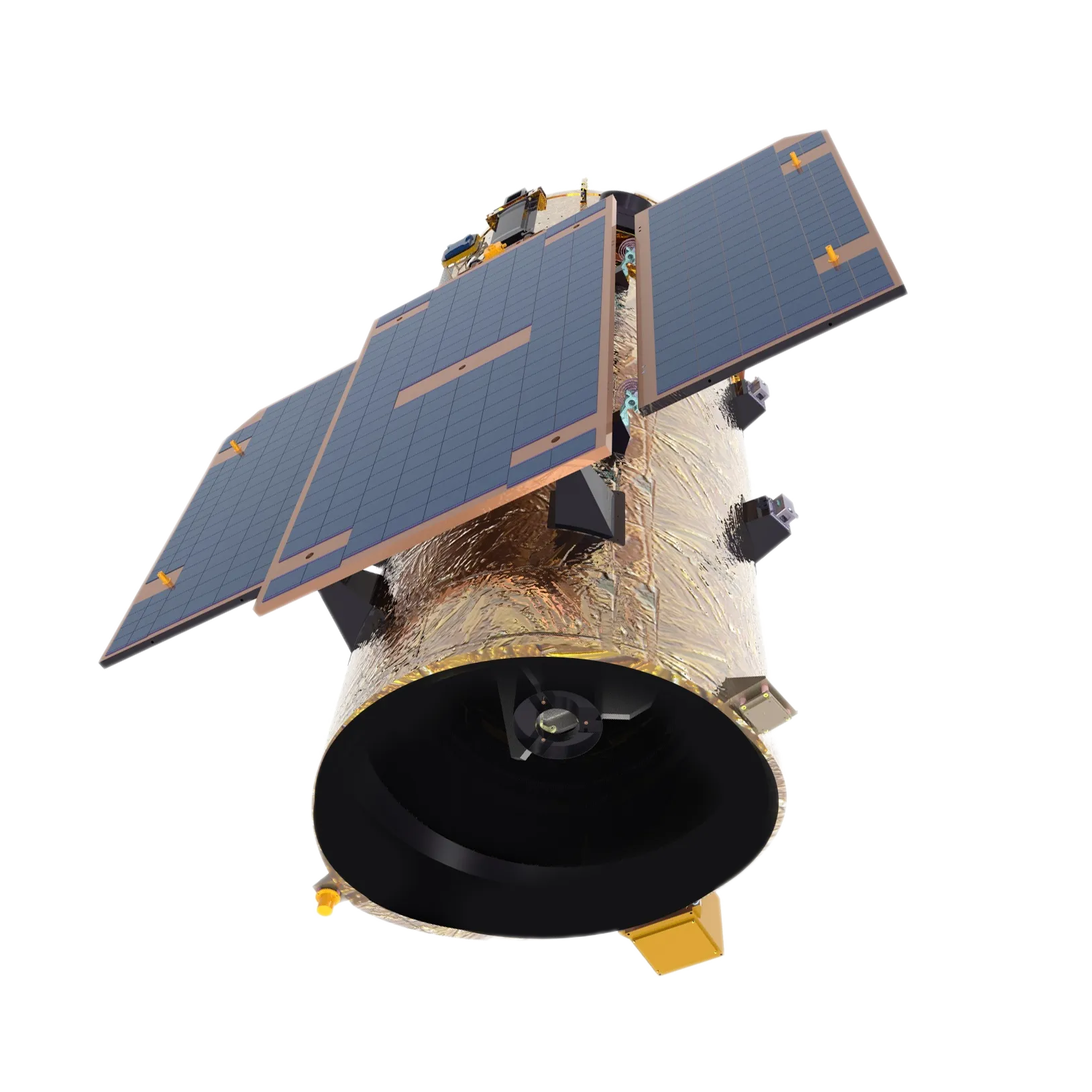
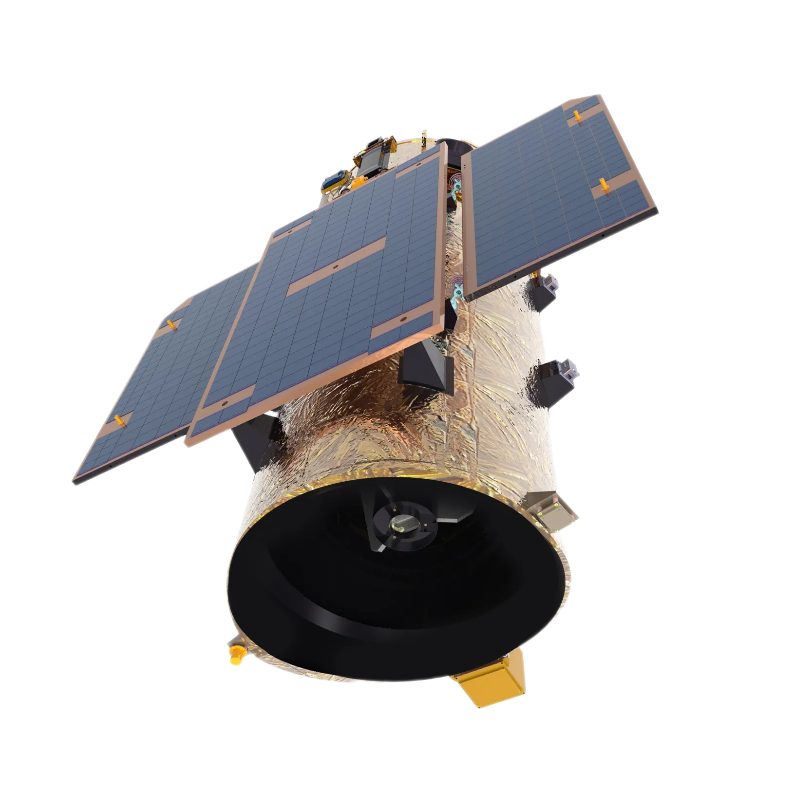
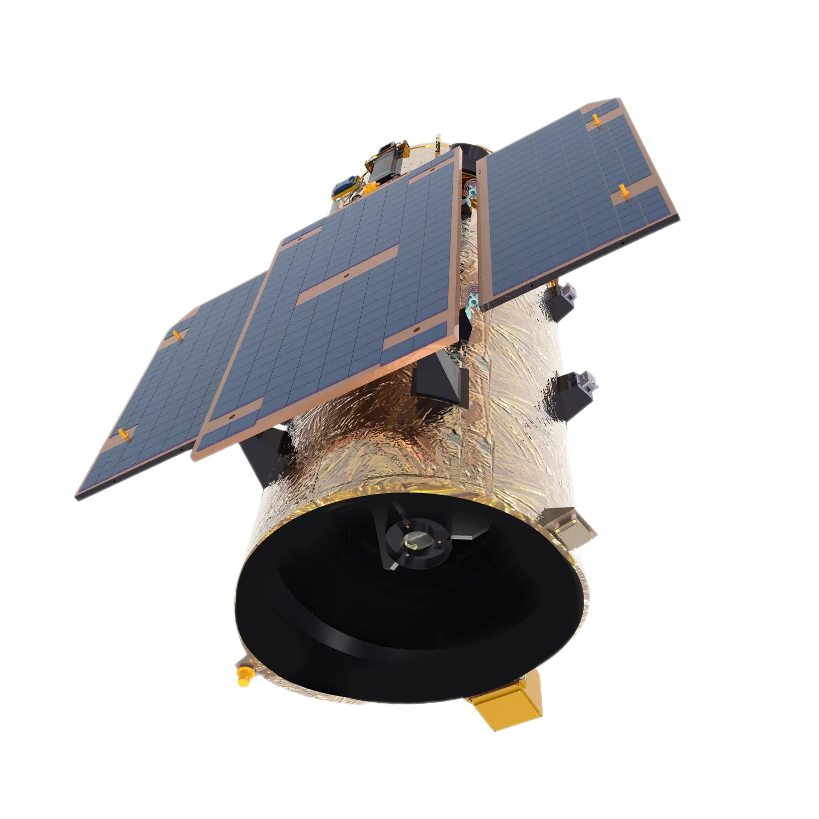
GF Series Satellites with 0.75m Resolution - SpaceNavi Co., Ltd.
GF Series Satellites with 0.75m Resolution
Discover the cutting-edge technology behind SpaceNavi Co., Ltd.'s GF Series satellites, designed for high-resolution remote sensing applications.

Introduction to the GF Series Satellites
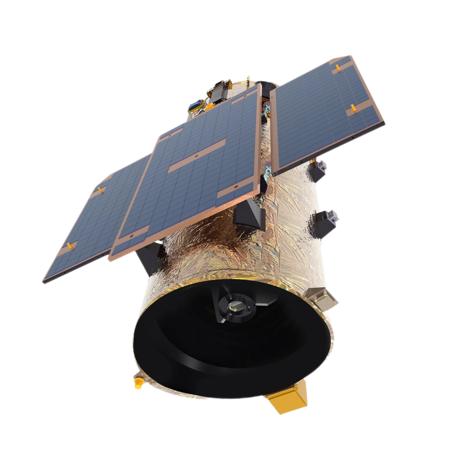
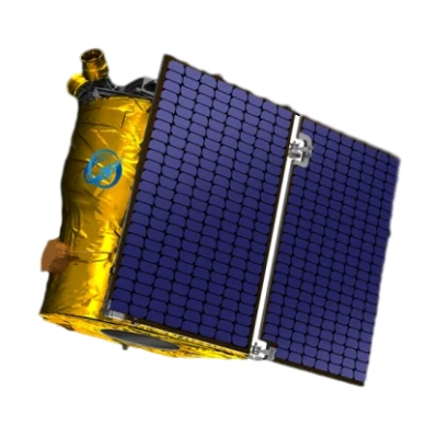
The **GF Series Satellites** with a resolution of **0.75m** represent a significant advancement in optical remote sensing technology. Developed by **SpaceNavi Co., Ltd.** (formerly Ningbo Mingji International Trading Co., Ltd.), these satellites are designed to deliver high-precision imaging for a wide range of applications, including environmental monitoring, urban planning, and disaster management. The GF Series combines lightweight design, high integration, and advanced imaging capabilities to meet the growing demand for cost-effective and efficient satellite solutions.
For more information about the GF Series, visit the official product page.
Key Features and Advantages
The GF Series satellites are engineered with **lightweight structures**, **highly integrated electronics systems**, and **high-resolution ultra-lightweight cameras**. These innovations ensure that the satellites are not only cost-effective but also energy-efficient and capable of delivering exceptional image quality. Key features include:
- Low Cost: Optimized for mass production, reducing overall operational expenses.
- Low Power Consumption: Advanced energy management systems enhance efficiency.
- Lightweight Design: Enables easier deployment and reduced launch costs.
- High Performance: Achieves 0.75m resolution, ensuring detailed and accurate data collection.
These features make the GF Series an ideal choice for both commercial and governmental applications requiring high-quality satellite imagery.
Technical Specifications
The GF Series includes several models, each tailored to specific needs. Below are the technical specifications for the **Jilin-1 GF03D**, **Jilin-1 GF02**, and **Jilin-1 GF06** satellites:
Jilin-1 GF03D
- Imaging Mode: Push-broom and inertial space imaging
- Resolution: 0.75m
- Spectral Coverage:
- Full color: 450nm–700nm
- Blue: 430nm–520nm
- Green: 520nm–610nm
- Red: 610nm–690nm
- Near-infrared: 770nm–895nm
- Swath Width (at Nadir): 17km
- Weight: ≈40kg
Jilin-1 GF02
- Imaging Mode: Push-broom and inertial space imaging
- Resolution: 0.75m
- Spectral Coverage:
- Full color: 450nm–800nm
- Blue: 450nm–510nm
- Green: 510nm–580nm
- Red: 630nm–690nm
- Near-infrared: 770nm–895nm
- Swath Width (at Nadir): 40km
- Weight: ≈200kg
Jilin-1 GF06
- Imaging Mode: Push-broom and video imaging
- Resolution: 0.75m
- Spectral Coverage:
- Panchromatic: 450nm–700nm
- Blue: 430nm–520nm
- Green: 520nm–610nm
- Red: 610nm–690nm
- Near-infrared: 770nm–895nm
- Swath Width (at Nadir): 18km
- Weight: ≈20kg
For detailed specifications, explore the GF Series product page.
Applications of GF Series Satellites
The GF Series satellites are versatile tools with applications across multiple industries. Key use cases include:
- Environmental Monitoring: Track deforestation, urban expansion, and climate change with high-resolution imagery.
- Disaster Management: Provide real-time data for flood mapping, earthquake response, and wildfire monitoring.
- Urban Planning: Support city development by analyzing infrastructure and land use patterns.
- AgriTech: Optimize crop management through soil analysis and yield prediction.
- Security and Defense: Enhance situational awareness with accurate and timely satellite data.
For more insights into how these satellites are used in various fields, visit the GF Series applications page.
Company Background: SpaceNavi Co., Ltd.
**SpaceNavi Co., Ltd.** (formerly Ningbo Mingji International Trading Co., Ltd.) is a leading provider of satellite technology and remote sensing solutions. With a focus on innovation and reliability, the company has established itself as a key player in the aerospace industry. Their GF Series satellites are a testament to their commitment to delivering high-quality, cost-effective imaging systems for global markets.
Learn more about the company at the SpaceNavi Co., Ltd. website.
Industry Standards and Compliance
The GF Series satellites adhere to rigorous industry standards to ensure reliability and performance. While specific NIST (National Institute of Standards and Technology) guidelines for satellite technology were not accessible during the research phase, NIST's role in establishing measurement and standards frameworks is critical to the aerospace industry. For example, NIST's work in satellite technology standards ensures that devices like the GF Series meet global benchmarks for accuracy and interoperability.
For more information on NIST's contributions to technology standards, visit the NIST website.
Conclusion
The **GF Series Satellites with 0.75m resolution** from **SpaceNavi Co., Ltd.** represent a leap forward in optical remote sensing technology. With their advanced features, versatility, and cost-effectiveness, these satellites are poised to revolutionize industries ranging from environmental monitoring to defense. Whether you're a researcher, urban planner, or business leader, the GF Series offers the precision and reliability needed to drive innovation and decision-making.
For inquiries or to explore partnership opportunities, contact SpaceNavi Co., Ltd. at jl1sales02@space-navi.com or call +86 13943095588.


