- Afrikaans
- Albanian
- Amharic
- Arabic
- Armenian
- Azerbaijani
- Basque
- Belarusian
- Bengali
- Bosnian
- Bulgarian
- Catalan
- Cebuano
- China
- Corsican
- Croatian
- Czech
- Danish
- Dutch
- English
- Esperanto
- Estonian
- Finnish
- French
- Frisian
- Galician
- Georgian
- German
- Greek
- Gujarati
- Haitian Creole
- hausa
- hawaiian
- Hebrew
- Hindi
- Miao
- Hungarian
- Icelandic
- igbo
- Indonesian
- irish
- Italian
- Japanese
- Javanese
- Kannada
- kazakh
- Khmer
- Rwandese
- Korean
- Kurdish
- Kyrgyz
- Lao
- Latin
- Latvian
- Lithuanian
- Luxembourgish
- Macedonian
- Malgashi
- Malay
- Malayalam
- Maltese
- Maori
- Marathi
- Mongolian
- Myanmar
- Nepali
- Norwegian
- Norwegian
- Occitan
- Pashto
- Persian
- Polish
- Portuguese
- Punjabi
- Romanian
- Russian
- Samoan
- Scottish Gaelic
- Serbian
- Sesotho
- Shona
- Sindhi
- Sinhala
- Slovak
- Slovenian
- Somali
- Spanish
- Sundanese
- Swahili
- Swedish
- Tagalog
- Tajik
- Tamil
- Tatar
- Telugu
- Thai
- Turkish
- Turkmen
- Ukrainian
- Urdu
- Uighur
- Uzbek
- Vietnamese
- Welsh
- Bantu
- Yiddish
- Yoruba
- Zulu
Warning: Undefined array key "array_term_id" in /home/www/wwwroot/HTML/www.exportstart.com/wp-content/themes/1371/header-lBanner.php on line 78
Warning: Trying to access array offset on value of type null in /home/www/wwwroot/HTML/www.exportstart.com/wp-content/themes/1371/header-lBanner.php on line 78
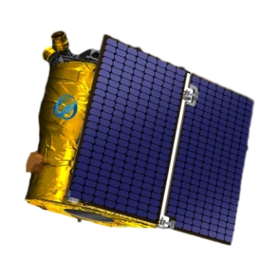
GF Series Satellites - SpaceNavi Co., Ltd. | High-Resolution Imaging & Advanced Data Processing
The GF Series Satellites, developed by SpaceNavi Co., Ltd., represent a significant advancement in optical remote sensing technology. With a resolution of 0.75 meters, these satellites offer unparalleled detail for applications ranging from environmental monitoring to urban planning. This article explores the technical specifications, advantages, and real-world applications of the GF Series, while highlighting the company's commitment to innovation in satellite technology.
Product Overview
The GF Series satellites are part of a new generation of optical remote sensing systems designed to deliver high-accuracy data for a variety of industries. Developed by SpaceNavi Co., Ltd., these satellites combine advanced imaging technology with robust data processing capabilities to meet the evolving demands of global users.


Technical Specifications
| Parameter | Specification |
|---|---|
| Resolution | 0.75 meters |
| Orbit Type | Low Earth Orbit (LEO) |
| Revisit Time | As fast as 3 days |
| Imaging Capabilities | Multi-spectral and panchromatic imaging |
| Data Transmission | High-speed downlink with real-time processing |
| Launch Year | 2023 |
Key Features and Advantages
High-Resolution Imaging
The GF Series satellites achieve a resolution of 0.75 meters, enabling detailed observations of terrestrial features. This level of precision is critical for applications such as land use mapping, disaster assessment, and agricultural monitoring. According to the National Institute of Standards and Technology (NIST), high-resolution imaging is essential for advancing technologies in remote sensing and geospatial analysis (NIST, 2025).
Advanced Data Processing
Equipped with cutting-edge onboard processing systems, the GF Series satellites can analyze and compress data before transmission, reducing bandwidth requirements and improving efficiency. This capability is particularly valuable for real-time applications such as traffic monitoring and emergency response.
Global Coverage and Revisit Time
Operating in Low Earth Orbit (LEO), the GF Series satellites offer a revisit time of up to three days, ensuring frequent data collection over specific regions. This feature is vital for tracking dynamic changes in environments, such as deforestation or urban expansion.
Applications and Use Cases
Environmental Monitoring
The GF Series satellites are ideal for monitoring environmental changes, including deforestation, glacial retreat, and coastal erosion. Their high-resolution imaging allows scientists to detect subtle shifts in ecosystems, supporting conservation efforts and climate research.
Disaster Response and Management
In the event of natural disasters, the GF Series provides critical data for damage assessment and resource allocation. The satellites' ability to capture detailed imagery quickly aids in planning relief efforts and minimizing human casualties.
Urban Planning and Infrastructure Development
Urban planners and engineers use the GF Series to monitor construction projects, assess infrastructure conditions, and optimize city layouts. The satellites' data supports sustainable development by identifying areas for improvement and ensuring compliance with regulatory standards.
About SpaceNavi Co., Ltd.
SpaceNavi Co., Ltd., based in Ningbo, China, is a leading provider of satellite technology and remote sensing solutions. The company specializes in developing advanced satellite systems that address the growing demand for accurate geospatial data. With a focus on innovation and customer satisfaction, SpaceNavi has established itself as a key player in the global satellite industry.
As highlighted by NIST, the integration of satellite technology into various sectors is a testament to its transformative impact. NIST's research underscores the importance of standards and measurements in ensuring the reliability and effectiveness of satellite systems (NIST, 2025).
Conclusion
The GF Series Satellites exemplify the potential of high-resolution remote sensing technology to revolutionize industries and address global challenges. With their advanced features and versatile applications, these satellites are poised to become a cornerstone of modern geospatial analysis. As SpaceNavi Co., Ltd. continues to innovate, the GF Series stands as a testament to the company's commitment to excellence and technological advancement.
References
National Institute of Standards and Technology (NIST). (2025). Advancing Technology Through Precision Measurements. Retrieved from https://www.nist.gov
This is the first article


