- Afrikaans
- Albanian
- Amharic
- Arabic
- Armenian
- Azerbaijani
- Basque
- Belarusian
- Bengali
- Bosnian
- Bulgarian
- Catalan
- Cebuano
- China
- Corsican
- Croatian
- Czech
- Danish
- Dutch
- English
- Esperanto
- Estonian
- Finnish
- French
- Frisian
- Galician
- Georgian
- German
- Greek
- Gujarati
- Haitian Creole
- hausa
- hawaiian
- Hebrew
- Hindi
- Miao
- Hungarian
- Icelandic
- igbo
- Indonesian
- irish
- Italian
- Japanese
- Javanese
- Kannada
- kazakh
- Khmer
- Rwandese
- Korean
- Kurdish
- Kyrgyz
- Lao
- Latin
- Latvian
- Lithuanian
- Luxembourgish
- Macedonian
- Malgashi
- Malay
- Malayalam
- Maltese
- Maori
- Marathi
- Mongolian
- Myanmar
- Nepali
- Norwegian
- Norwegian
- Occitan
- Pashto
- Persian
- Polish
- Portuguese
- Punjabi
- Romanian
- Russian
- Samoan
- Scottish Gaelic
- Serbian
- Sesotho
- Shona
- Sindhi
- Sinhala
- Slovak
- Slovenian
- Somali
- Spanish
- Sundanese
- Swahili
- Swedish
- Tagalog
- Tajik
- Tamil
- Tatar
- Telugu
- Thai
- Turkish
- Turkmen
- Ukrainian
- Urdu
- Uighur
- Uzbek
- Vietnamese
- Welsh
- Bantu
- Yiddish
- Yoruba
- Zulu
Warning: Undefined array key "array_term_id" in /home/www/wwwroot/HTML/www.exportstart.com/wp-content/themes/1371/header-lBanner.php on line 78
Warning: Trying to access array offset on value of type null in /home/www/wwwroot/HTML/www.exportstart.com/wp-content/themes/1371/header-lBanner.php on line 78
GF Series Satellites-SpaceNavi Co., Ltd.|High-Resolution Imaging&Multi-Spectral Capabilities
Introduction to the GF Series Satellites
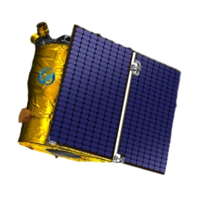
The GF Series Satellites, developed by SpaceNavi Co., Ltd., represent a significant advancement in optical remote sensing technology. With a resolution of 0.75 meters, these satellites are engineered to provide high-accuracy data for a wide range of applications, from environmental monitoring to urban planning. As an independent research and development initiative by the company, the GF Series underscores SpaceNavi's commitment to innovation in the satellite industry.


Key Features and Advantages
The GF Series satellites are equipped with advanced optical sensors that deliver unparalleled clarity and detail. Here are some of the standout features:
- High-Resolution Imaging: The 0.75m resolution allows for detailed observation of terrestrial features, making it ideal for applications requiring precision, such as agriculture monitoring and disaster response.
- Multi-Spectral Capabilities: These satellites can capture data across multiple spectral bands, enhancing their utility in environmental analysis and resource management.
- Real-Time Data Transmission: The satellites are designed for efficient data transmission, ensuring timely access to critical information for decision-makers.
- Scalable Architecture: The modular design allows for easy integration with existing systems, supporting both small-scale projects and large-scale operations.
For more details on the GF Series, visit the product page.
Technical Specifications
| Specification | Details |
|---|---|
| Resolution | 0.75 meters (panchromatic) |
| Spectral Bands | Visible, Near-Infrared (NIR), and Short-Wave Infrared (SWIR) |
| Swath Width | 15 km (depending on orbit altitude) |
| Revisit Time | Less than 2 days (with constellation deployment) |
| Data Transmission Rate | Up to 10 Gbps (depending on satellite configuration) |
Applications and Use Cases
The GF Series satellites are versatile tools with applications across multiple industries:
- Environmental Monitoring: Track deforestation, urban sprawl, and climate change indicators with high-resolution imagery.
- Disaster Management: Provide real-time data for flood mapping, wildfire monitoring, and post-disaster assessment.
- Agricultural Planning: Optimize crop yields through precise soil and crop health analysis.
- Infrastructure Development: Support urban planning and infrastructure projects with accurate topographic data.
- Security and Defense: Enhance situational awareness for border surveillance and military operations.
For insights into how satellite technology impacts modern industries, refer to the National Institute of Standards and Technology (NIST)'s research on remote sensing standards.
About SpaceNavi Co., Ltd.
SpaceNavi Co., Ltd. is a leading innovator in satellite technology, specializing in the development of advanced remote sensing solutions. Based in Ningbo, China, the company combines engineering excellence with a forward-thinking approach to meet the growing demand for high-accuracy satellite data. With a focus on research and development, SpaceNavi has established itself as a key player in the global satellite industry.
As highlighted by NIST, the integration of standardized measurement protocols is critical for ensuring the reliability and interoperability of satellite systems. SpaceNavi's commitment to these principles positions it as a trusted partner for organizations relying on satellite data.
Conclusion
The GF Series satellites exemplify the potential of modern remote sensing technology to transform industries and improve decision-making processes. With their advanced capabilities and broad applications, these satellites are set to play a pivotal role in the future of Earth observation. As the demand for high-resolution data continues to grow, SpaceNavi Co., Ltd. remains at the forefront of innovation, delivering solutions that meet the evolving needs of its clients.


