- Afrikaans
- Albanian
- Amharic
- Arabic
- Armenian
- Azerbaijani
- Basque
- Belarusian
- Bengali
- Bosnian
- Bulgarian
- Catalan
- Cebuano
- China
- Corsican
- Croatian
- Czech
- Danish
- Dutch
- English
- Esperanto
- Estonian
- Finnish
- French
- Frisian
- Galician
- Georgian
- German
- Greek
- Gujarati
- Haitian Creole
- hausa
- hawaiian
- Hebrew
- Hindi
- Miao
- Hungarian
- Icelandic
- igbo
- Indonesian
- irish
- Italian
- Japanese
- Javanese
- Kannada
- kazakh
- Khmer
- Rwandese
- Korean
- Kurdish
- Kyrgyz
- Lao
- Latin
- Latvian
- Lithuanian
- Luxembourgish
- Macedonian
- Malgashi
- Malay
- Malayalam
- Maltese
- Maori
- Marathi
- Mongolian
- Myanmar
- Nepali
- Norwegian
- Norwegian
- Occitan
- Pashto
- Persian
- Polish
- Portuguese
- Punjabi
- Romanian
- Russian
- Samoan
- Scottish Gaelic
- Serbian
- Sesotho
- Shona
- Sindhi
- Sinhala
- Slovak
- Slovenian
- Somali
- Spanish
- Sundanese
- Swahili
- Swedish
- Tagalog
- Tajik
- Tamil
- Tatar
- Telugu
- Thai
- Turkish
- Turkmen
- Ukrainian
- Urdu
- Uighur
- Uzbek
- Vietnamese
- Welsh
- Bantu
- Yiddish
- Yoruba
- Zulu
Warning: Undefined array key "array_term_id" in /home/www/wwwroot/HTML/www.exportstart.com/wp-content/themes/1371/header-lBanner.php on line 78
Warning: Trying to access array offset on value of type null in /home/www/wwwroot/HTML/www.exportstart.com/wp-content/themes/1371/header-lBanner.php on line 78
GF Series Satellites - SpaceNavi Co., Ltd.|High-Resolution Imaging&AI Data Processing
Introduction to the GF Series Satellites
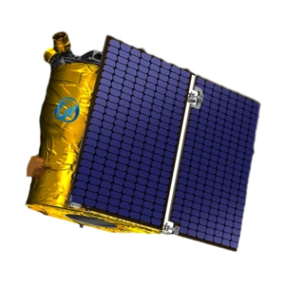
The GF Series Satellites represent a significant advancement in optical remote sensing technology. Developed by SpaceNavi Co., Ltd., these satellites are designed to deliver high-resolution imagery with a resolution of 0.75 meters, enabling precise monitoring and analysis of Earth's surface. This article provides an in-depth overview of the product's features, technical specifications, applications, and the company's background.


Product Features and Capabilities
The GF Series Satellites are equipped with cutting-edge optical sensors that provide detailed imagery for a wide range of applications. Key features include:
- High-Resolution Imaging: 0.75m resolution allows for the detection of small objects and features on the Earth's surface.
- Advanced Data Processing: Integrated artificial intelligence algorithms enhance image analysis and data interpretation.
- Multi-Spectral Capabilities: Support for multiple spectral bands enables comprehensive environmental monitoring.
- Real-Time Data Transmission: Efficient communication systems ensure timely delivery of satellite data to end-users.
These features make the GF Series Satellites ideal for applications such as urban planning, agricultural monitoring, and disaster management. For more details, visit the GF Series Satellites page.
Technical Specifications
| Specification | Details |
|---|---|
| Resolution | 0.75 meters |
| Spectral Bands | Visible, Near-Infrared (NIR), Shortwave Infrared (SWIR) |
| Orbit Type | Low Earth Orbit (LEO) |
| Revisit Time | Less than 24 hours |
| Data Transmission Rate | Up to 1 Gbps |
| Power Source | Solar panels with lithium-ion batteries |
Applications of GF Series Satellites
The versatility of the GF Series Satellites makes them suitable for various industries and sectors. Key applications include:
- Urban Planning: High-resolution imagery aids in city development, infrastructure monitoring, and land use analysis.
- Agricultural Monitoring: Multi-spectral data helps assess crop health, optimize irrigation, and predict yields.
- Environmental Protection: Continuous monitoring of forests, water bodies, and pollution levels supports conservation efforts.
- Disaster Response: Real-time data enables rapid assessment of natural disasters such as floods, wildfires, and earthquakes.
For more information on specific applications, explore the SpaceNavi Co., Ltd. website.
Company Background: SpaceNavi Co., Ltd.
SpaceNavi Co., Ltd. is a leading company in the field of satellite technology, based in Ningbo, China. With a commitment to innovation and excellence, the company specializes in developing advanced remote sensing solutions for global markets. Their expertise in satellite design, data processing, and customer support has established them as a trusted name in the industry.
SpaceNavi's mission is to provide cutting-edge satellite technology that addresses the evolving needs of various sectors. Their products, including the GF Series Satellites, are designed to meet the highest standards of performance and reliability. For more details about the company, visit the SpaceNavi Co., Ltd. website.
Industry Standards and NIST Collaboration
The development of the GF Series Satellites aligns with industry standards for remote sensing technology. According to the National Institute of Standards and Technology (NIST), "Precision and accuracy in remote sensing are critical for ensuring the reliability of data used in scientific research and commercial applications" (NIST, 2025). NIST's work in establishing measurement standards for satellite technology plays a vital role in advancing the field.
For more information on NIST's role in remote sensing standards, visit the NIST website.
Conclusion
The GF Series Satellites with 0.75m resolution are a testament to the advancements in optical remote sensing technology. With their high-resolution imaging capabilities, advanced data processing, and diverse applications, these satellites offer valuable solutions for various industries. SpaceNavi Co., Ltd. continues to innovate and provide reliable satellite technology that meets the demands of a rapidly evolving market.


