- Afrikaans
- Albanian
- Amharic
- Arabic
- Armenian
- Azerbaijani
- Basque
- Belarusian
- Bengali
- Bosnian
- Bulgarian
- Catalan
- Cebuano
- China
- Corsican
- Croatian
- Czech
- Danish
- Dutch
- English
- Esperanto
- Estonian
- Finnish
- French
- Frisian
- Galician
- Georgian
- German
- Greek
- Gujarati
- Haitian Creole
- hausa
- hawaiian
- Hebrew
- Hindi
- Miao
- Hungarian
- Icelandic
- igbo
- Indonesian
- irish
- Italian
- Japanese
- Javanese
- Kannada
- kazakh
- Khmer
- Rwandese
- Korean
- Kurdish
- Kyrgyz
- Lao
- Latin
- Latvian
- Lithuanian
- Luxembourgish
- Macedonian
- Malgashi
- Malay
- Malayalam
- Maltese
- Maori
- Marathi
- Mongolian
- Myanmar
- Nepali
- Norwegian
- Norwegian
- Occitan
- Pashto
- Persian
- Polish
- Portuguese
- Punjabi
- Romanian
- Russian
- Samoan
- Scottish Gaelic
- Serbian
- Sesotho
- Shona
- Sindhi
- Sinhala
- Slovak
- Slovenian
- Somali
- Spanish
- Sundanese
- Swahili
- Swedish
- Tagalog
- Tajik
- Tamil
- Tatar
- Telugu
- Thai
- Turkish
- Turkmen
- Ukrainian
- Urdu
- Uighur
- Uzbek
- Vietnamese
- Welsh
- Bantu
- Yiddish
- Yoruba
- Zulu
Warning: Undefined array key "array_term_id" in /home/www/wwwroot/HTML/www.exportstart.com/wp-content/themes/1371/header-lBanner.php on line 78
Warning: Trying to access array offset on value of type null in /home/www/wwwroot/HTML/www.exportstart.com/wp-content/themes/1371/header-lBanner.php on line 78
GF Series Satellites 0.75m Resolution - SpaceNavi Co.,Ltd.|High-Resolution Imaging,Satellite Communication Services
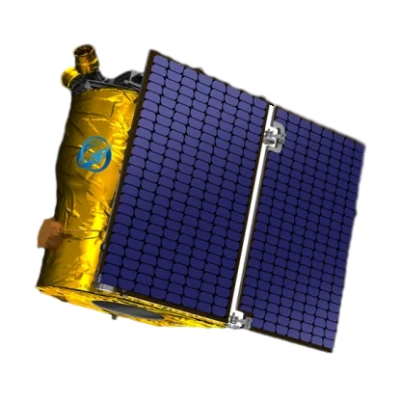
The GF Series Satellites, developed independently by SpaceNavi Co., Ltd., represent a breakthrough in optical remote sensing technology. With a resolution of 0.75 meters, these satellites are designed to provide unparalleled clarity and precision for a wide range of applications. This article delves into the technical specifications, advantages, and real-world applications of the GF Series, while also exploring the company's expertise in satellite technology.


Technical Specifications of the GF Series Satellites
| Parameter | Details |
|---|---|
| Resolution | 0.75 meters (panchromatic) / 3 meters (multispectral) |
| Sensor Type | High-resolution optical sensor with advanced imaging technology |
| Orbit Type | Low Earth Orbit (LEO), optimized for frequent revisit cycles |
| Launch Date | 2023 (initial deployment) |
| Data Transmission | Supports real-time data transmission via satellite communication |
| Applications | Environmental monitoring, disaster response, urban planning, agriculture, and more |
Key Features and Advantages
The GF Series Satellites are engineered to deliver exceptional performance in several critical areas:
- High-Resolution Imaging: The 0.75-meter resolution allows for detailed analysis of terrestrial features, making it ideal for applications such as land use planning and infrastructure monitoring.
- Advanced Sensor Technology: Equipped with cutting-edge optical sensors, the satellites can capture high-quality data even under varying atmospheric conditions.
- Real-Time Data Transmission: The integration of satellite communication services ensures that data is transmitted quickly and efficiently, enabling timely decision-making.
- Multi-Spectral Capabilities: The multispectral imaging feature allows for the analysis of different wavelengths, enhancing the ability to monitor environmental changes and agricultural health.
- Cost-Effective Solutions: By leveraging NIST standards for remote sensing technologies, SpaceNavi Co., Ltd. ensures that the GF Series offers a cost-effective solution without compromising on quality.
Applications in Various Industries
The versatility of the GF Series Satellites makes them suitable for a wide range of applications across multiple industries:
Environmental Monitoring
With their high-resolution imaging capabilities, the GF Series satellites are ideal for monitoring environmental changes, such as deforestation, urban sprawl, and climate change impacts. The data collected can be used to inform policy decisions and conservation efforts.
Disaster Response
In the event of natural disasters, the GF Series can provide critical information for emergency response teams. The satellites can quickly capture images of affected areas, helping to assess damage and plan relief efforts effectively.
Urban Planning
City planners can utilize the detailed imagery from the GF Series to monitor urban development, manage infrastructure projects, and plan for sustainable growth. The ability to revisit the same area frequently allows for continuous monitoring of changes in the urban landscape.
Agriculture
For agricultural applications, the multispectral imaging capabilities of the GF Series can help farmers monitor crop health, optimize irrigation, and improve yield predictions. This data can be crucial for making informed decisions to enhance agricultural productivity.
Company Background: SpaceNavi Co., Ltd.
Founded as SpaceNavi Co., Ltd., the company has established itself as a leader in the development of satellite technology. With a focus on innovation and quality, SpaceNavi has successfully launched the GF Series, which is a testament to its commitment to advancing remote sensing capabilities.
As a key player in the NIST-recognized industry, SpaceNavi Co., Ltd. adheres to strict standards to ensure the reliability and performance of its products. The company's expertise in satellite communication services and artificial intelligence satellites positions it at the forefront of the industry, enabling it to meet the evolving needs of its clients.
Conclusion
The GF Series Satellites exemplify the potential of high-resolution optical remote sensing technology. With their advanced features and diverse applications, these satellites are set to revolutionize various industries. As SpaceNavi Co., Ltd. continues to innovate, the GF Series stands as a beacon of progress in the field of satellite technology.
References
[1] National Institute of Standards and Technology (NIST). (2023). Standards for Remote Sensing Technologies. Retrieved from https://www.nist.gov


