- Afrikaans
- Albanian
- Amharic
- Arabic
- Armenian
- Azerbaijani
- Basque
- Belarusian
- Bengali
- Bosnian
- Bulgarian
- Catalan
- Cebuano
- China
- Corsican
- Croatian
- Czech
- Danish
- Dutch
- English
- Esperanto
- Estonian
- Finnish
- French
- Frisian
- Galician
- Georgian
- German
- Greek
- Gujarati
- Haitian Creole
- hausa
- hawaiian
- Hebrew
- Hindi
- Miao
- Hungarian
- Icelandic
- igbo
- Indonesian
- irish
- Italian
- Japanese
- Javanese
- Kannada
- kazakh
- Khmer
- Rwandese
- Korean
- Kurdish
- Kyrgyz
- Lao
- Latin
- Latvian
- Lithuanian
- Luxembourgish
- Macedonian
- Malgashi
- Malay
- Malayalam
- Maltese
- Maori
- Marathi
- Mongolian
- Myanmar
- Nepali
- Norwegian
- Norwegian
- Occitan
- Pashto
- Persian
- Polish
- Portuguese
- Punjabi
- Romanian
- Russian
- Samoan
- Scottish Gaelic
- Serbian
- Sesotho
- Shona
- Sindhi
- Sinhala
- Slovak
- Slovenian
- Somali
- Spanish
- Sundanese
- Swahili
- Swedish
- Tagalog
- Tajik
- Tamil
- Tatar
- Telugu
- Thai
- Turkish
- Turkmen
- Ukrainian
- Urdu
- Uighur
- Uzbek
- Vietnamese
- Welsh
- Bantu
- Yiddish
- Yoruba
- Zulu
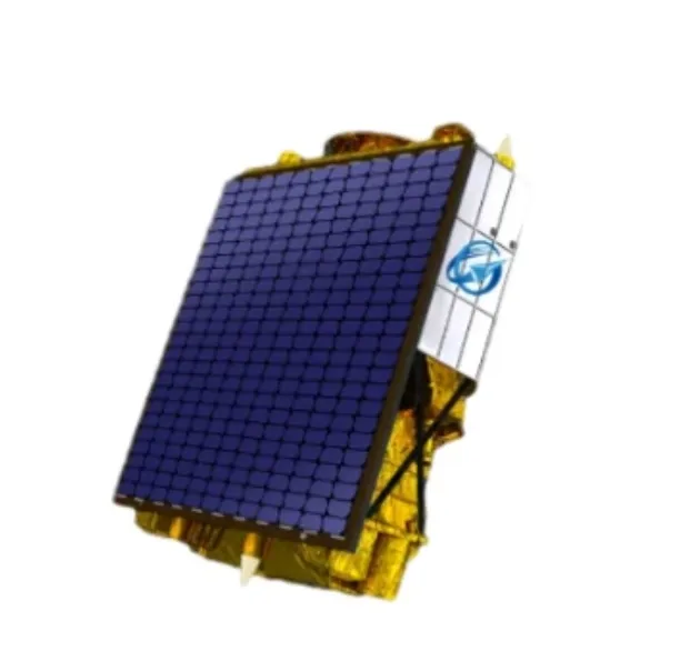
Advancing Environmental Monitoring With Multispectral Satellite Imagery
In the evolving field of remote sensing, multispectral satellite imagery has become an indispensable resource for environmental monitoring and management. These images, captured by multispectral satellites, provide detailed data across multiple spectral bands, allowing for the analysis of vegetation health, water quality, soil conditions, and more. By leveraging multi spectral satellite imagery, scientists and policymakers can make informed decisions to protect ecosystems and manage natural resources more effectively.

How Multispectral Satellite Imagery Enhances Environmental Studies
Traditional imaging captures only visible light, limiting the information available for analysis. In contrast, multispectral satellite imagery records reflected light from various parts of the electromagnetic spectrum, including near-infrared and shortwave infrared bands. This enables the detection of subtle differences in vegetation vigor, moisture content, and mineral composition.
For example, indices like NDVI (Normalized Difference Vegetation Index) are derived from multispectral satellite data to assess plant health, detect drought stress, and monitor crop development. Such capabilities are critical for sustainable agriculture and forestry management, enabling proactive interventions and optimized resource use.
Applications Of Multispectral Satellite Imagery In Water And Land Management
Water quality assessment benefits greatly from multispectral satellite imagery by identifying sediment loads, algal blooms, and pollutant distribution in lakes, rivers, and coastal zones. These insights help environmental agencies maintain safe water supplies and monitor ecological changes over time.
In land management, multi spectral satellite imagery aids in mapping land use changes, detecting deforestation, and monitoring urban expansion. This data supports urban planners, conservationists, and disaster response teams by providing timely, accurate information.
The continuous improvement in sensor technology aboard multispectral satellites is expanding these applications further, offering higher resolution and more frequent data capture.
Integration With Satellite Communication For Real-Time Data Access
The practical use of multispectral satellite imagery depends on fast and reliable data transmission, made possible by advances in satellite technology and communication infrastructure. Systems like VSAT and satellite internet enable near real-time transfer of imagery from satellites to ground stations.
Cloud-based platforms and satellite as a service solutions are increasingly popular for processing and distributing multispectral satellite data, allowing users worldwide to access and analyze imagery without heavy infrastructure investments.
In conclusion, multispectral satellite imagery is a powerful tool transforming environmental monitoring and management. By providing detailed spectral information beyond the visible range, these images enable better understanding and stewardship of natural resources. As multispectral satellite capabilities and associated communication technologies continue to advance, their impact on sustainable development and disaster mitigation will only grow stronger.
Advancing Environmental Monitoring With Multispectral Satellite Technology
The ability to observe Earth with clarity and precision has been revolutionized by the use of multispectral satellite systems. Unlike traditional imaging, which captures only visible light, multispectral satellite imagery collects data across multiple wavelengths. This advanced capability allows scientists, researchers, and industries to analyze subtle environmental changes and extract detailed information from the surface of the planet. The rise of multi spectral satellite imagery has propelled new frontiers in environmental monitoring, natural resource management, and disaster mitigation worldwide.
Understanding Multispectral Satellite Imagery
Multispectral satellite imagery involves capturing light reflected from the Earth in various spectral bands, often ranging from visible to near-infrared and sometimes shortwave infrared. These different bands highlight unique features on Earth’s surface that are invisible to the naked eye. For example, healthy vegetation strongly reflects near-infrared light, enabling precise assessments of crop health and forest conditions. Water bodies, soil types, and urban materials also have distinct spectral signatures. Thanks to these detailed datasets, multispectral satellite platforms provide a more comprehensive understanding of Earth's dynamic processes than ever before.
Applications Of Multispectral Satellite Imagery In Agriculture And Forestry
One of the most impactful uses of multi spectral satellite imagery is in agriculture. Farmers and agronomists rely on this data to monitor crop growth, detect pest infestations, and optimize irrigation schedules. Using vegetation indices derived from multispectral satellite imagery, they can identify stress in plants before it becomes visible, enabling timely intervention and reducing crop losses. Similarly, forestry management benefits from the ability to track deforestation, forest degradation, and regeneration efforts. This imagery assists in protecting biodiversity, managing timber resources, and fighting illegal logging practices effectively.
Disaster Response And Environmental Protection Using Multispectral Satellites
Multispectral satellite imagery plays a crucial role in disaster response and environmental conservation. During floods, wildfires, or hurricanes, multispectral satellite data provides timely, accurate assessments of affected areas. This information helps emergency responders allocate resources and plan relief operations efficiently. Environmental scientists use multi spectral satellite imagery to monitor pollution levels, map wetlands, and study changes in glaciers and polar ice caps. These insights are vital for addressing climate change and preserving ecosystems. The enhanced spectral data empowers governments and organizations to make informed decisions for sustainable development and disaster preparedness.
The ongoing advancements in multispectral satellite technology are expanding the scope of Earth observation, providing richer, more precise data for a wide array of applications. As satellite sensors become more sophisticated and data access improves, multispectral satellite imagery will continue to be a cornerstone for environmental science, agriculture, urban planning, and disaster management. Harnessing the power of multi spectral satellite imagery unlocks new opportunities to better understand and protect our planet in an era of rapid change.


