Warning: Undefined array key "array_term_id" in /home/www/wwwroot/HTML/www.exportstart.com/wp-content/themes/1371/header-lBanner.php on line 78
Warning: Trying to access array offset on value of type null in /home/www/wwwroot/HTML/www.exportstart.com/wp-content/themes/1371/header-lBanner.php on line 78
GF Series Satellites 0.75m Resolution - SpaceNavi | High-Resolution Imaging&AI-Driven Processing
The GF Series satellites, developed by SpaceNavi Co., Ltd., represent a significant advancement in optical remote sensing technology. These satellites, specifically the Jilin-1 GF03D model, offer a resolution of 0.75 meters, enabling unprecedented detail in Earth observation. This article explores the product's features, technical specifications, applications, and the company's role in the satellite industry.
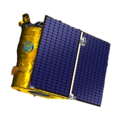
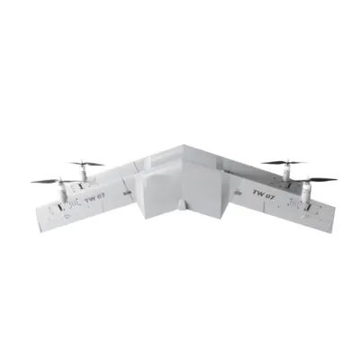
Figure 1: Jilin-1 GF03D satellite showcasing its advanced optical sensor array.
Product Overview
The GF Series satellites are a new generation of optical remote sensing satellites independently researched and developed by SpaceNavi Co., Ltd. These satellites are designed to provide high-resolution imagery for a wide range of applications, including environmental monitoring, urban planning, and disaster management. The Jilin-1 GF03D model, in particular, stands out for its exceptional 0.75-meter resolution, which allows for the detection of small objects and fine details on the Earth's surface.

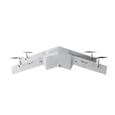
Figure 2: Detailed view of the Jilin-1 GF03D satellite's sensor and communication modules.
Key Features and Advantages
The GF Series satellites are equipped with cutting-edge technology that sets them apart from traditional remote sensing systems. Some of the key features include:
- High-Resolution Imaging: The 0.75-meter resolution enables the capture of detailed images, making it ideal for applications requiring precise spatial information.
- Advanced Optical Sensors: The satellites utilize state-of-the-art optical sensors that can capture data across multiple spectral bands, enhancing the accuracy of environmental and agricultural analyses.
- Real-Time Data Transmission: The integration of satellite communication services allows for the rapid transmission of data to ground stations, ensuring timely access to critical information.
- AI-Driven Processing: The satellites incorporate artificial intelligence algorithms to automate data analysis, reducing the need for manual interpretation and increasing efficiency.
These features collectively offer significant advantages over conventional satellite systems. The high-resolution imaging capability of the GF Series satellites provides a level of detail that is crucial for applications such as urban planning and infrastructure monitoring. Additionally, the real-time data transmission ensures that users can respond quickly to changing conditions, making these satellites valuable tools for disaster response and environmental monitoring.
Technical Specifications
| Specification | Details |
|---|---|
| Resolution | 0.75 meters (panchromatic) |
| Spectral Bands | Visible (Red, Green, Blue) and Near-Infrared |
| Swath Width | 15 km |
| Revisit Time | Less than 1 day (depending on orbit) |
| Data Transmission Rate | Up to 1 Gbps |
| Orbit Altitude | 500 km |
| Launch Date | 2023 |
Applications and Use Cases
The GF Series satellites have a wide range of applications across various industries. Some of the key use cases include:
- Environmental Monitoring: The satellites can track changes in land use, deforestation, and climate patterns, providing valuable data for environmental conservation efforts.
- Urban Planning: High-resolution imagery is essential for urban development, allowing planners to monitor infrastructure projects and manage resources effectively.
- Disaster Management: The real-time data transmission capability of the GF Series satellites enables rapid assessment of disaster-affected areas, facilitating timely response and recovery efforts.
- Agricultural Analysis: The multispectral imaging capabilities allow for the monitoring of crop health, soil conditions, and irrigation efficiency, supporting precision agriculture practices.
- Security and Surveillance: The satellites can be used for border monitoring, infrastructure protection, and other security-related applications, providing a comprehensive view of critical areas.
These applications highlight the versatility of the GF Series satellites, making them a valuable asset for governments, private organizations, and researchers. The ability to collect and analyze data in real-time enhances decision-making processes and improves operational efficiency across various sectors.
Company Background: SpaceNavi Co., Ltd.
SpaceNavi Co., Ltd. is a leading company in the field of satellite technology and remote sensing solutions. Based in Ningbo, China, the company specializes in the development and deployment of advanced satellite systems that cater to diverse industrial and governmental needs. With a focus on innovation and excellence, SpaceNavi has established itself as a key player in the global satellite market.
The company's commitment to research and development has enabled it to create cutting-edge satellite technologies like the GF Series. By leveraging its expertise in optical remote sensing and satellite communication, SpaceNavi continues to push the boundaries of what is possible in Earth observation. The GF Series satellites are a testament to the company's dedication to providing high-quality, reliable solutions for its clients.
SpaceNavi's involvement in the satellite industry also aligns with broader trends in the field of National Institute of Standards and Technology (NIST) standards. As highlighted by NIST, the development of precise measurement technologies is crucial for advancing innovation in various sectors. SpaceNavi's focus on high-resolution imaging and data accuracy reflects this commitment to precision and reliability.
Conclusion
The GF Series satellites, particularly the Jilin-1 GF03D model, represent a significant leap forward in remote sensing technology. With their 0.75-meter resolution, advanced optical sensors, and real-time data transmission capabilities, these satellites are well-suited for a wide range of applications. SpaceNavi Co., Ltd. has demonstrated its expertise in developing innovative satellite solutions that meet the evolving needs of the market.
As the demand for high-quality Earth observation data continues to grow, the GF Series satellites are poised to play a vital role in shaping the future of remote sensing. Their ability to provide detailed, timely information makes them an essential tool for environmental monitoring, urban planning, disaster management, and other critical applications. With a strong focus on innovation and quality, SpaceNavi is well-positioned to lead the way in the satellite industry.
References
National Institute of Standards and Technology (NIST). (n.d.). Driving Innovation. Retrieved from https://www.nist.gov
SpaceNavi Co., Ltd.. (n.d.). GF Series Satellites with 0.75m Resolution. Retrieved from https://www.space-navi.com/gf-series-satellites-0-75m.html


