- African
- ChiAlbanian
- ChiAmharic
- ChiArabic
- ChiArmenian
- Azerbaijani
- ChiBasque
- Chiberaruzi
- ChiBengali
- ChiBosnian
- ChiBulgarian
- Katarani
- Cebuano
- China
- Kosikeni
- ChiCroatian
- ChiCzech
- ChiDanish
- ChiDutch
- Chirungu
- Esiperando
- ChiEstonian
- ChiFinish
- ChiFrench
- Frisian
- ChiGalician
- ChiGeorgian
- ChiJerimani
- ChiGiriki
- ChiGujarati
- Kiriyoro yeHaiti
- ChiHausa
- Chihawayi
- ChiHebhuru
- Aihwa
- Miao
- ChiHungarian
- ChiIcelandic
- igbo
- ChiIndonesian
- ChiIrish
- ChiItalian
- ChiJapanese
- ChiJavanese
- ChiKannada
- Kazaki
- Khmer
- Rwandan
- ChiKorean
- ChiKedhi
- Kiyagizi
- Basa
- Ratini
- ChiLatvian
- Ritunia
- Rukusembogi
- ChiMacedonian
- Malagasy
- ChiMalay
- ChiMalayalam
- ChiMaltese
- Maori
- ChiMarati
- ChiMongoria
- Mayanima
- ChiNepali
- ChiNorwegian
- ChiNorwegian
- Occitan
- Pashito
- ChiPersian
- ChiPolish
- ChiPutukezi
- Punjabi
- ChiRomanian
- ChiRussian
- Samoan
- ChiGaelic cheScottish
- ChiSebhiya
- Chirungu
- Shona
- ChiSindhi
- Sinhala
- ChiSlovak
- ChiSlovanian
- Somari
- ChiSpanish
- Sundanese
- ChiSwahili
- ChiSwedish
- ChiTagalog
- Tajik
- ChiTamil
- Tatar
- ChiTelugu
- ChiThai
- Turkish
- ChiTeki
- Ukrainian
- Urdu
- Uighur
- Uzbek
- Vietnamese
- Welsh
- Help
- Yiddish
- Yoruba
- Zulu
R&D
R&D Level
(1) Remote Sensing Satellite
In terms of satellite R&D, in accordance with the judgment of satellite technology development trend and commercial development mode, the core technical team has broken through the traditional design concept and adopted the technical route of "satellite platform and load integration". After four times of progress in ten years, the weight of the satellite has been reduced to 20kg from 400kg of the initial generation.

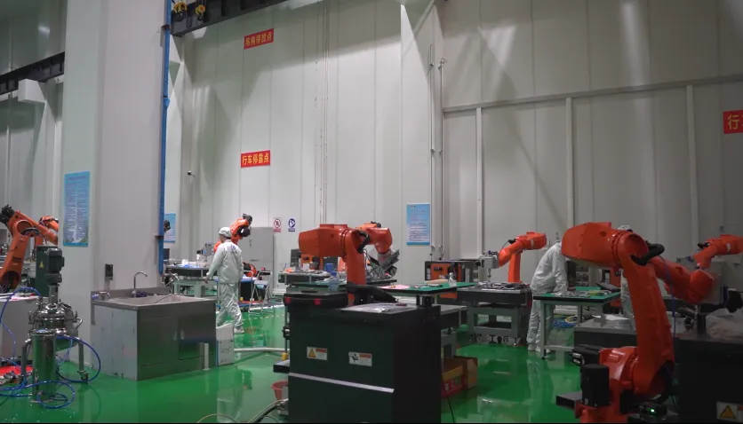
At present, SpaceNavi has an annual output of more than 200 satellites, and has achieved self-developed mass production of core single machines, including magnetic torquer, magnetometer, central computer, star sensor and imaging processing box, etc., and gradually formed a whole industrial chain cluster with satellite R&D and production as the core.

(2) Kukurukurirana Satellite
Iine yakura tekinoroji hwaro musetiraiti R&D, kubvira 2019, SpaceNavi yaita uye nekubudirira kupedza akati wandei ezvekutaurirana setiraiti R&D mabasa. Parizvino, SpaceNavi yave mutengesi akakosha weChina Satellite Network mukutaurirana setiraiti R&D. Ikozvino, CGSTL irikushingairira kuronga kuvaka tambo yekutaurirana setiraiti yekugadzira. Kusvika pari zvino, yakatanga kugadzira gore negore R&D kugona kwemasatelliti zana ekutaurirana.
Pamusoro pezvo, SpaceNavi yapedza R&D yesatellite-to-ground laser terminal, inter-satellite laser terminal uye pasi laser station, yakapedza chirongwa chese chekuyedza satellite-to-ground uye inter-satellite 100Gbps laser data transmission, uye yakamisa nzvimbo yakakwirira-speed laser data transmission network test system.
(3) Satellite Constellation Management
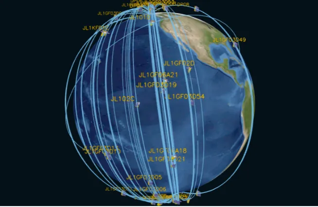
SpaceNavi yakavaka otomatiki dhijitari satellite nyeredzi mashandiro ekudzora system, ichiziva otomatiki setiraiti kushanda, chinodiwa, data kugadzira interface uye kugovera, uye ine yakazara kugona kwe telecontrol telemetry uye satellite kushanda. Dhata yemifananidzo yeachangopfuura mamirioni gumi emakiromita emakiromita anogona kuwanikwa zuva rega rega, uye zuva nezuva mabasa ekufungidzira enguva 1,700 anogona kupedzwa. Iyo nguva yekutumira isingasviki miniti imwe, iyo yemazuva ese yedhijitari yekufambisa mabasa inogona kuita mazana matatu madenderedzwa. Muzuva, chero nzvimbo pasi rose inogona kushanyirwa ka37-39 pazuva, uye SpaceNavi inokwanisa kufukidza nyika yese katanhatu pagore uye kuvhara China yese hafu yemwedzi.
(4) Data Chigadzirwa
Relying on "Jilin-1" satellite constellation, SpaceNavi has gradually established a mature product system: The first is basic data product of 6 categories, including panchromatic data, multispectral data, nighttime light data, video data, spatial target data and DSM data; The second is thematic product of 9 categories in the fields of agriculture and forestry production, environmental monitoring and intelligent city, etc.; The third is platform product of 20 categories, including data access system, earth remote sensing emergency service system and remote sensing monitoring and supervision, etc. SpaceNavi is committed to "serving 7 billion people in the world with remote integrated space-air-ground sensing information products", and has successively provided more than 1 million high-quality remote sensing information services to users in more than 70 countries.

Mamiriro Okugadzira
(1)Optical Processing Area
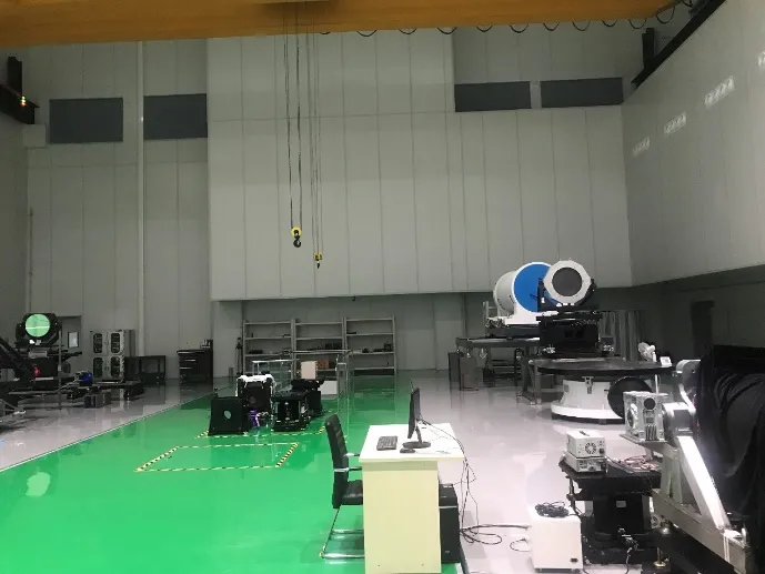
Nzvimbo yese yenzvimbo yekutarisa yemaziso ndeye 10000m2. Iyi nzvimbo inokwanisa kuita kugadzirwa kwehuwandu hwepamusoro-chaiyo optical components, uye inokwanisa kugadzirisa optical components yakagadzirwa negirazi ceramics nesilicon carbide, nezvimwewo kubva kune yakakora kusvika kune yakatsetseka, pamwe chete nekuona kunoenderana.
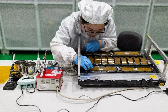
(2)Kamera Gungano Uye Kugadzirisa Nzvimbo
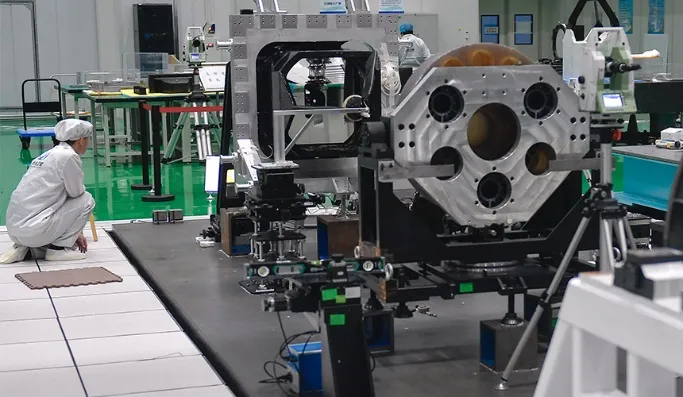
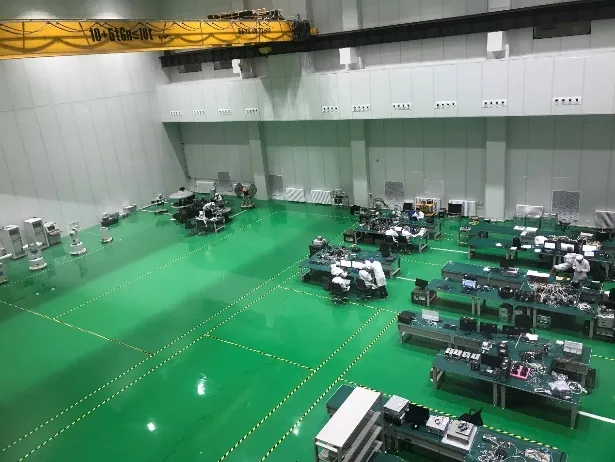
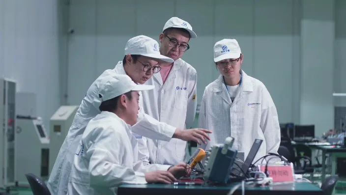
Iyo yakazara nzvimbo yekusangana kwekamera uye nzvimbo yekugadzirisa ndeye 1,800m2. Pano, kuongororwazve kwekamera optical zvikamu zvisati zvasangana uye kugadzirisa, kusangana kwemaziso, kutumwa uye kuyedzwa kwekamera system kunoitwa. Iyi nharaunda ine kugona kwediki batch kugadzirwa kwemadiki uye epakati-saizi optical kamera.
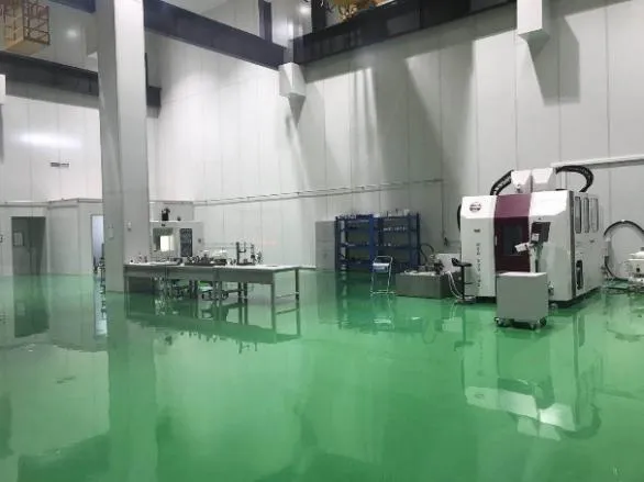
(3) Satellite Final Gungano Nzvimbo
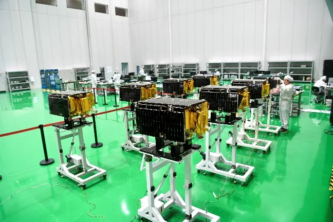
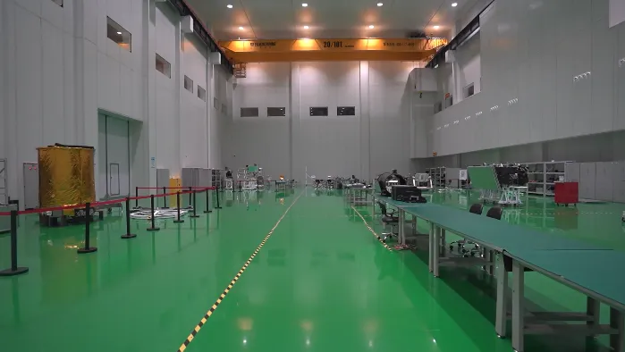
Iyo yakazara nzvimbo yesetiraiti yekupedzisira gungano nzvimbo ndeye 4,500m2. Iyi nharaunda inokwanisa kuzadzisa zvinodikanwa zvekusangana kwekupedzisira kwemasatelliti.
(4)Satellite Test Area
Nzvimbo yese yenzvimbo yekuyedza setiraiti ndeye 560m2. Pano, bvunzo yemuchina mumwe chete, bvunzo yesystem, yese satellite desktop musanganiswa bvunzo uye modhi yekubhururuka bvunzo inogona kuitwa. Iyi nharaunda inokwanisa kuyedza anopfuura gumi masetelliti synchronously.
(5)Kamera Radiometric Calibration Area
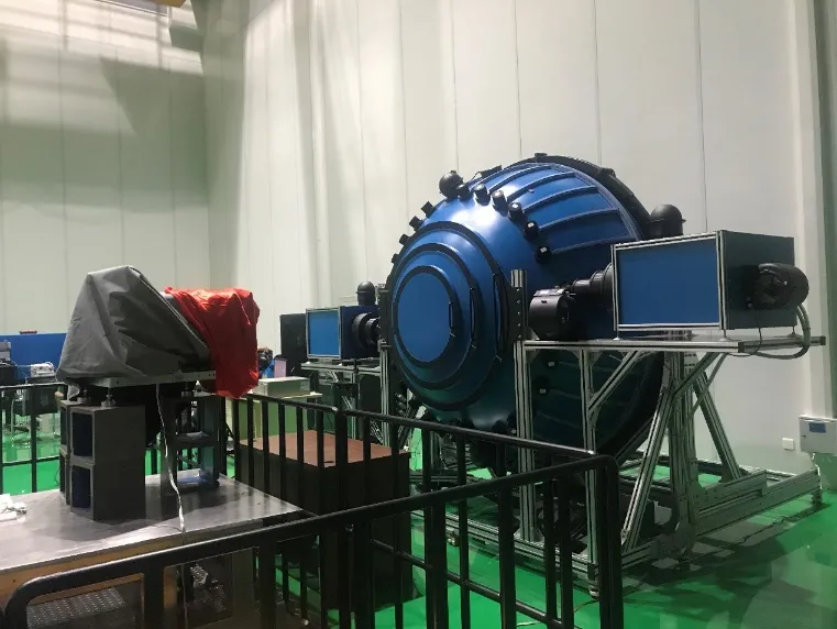
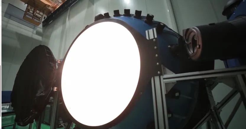
Nzvimbo yekamera radiometric calibration nzvimbo ndeye 500m2. Pano, radiometric calibration mabasa eaerospace kamera uye kuzorora uye kutariswa kweakakodzera focal ndege detector machipisi anogona kuitwa.
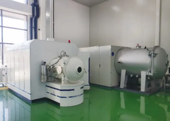
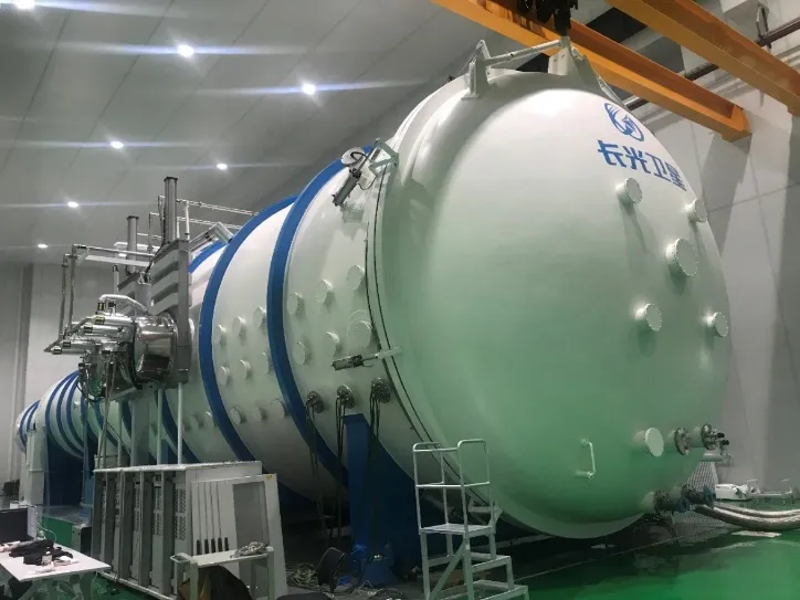
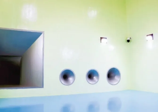
(6)Environmental Test Area
Iyo yakazara nzvimbo yenzvimbo yekuyedza nharaunda i10,000m2, Miedzo yezvakatipoteredza, inosanganisira vibration test, modal test, atmospheric thermal cycle test, vacuum thermal cycle test, thermal balance test, thermo-optical test, noise test, strain test uye micro-vibration test, nezvimwewo panguva yekugadzirwa kwemasatelliti uye zvikamu zvinogona kuitwa.
-
Environmental Test Area
-
Environmental Test Area
