- ʻApelika
- Alapania
- Amahapika
- Apapika
- Ameniana
- Azerbaijani
- Pōkē
- ʻŌlelo Belarusa
- Penekali
- Ponia
- Pukalia
- ʻŌlelo Katalonia
- Cebuano
- Kina
- ʻŌlelo Kokia
- Koalia
- Keka
- Kenemaka
- Hōlani
- Pelekania
- ʻŌlelo Esperanto
- Ekekonia
- Pinilana
- Palani
- Frisian
- Kalikia
- Keokia
- Alemania
- Helene
- Kuhalaki
- ʻŌlelo Haiki
- Hauka
- ʻŌlelo Hawaiʻi
- Hepela
- ʻAʻole
- Miao
- Hunakalia
- ʻĀinahau
- igbo
- ʻInikonia
- Ipelana
- Ikalia
- Kepanī
- Kawanī
- Kanākā
- ʻŌlelo Kazaka
- Khmer
- Rwandan
- Kolea
- ʻŌlelo Kurdish
- ʻŌlelo Kyrgyz
- hana hana
- ʻŌlelo Lākni
- Lakiwiana
- ʻŌlelo Lituania
- ʻŌlelo Lukemapuka
- Makekoni
- Malagasy
- Mālei
- Mālealama
- Malkī
- ʻŌlelo Māori
- Malapi
- ʻŌlelo Monokolia
- Maianamara
- Nepali
- Nolewai
- Nolewai
- ʻOkitana
- ʻŌlelo Pashto
- Pelekia
- Pōlani
- Pukikī
- ʻŌlelo Punajabi
- Lomānia
- Lukia
- Sāmoa
- Gaelika Sekotia
- ʻŌlelo Serbia
- Pelekania
- Shona
- Kiniki
- Sinhala
- Kolowakia
- Kolewenia
- ʻŌlelo Somalia
- Kepania
- Sundana
- Kawahili
- Kuekene
- Kakalo
- Tajika
- Kamili
- Tatar
- Keluku
- Kailani
- Tureke
- ʻŌlelo Kuleke
- Ukrainian
- Urdu
- Uighur
- ʻUzbek
- Vietnamese
- Welsh
- Kokua
- Yiddish
- Yoruba
- Zulu
R&K
Papa R&D
(1)Satellite Sensing mamao
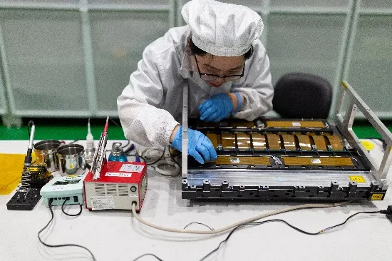
In terms of satellite R&D, in accordance with the judgment of satellite technology development trend and commercial development mode, the core technical team has broken through the traditional design concept and adopted the technical route of "kahua ukali and load integration". After four times of progress in ten years, the weight of the satellite has been reduced to 20kg from 400kg of the initial generation.

At present, SpaceNavi has an annual output of more than 200 satellites, and has achieved self-developed mass production of core single machines, including magnetic torquer, magnetometer, central computer, star sensor and imaging processing box, etc., and gradually formed a whole industrial chain cluster with satellite R&D and production as the core.

(2)Satellite kamaʻilio
Me ka hoʻokumu ʻenehana makua i ka satellite R&D, mai ka makahiki 2019, ua hoʻokō ʻo SpaceNavi a hoʻopau maikaʻi i kekahi mau hana R&D pili aupuni. I kēia manawa, ua lilo ʻo SpaceNavi i mea hoʻolako koʻikoʻi o China Satellite Network i ka R&D satellite kamaʻilio. I kēia manawa, ke hoʻolālā nei ʻo CGSTL i ke kūkulu ʻana i kahi laina hana satellite kamaʻilio. I kēia manawa, ua hoʻomohala mua ʻo ia i kahi mana R&D makahiki o 100 mau ukali kamaʻilio.
Eia kekahi, ua hoʻopau ʻo SpaceNavi i ka R&D o ka satellite-a-ground laser terminal, inter-satellite laser terminal a me ka honua laser station, ua hoʻopau i ke kaʻina hana holoʻokoʻa o ka satellite-to-ground a me ka inter-satellite 100Gbps laser data transmission, a ua hoʻokumu i kahi kikowaena kiʻekiʻe kiʻekiʻe.
(3)Ka hoʻokele hoʻokele hōkū
Ua kūkulu ʻo SpaceNavi i kahi ʻōnaehana hoʻokele hoʻokele hoʻokele kikohoʻe kikohoʻe, e ʻike ana i ka hana ukali, koi ʻia, hoʻoili ʻikepili a me ka hāʻawi ʻana, a loaʻa iā ia ka mana piha o ka telecontrol telemetry a me ka hana ukali. Hiki ke loaʻa ka ʻikepili kiʻi o 10 miliona mau kilomika square i kēlā me kēia lā, a hiki ke hoʻopau ʻia nā hana kiʻi i kēlā me kēia lā o 1,700 mau manawa. ʻO ka manawa hoʻouna ma lalo o 1 mau minuke, hiki i nā hana hoʻoili uila i kēlā me kēia lā ke 300 pōʻai. I ka lā, hiki ke kipa ʻia nā wahi āpau o ka honua no 37-39 mau manawa i ka lā, a hiki iā SpaceNavi ke uhi i ka honua holoʻokoʻa i 6 mau manawa i ka makahiki a uhi iā Kina holoʻokoʻa i kēlā me kēia hapalua mahina.
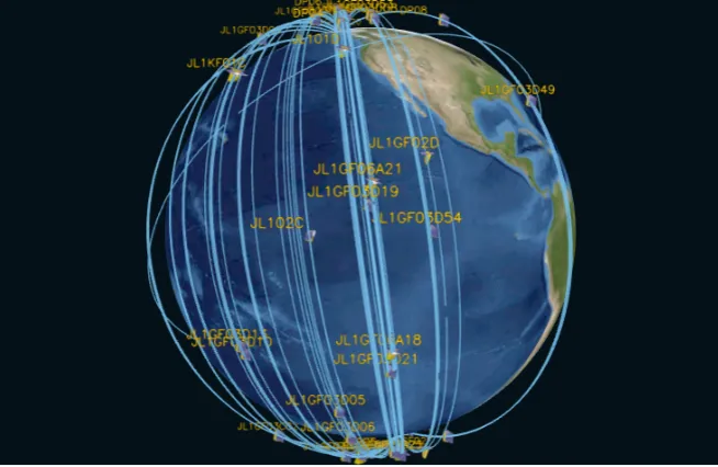
(4) Huahana ʻIkepili
Relying on "Jilin-1" satellite constellation, SpaceNavi has gradually established a mature product system: The first is basic data product of 6 categories, including panchromatic data, multispectral data, nighttime light data, video data, spatial target data and DSM data; The second is thematic product of 9 categories in the fields of agriculture and forestry production, environmental monitoring and intelligent city, etc.; The third is platform product of 20 categories, including data access system, earth remote sensing emergency service system and remote sensing monitoring and supervision, etc. SpaceNavi is committed to "serving 7 billion people in the world with remote integrated space-air-ground sensing information products", and has successively provided more than 1 million high-quality remote sensing information services to users in more than 70 countries.

Nā Kūlana Hana
(1) Wahi Hoʻoponopono Optical
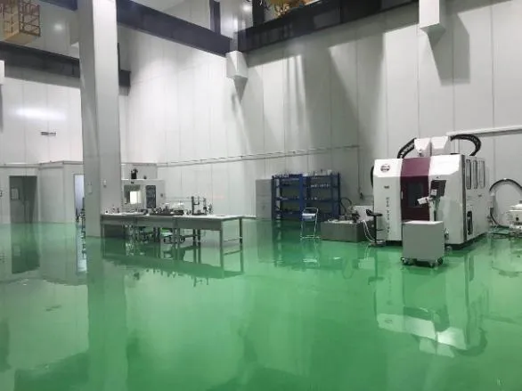
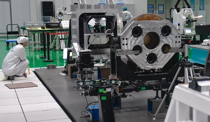
ʻO 10000m ka nui o ka ʻāpana o ka ʻāpana hana optical2. Hiki i kēia wahi ke hana i ka hana nui o nā ʻāpana optical kiʻekiʻe, a loaʻa iā ia ka hiki ke hana i nā ʻāpana optical i hana ʻia me nā ceramics aniani a me ka silicon carbide, a me nā mea ʻē aʻe mai ke koʻikoʻi a i ka maikaʻi, a me ka ʻike pili.
(2) Hui Pū ʻIa a me ka wahi hoʻoponopono
ʻO 1,800m ka nui o ka ʻāpana o ka hui kamera a me ka hoʻoponopono2. Ma ʻaneʻi, e hoʻāʻo hou i nā ʻāpana optical kamera ma mua o ka hui ʻana a me ka hoʻoponopono ʻana, mālama ʻia ka hui optical, hoʻokō a me ka hoʻāʻo ʻana i ka ʻōnaehana kamera. Loaʻa i kēia wahi ka hiki ke hana i nā pahu liʻiliʻi o nā kiʻi kamepiula liʻiliʻi a me ka nui.
(3)Wāhi Hōʻuluʻulu Manaʻo Satellite
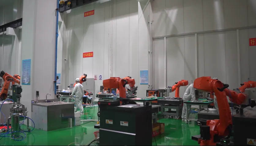
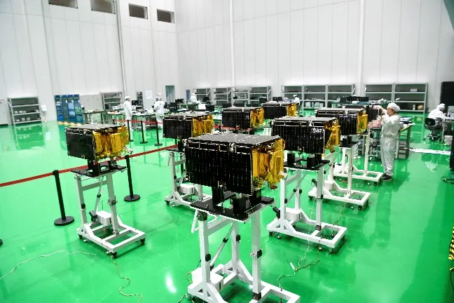
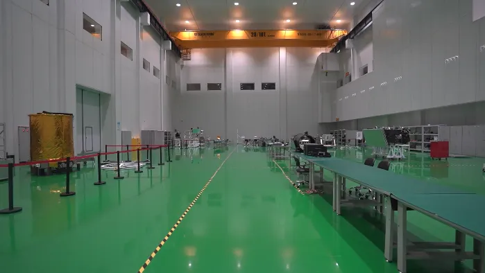
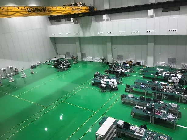
ʻO 4,500m ka nui o ka ʻāpana o ka ʻāpana hui hope2. Hiki i kēia wahi ke hoʻokō i nā koi o ka hui hope loa o nā satelite.
(4) Wahi Ho'āʻo Satellite
ʻO 560m ka huina o ka wahi hoʻāʻo satellite2. Ma ʻaneʻi, hiki ke hoʻokō ʻia ka hoʻāʻo ʻana o ka mīkini hoʻokahi, ka hoʻāʻo ʻōnaehana, ka hoʻāʻo hui ʻana o ka satellite holoʻokoʻa a me ka hoʻāʻo lele hoʻohālike. Hiki i kēia wahi ke hoʻāʻo ma mua o 10 mau satelite i ka manawa like.
(5) Kamelika Radiometric Calibration Area
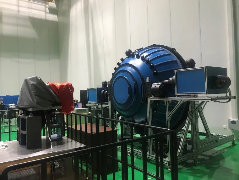
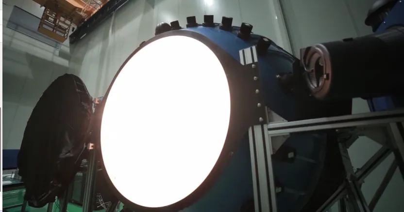
ʻO 500m ka ʻāpana o ke kāʻei radiometric calibration2. Ma ʻaneʻi, hiki ke hoʻokō ʻia nā hana hoʻoponopono radiometric o ka pahu kiʻi aerospace a me ka hoʻomaha a me ka nānā ʻana i nā pahu ʻike kikoʻī kikoʻī kūpono.
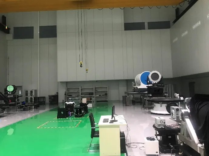
(6) Wahi Ho'āʻo Kaiapuni
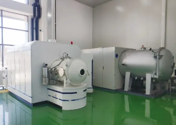
ʻO 10,000m ka huina o ka wahi hoʻāʻo kaiapuni2, Nā ho'āʻo kaiapuni, e like me ka vibration test, modal test, atmospheric thermal cycle test, vacuum thermal cycle test, thermal balance test, thermo-optical test, noise test, strain test and micro-vibration test, etc.
-
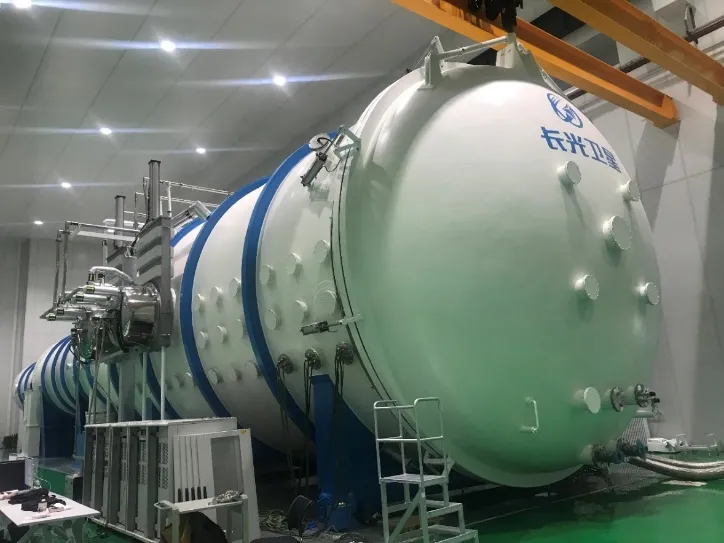
Wahi Hoao Kaiapuni
-
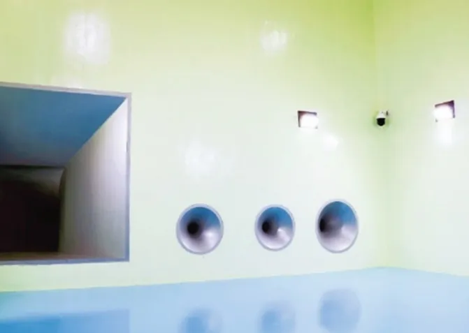
Wahi Hoao Kaiapuni
