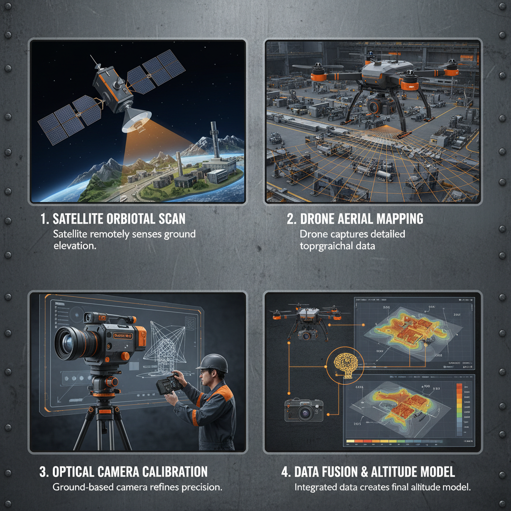
The global demand for precise earth observation has led to the rapid evolution of various types of remote sensing satellites. These orbiting platforms serve as the eyes of humanity, providing critical data that enable us to monitor environmental changes, manage natural resources, and ensure global security from a vantage point unreachable by terrestrial means.
From the perspective of aerospace engineering, the efficacy of these systems depends heavily on the integration of high-performance onboard electronics and robust structural components. The ability to capture high-resolution imagery or precise spectral data requires a sophisticated synergy between the sensor payload and the central processing unit, which manages the complex operations of the spacecraft.
Understanding the different types of remote sensing satellites is essential for stakeholders in the agriculture, defense, and climate science sectors to choose the right data source for their specific operational needs.
The Technical Architecture of Remote Sensing Systems
The architectural foundation of remote sensing systems relies on a sophisticated blend of hardware that can survive the vacuum and radiation of space. At the core of these systems is the spacecraft bus, which provides power, thermal control, and communication links, allowing the specialized remote sensing instruments to function optimally regardless of the orbital position.
For instance, the central computer acts as the primary coordinator, processing sensor data and managing the orientation of the satellite. With a main frequency of 100MHz and memory capacity of 8MB, components like the CG-DJ-OBC-L484S(D) ensure that data throughput remains stable, enabling the satellite to execute complex imaging sequences with high precision.
Categorization by Sensor Technology and Data Acquisition
Remote sensing satellites are primarily categorized by the type of energy they detect. Passive sensors, such as optical cameras, rely on reflected sunlight or emitted thermal radiation from the Earth's surface. These are widely used for mapping land cover and monitoring vegetation health through multispectral imaging.
Active sensors, on the other hand, emit their own energy pulses to probe the target. Synthetic Aperture Radar (SAR) is a prime example, allowing satellites to "see" through clouds and darkness, making them indispensable for maritime surveillance and disaster monitoring where optical visibility is compromised.
Beyond these, there are hyperspectral satellites that capture hundreds of narrow spectral bands. This allows for the precise identification of mineral deposits or specific chemical signatures in the atmosphere, providing a level of detail far beyond standard RGB imaging.
The Role of Central Computers in Satellite Operations
The operational success of various types of remote sensing satellites depends on the reliability of the On-Board Computer (OBC). This component manages the critical interface between the ground station commands and the satellite's actuators, ensuring that the sensor points exactly where it needs to for every capture.
Specifically, a high-performance central computer like the CG-DJ-OBC-L484S(D) handles data from multiple CAN and RS422 buses, which are vital for coordinating the various types of remote sensing satellites payloads. With a power consumption of only 1.2W and a weight under 200g, it optimizes the satellite's energy budget while maintaining rigorous time accuracy better than 10us.
By implementing fault tolerance and self-diagnostic capabilities, these central computers protect the mission against hardware failure. This resilience is mandatory for the diverse types of remote sensing satellites that operate in high-radiation orbits, where single-event upsets could otherwise lead to catastrophic mission loss.
Comparing Performance Metrics Across Satellite Types
When evaluating different orbital platforms, engineers look at key metrics such as spatial resolution, temporal resolution (revisit time), and spectral resolution. Low Earth Orbit (LEO) satellites typically offer the highest spatial resolution, enabling the detection of small objects on the ground, whereas Geostationary (GEO) satellites provide constant monitoring of a single region.
The choice of hardware, such as the power supply (5.2V/12V) and communication interfaces, directly impacts how these satellites process the vast amounts of data generated by their sensors. The efficiency of the central computer determines how quickly the raw data can be compressed and transmitted back to Earth.
Comparative Efficiency of Satellite System Types
Global Applications of Earth Observation Data
The practical application of data from various types of remote sensing satellites is vast. In precision agriculture, multispectral data allows farmers to monitor crop health and optimize fertilizer use, significantly increasing yields while reducing chemical runoff into the environment.
In disaster management, the ability of SAR satellites to penetrate cloud cover provides real-time flood mapping during hurricanes, enabling rescue teams to identify isolated communities. This capability transforms the response from reactive to proactive, saving countless lives through timely intervention.
Long-term Value of Orbital Monitoring
The long-term value of deploying multiple types of remote sensing satellites lies in the creation of historical data archives. By comparing images of the same region over decades, scientists can quantify the rate of glacial melt, deforestation in the Amazon, and the expansion of urban sprawls with empirical evidence.
Economically, this data provides a transparent mechanism for verifying carbon credits and monitoring global trade via ship tracking. It fosters a level of trust and accountability in international environmental agreements that would be impossible to achieve through ground-based reporting alone.
Furthermore, the reliability of the satellite's internal components ensures that this data stream is uninterrupted. The use of space-grade components that withstand extreme temperatures and vibration ensures that the investment in these platforms yields returns for their entire design life.
Future Trends in Remote Sensing Hardware
The future of remote sensing is moving toward "constellations" of small satellites (CubeSats) rather than a few massive platforms. This shift increases the temporal resolution, meaning we can observe the same spot on Earth every hour instead of every few days, which is critical for tracking fast-moving wildfires.
Technological advancements in onboard processing are also key. The transition to more powerful, energy-efficient central computers allows for "edge computing" in space, where the satellite can analyze the image and only send back the relevant data, drastically reducing the bandwidth required for TT&C products.
As we integrate AI into the onboard logic, we will see satellites that can autonomously detect a forest fire and trigger high-resolution imaging without waiting for ground commands, marking a new era of autonomous orbital intelligence.
Comparative Analysis of Remote Sensing Hardware Specifications
| Component Category |
Technical Parameter |
Impact on Performance |
Mission Criticality |
| Central Computer |
100MHz Frequency |
Fast command execution |
High |
| Memory Module |
8MB Capacity |
Efficient data buffering |
Medium |
| Power System |
5.2V / 12V Supply |
Subsystem stability |
High |
| Communication |
CAN / RS422 Bus |
Inter-module connectivity |
High |
| Time Sync |
< 10us Accuracy |
Precise image timestamping |
Medium |
| Physical Build |
< 200g Weight |
Lower launch costs |
Low |
FAQS
The primary types include optical satellites for high-resolution visual imagery, Synthetic Aperture Radar (SAR) satellites for all-weather imaging, and hyperspectral satellites for detailed chemical and mineral analysis. Each serves a different purpose depending on whether the mission requires visual clarity, cloud penetration, or spectral precision.
The central computer manages all subsystems, from power distribution to sensor orientation. A high-performance OBC like the CG-DJ-OBC-L484S(D) ensures low-latency processing of sensor data and precise timing (under 10us), which is critical for accurately geolocating the images captured during high-speed orbital flight.
Yes, SAR satellites are active sensors that emit their own microwave pulses. Unlike optical satellites that require sunlight, SAR can penetrate clouds, smoke, and darkness, making them the superior choice for emergency response and maritime surveillance in adverse weather conditions.
Lifespan varies by orbit and hardware quality, typically ranging from 3 to 15 years. The longevity is largely determined by the durability of the electronics against radiation and the efficiency of the power system, such as the solar arrays and lithium battery packs used to sustain operations during eclipses.
Spatial resolution refers to the smallest detail a satellite can distinguish on the ground (e.g., 30cm vs 10m per pixel). Temporal resolution refers to the "revisit time," or how often the satellite returns to the same location to take a new image. Constellations of small satellites are used to improve temporal resolution.
Data is transmitted via RF links using TT&C (Telemetry, Tracking, and Command) products. The onboard computer compresses the data and schedules transmissions to ground antennas. Higher frequency bands (like Ka-band) are increasingly used to handle the massive data volumes produced by hyperspectral sensors.
Conclusion
The diversity in types of remote sensing satellites has fundamentally changed our ability to interact with and protect our planet. By combining passive optical sensors, active radar systems, and high-performance onboard computing, we have created a global monitoring network that provides indispensable data for environmental sustainability, economic planning, and humanitarian aid.
Looking forward, the integration of miniaturized, high-efficiency components and autonomous AI processing will further democratize access to space-based data. For organizations seeking to build the next generation of orbital platforms, investing in reliable, space-grade central computers and power systems is the key to ensuring mission success and long-term data integrity. Visit our website: www.space-navi.com