- Châu Phi
- Tiếng Albania
- Tiếng Amharic
- Tiếng Ả Rập
- người Armenia
- Tiếng Azerbaijan
- Tiếng Basque
- người Belarus
- Tiếng Bengal
- người Bosnia
- Tiếng Bulgaria
- Tiếng Catalan
- Tiếng Cebuano
- Trung Quốc
- người Corsica
- Tiếng Croatia
- Tiếng Séc
- Tiếng Đan Mạch
- Tiếng Hà Lan
- Tiếng Anh
- Tiếng Esperanto
- Tiếng Estonia
- Phần Lan
- Tiếng Pháp
- Tiếng Frisia
- Tiếng Galicia
- người Gruzia
- Tiếng Đức
- Tiếng Hy Lạp
- Tiếng Gujarat
- Tiếng Creole Haiti
- Tiếng Hausa
- người Hawaii
- Tiếng Do Thái
- KHÔNG
- Miêu
- Tiếng Hungary
- Tiếng Iceland
- người Igbo
- Tiếng Indonesia
- người Ai-len
- Tiếng Ý
- Tiếng Nhật
- Tiếng Java
- Tiếng Kannada
- tiếng kazakh
- Tiếng Khmer
- người Rwanda
- Hàn Quốc
- người Kurd
- Tiếng Kyrgyzstan
- Lao
- Tiếng La-tinh
- Tiếng Latvia
- Tiếng Litva
- Tiếng Luxembourg
- Tiếng Macedonia
- Tiếng Malagasy
- Tiếng Mã Lai
- Tiếng Mã Lai
- Tiếng Malta
- Người Maori
- Tiếng Marathi
- Mông Cổ
- Miến Điện
- Tiếng Nepal
- Tiếng Na Uy
- Tiếng Na Uy
- Tiếng Occitan
- Tiếng Pashto
- Tiếng Ba Tư
- Đánh bóng
- Tiếng Bồ Đào Nha
- Tiếng Punjab
- Tiếng Rumani
- Tiếng Nga
- Người Samoa
- Tiếng Gaelic Scotland
- Tiếng Serbia
- Tiếng Anh
- Shona
- Tiếng Sindhi
- Tiếng Sinhala
- Tiếng Slovak
- Tiếng Slovenia
- Tiếng Somali
- Tiếng Tây Ban Nha
- Tiếng Sunda
- Tiếng Swahili
- Tiếng Thụy Điển
- Tiếng Tagalog
- Tiếng Tajik
- Tiếng Tamil
- Người Tatar
- Tiếng Telugu
- Thái Lan
- Thổ Nhĩ Kỳ
- Người Turkmen
- Tiếng Ukraina
- Tiếng Urdu
- Người Duy Ngô Nhĩ
- Tiếng Uzbek
- Tiếng Việt
- Tiếng Wales
- Giúp đỡ
- Tiếng Yiddish
- Tiếng Yoruba
- Tiếng Zulu
The Growing Importance Of Multispectral Satellite Imagery In Disaster Management
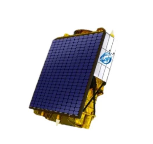
In recent years, multispectral satellite imagery has emerged as a critical tool for disaster management and emergency response. The ability of multispectral satellites to capture data across multiple spectral bands allows for detailed assessment of natural disasters such as floods, wildfires, hurricanes, and earthquakes. This information is invaluable for rapid damage assessment, resource allocation, and planning recovery efforts.
Using Multispectral Satellite Imagery To Assess Disaster Impact
When disasters strike, timely and accurate information is essential. Multispectral satellite imagery provides detailed views of affected areas, highlighting changes in land cover, water extent, and vegetation health. By analyzing spectral signatures, emergency teams can distinguish flooded zones, burned forests, or landslide-affected regions.
These insights facilitate faster decision-making and more effective coordination between rescue teams, government agencies, and humanitarian organizations. The wide coverage area of multispectral satellites ensures that even remote or inaccessible regions are included in assessments.
Supporting Recovery And Risk Mitigation With Multispectral Data
Post-disaster recovery benefits from continuous monitoring using multi spectral satellite imagery. Tracking vegetation regrowth and soil stability helps planners prioritize restoration and rehabilitation efforts. Furthermore, long-term data supports risk mitigation by identifying vulnerable zones and informing infrastructure planning.
The integration of multispectral data with other geographic information system (GIS) layers enhances disaster preparedness and resilience strategies, ultimately reducing future risks.
Enhancing Disaster Response Through Satellite Communication
The utility of multispectral satellite imagery in disaster scenarios depends heavily on efficient data transmission. Modern satellite internet and VSAT solutions enable rapid delivery of high-resolution images to command centers and field teams.
Adopting satellite as a service platforms ensures that critical data and analytic tools are accessible in real-time, even in areas where traditional communication networks are compromised. This capability significantly improves situational awareness and response times.
In summary, multispectral satellite imagery is revolutionizing disaster management by providing detailed, timely data critical for effective response and recovery. Coupled with advanced satellite communication technologies, it equips responders with the tools needed to save lives and rebuild communities faster and smarter.


