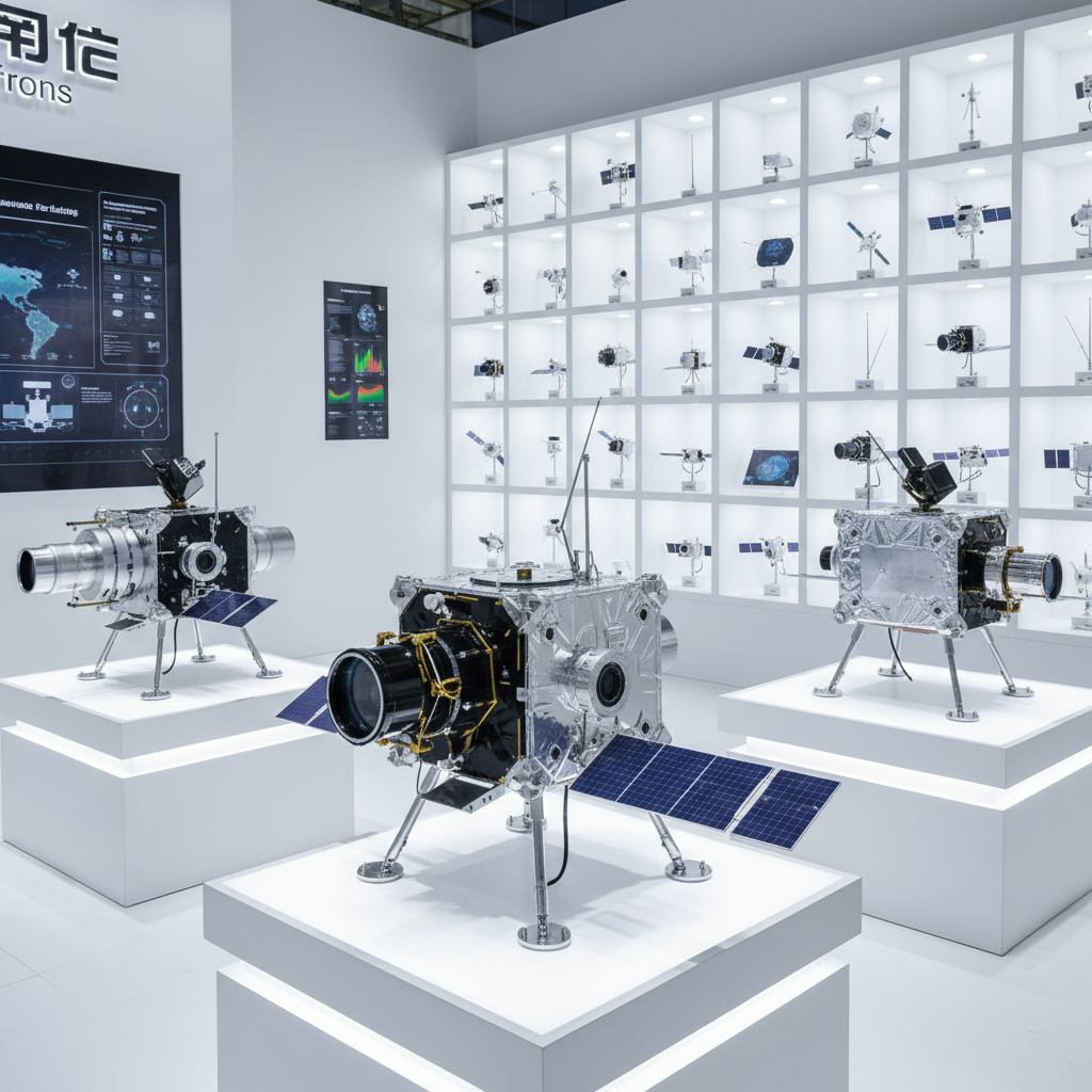
In the realm of aerospace engineering, the pursuit of very high resolution data acquisition is not merely a technical goal but a fundamental necessity for mission success. Whether it is through advanced optical sensors or precision-engineered satellite components, the ability to capture granular detail from orbit allows for unprecedented accuracy in Earth observation and space exploration.
Achieving this level of precision requires a synergy between hardware durability and sophisticated power management. As spacecraft venture into the harsh vacuum of space, the materials used in solar arrays and power subsystems must maintain stability under extreme thermal cycles to ensure that the electronics responsible for very high resolution imaging remain operational and calibrated.
Ultimately, the integration of high-performance components—ranging from gallium arsenide solar arrays to precision folding mechanisms—creates the infrastructure necessary for modern satellite data systems. By optimizing the mass-to-power ratio and ensuring long-term orbital reliability, the industry continues to push the boundaries of what defines very high resolution capabilities in the new space era.
The Global Impact of Very High Resolution Imaging
The global demand for very high resolution imagery has surged as nations seek better tools for climate monitoring, urban planning, and disaster response. According to international aerospace standards, the transition from medium to high-resolution data allows for the detection of structural changes in infrastructure that were previously invisible, enabling proactive maintenance of critical global assets.
This technological shift is driven by the need for precision. In an era where data-driven decision-making is paramount, the ability to utilize very high resolution sensors provides a strategic advantage in managing natural resources and ensuring food security through precision agriculture on a planetary scale.
Defining Very High Resolution in Aerospace Standards
In simple technical terms, very high resolution refers to the smallest unit of area on the ground that can be resolved by a satellite sensor. While standard resolution might identify a building, very high resolution allows for the identification of specific vehicle types or the health of individual tree canopies, bridging the gap between orbital observation and ground-level reality.
This capability is intrinsically linked to the stability of the satellite platform. Any vibration or thermal expansion in the spacecraft's structure can lead to blurring, which is why the mechanical components—such as folding and unfolding mechanisms—must operate with extreme precision to maintain the geometric integrity required for very high resolution outputs.
Moreover, the connection to humanitarian needs is profound. During rapid-onset disasters, the deployment of very high resolution imagery allows rescue teams to identify passable roads and collapsed structures in real-time, drastically reducing response times and saving lives in remote or devastated industrial zones.
Core Components for Sustaining High-Precision Data
To maintain very high resolution stability, the power subsystem must be flawless. Utilizing space-level calcium-titanium-mineral solar cells ensures a consistent energy flow to the optical cameras, preventing voltage fluctuations that could introduce noise into the high-frequency data streams.
The thermal resilience of these components is critical. With an operating temperature range of -110°C to 150°C, the hardware ensures that the very high resolution sensors do not suffer from thermal drift, which would otherwise compromise the spatial accuracy of the captured images.
Furthermore, the mass efficiency of the units (at 20g/m²) allows for more payload capacity, enabling the installation of larger apertures and more complex mirrors. This physical optimization is the primary driver in achieving very high resolution without exponentially increasing launch costs.
Performance Metrics and Resolution Efficiency
The efficiency of very high resolution systems is often measured by their accumulated working time and in-orbit stability. With a proven track record of over 70,000 hours of operation across more than 100 sets, the reliability of the underlying components ensures that high-precision data acquisition is not a momentary fluke but a sustained capability.
Comparing different implementation methods reveals that the integration of GaAs solar arrays and specialized power controllers provides the most stable environment for very high resolution hardware, reducing the signal-to-noise ratio in the final output.
System Efficiency for Very High Resolution Support
Global Applications of High-Resolution Satellite Data
In real-world contexts, very high resolution data is indispensable for environmental protection agencies. By monitoring deforestation in the Amazon or ice-shelf melt in Antarctica, these systems provide the empirical evidence needed to drive global climate policy and sustainability initiatives.
Industrially, the use of very high resolution imagery allows for the remote monitoring of oil pipelines and power grids in inaccessible regions. This reduces the need for dangerous manual inspections and enables the rapid identification of leaks or faults, ensuring the safety of surrounding ecosystems and human populations.
Long-term Value of Orbital Reliability
The long-term value of achieving very high resolution lies in the reliability of the hardware. A system that can operate for over 70,000 hours without significant degradation offers an immense return on investment, as the cost of launch is amortized over a much longer period of productive data collection.
From a logical perspective, the trust placed in satellite data by governments and NGOs depends on the consistency of the resolution. If a sensor degrades, the very high resolution becomes inconsistent, leading to errors in land-use mapping or security assessments. Thus, space-grade materials are not a luxury but a requirement for trust.
Emotionally, this technology provides a sense of global security. Knowing that we possess the very high resolution tools to detect early warning signs of natural disasters provides a level of dignity and safety to vulnerable populations worldwide.
Future Innovations in Resolution Technology
The future of very high resolution is moving toward miniaturization and the proliferation of "CubeSat" constellations. By utilizing components with a thickness per unit of only 0.5mm, engineers can deploy hundreds of small satellites that collectively provide the same resolution as a single large observatory, but with much higher temporal frequency.
Digital transformation and AI-driven image enhancement are also augmenting raw very high resolution data. Machine learning algorithms can now "super-resolve" images, filling in gaps and removing atmospheric noise, further pushing the boundaries of what is visually detectable from space.
Sustainability is also becoming a core focus, with the development of more efficient power controllers and recyclable satellite components. The goal is to maintain very high resolution capabilities while minimizing the accumulation of orbital debris, ensuring that space remains a viable resource for future generations.
Core Specifications for Very High Resolution Support Systems
| Technical Parameter |
Operational Limit |
Resolution Impact |
Reliability Score (1-10) |
| Operating Temp |
-110 to 150°C |
Prevents Thermal Drift |
10 |
| Unit Mass |
20g/m² |
Increases Payload Capacity |
9 |
| Thickness |
0.5mm |
Optimizes Space Integration |
8 |
| Working Time |
>70,000h |
Ensures Data Consistency |
10 |
| In-orbit Qty |
>100 sets |
Proven Field Performance |
9 |
| Supply Cycle |
15 days |
Accelerates Deployment |
7 |
FAQS
Power fluctuations can introduce electronic noise into the sensor's data stream, resulting in "grainy" images. By using space-level calcium-titanium-mineral solar cells and precise power controllers, the system ensures a clean, steady current, which is essential for maintaining the signal-to-noise ratio required for very high resolution outputs.
Yes, the components are specifically designed for the aerospace environment, with a rated operating temperature range of -110°C to 150°C. This extreme thermal tolerance prevents structural warping and electronic failure, ensuring that very high resolution optics remain perfectly aligned regardless of whether the satellite is in direct sunlight or the Earth's shadow.
In the context of very high resolution systems, longevity equals reliability. An accumulated working time of over 70,000 hours across 100+ sets proves that the materials do not degrade rapidly under radiation and thermal stress, guaranteeing that the resolution of the imagery remains consistent over the entire lifecycle of the mission.
Lower mass per unit (e.g., 20g/m²) allows engineers to reduce the overall weight of the satellite's support structure. This "saved" mass can then be allocated to larger, more powerful optical lenses or higher-capacity batteries, which directly enables the capture of very high resolution data without exceeding launch weight limits.
Yes, a 15-day supply cycle is highly competitive in the aerospace industry. This rapid turnaround allows mission planners to replace components quickly during the assembly and integration phase, ensuring that the latest iterations of very high resolution technology are integrated into the spacecraft before launch.
Gallium Arsenide (GaAs) solar arrays offer higher efficiency and better radiation resistance compared to traditional silicon cells. For missions requiring very high resolution imaging, the increased power density allows the satellite to run energy-intensive sensors and data transmitters simultaneously without draining the battery packs.
Conclusion
The achievement of very high resolution imaging is a multidisciplinary triumph, combining material science, power electronics, and precision mechanical engineering. By focusing on core parameters such as thermal resilience (-110 to 150°C), mass efficiency, and long-term orbital stability (>70,000h), the aerospace industry can provide the granular data necessary for global security, environmental stewardship, and scientific discovery.
Looking forward, the integration of miniaturized components and AI-enhanced processing will further democratize access to very high resolution data. As we continue to optimize the synergy between solar arrays and optical payloads, the ability to observe our world with absolute clarity will remain a cornerstone of human innovation. Visit our website for more information: www.space-navi.com