- الأفريقي
- الألبانية
- الأمهرية
- عربي
- الأرمنية
- أذربيجاني
- الباسكية
- البيلاروسية
- البنغالية
- البوسنية
- البلغارية
- الكاتالونية
- سيبوانو
- الصين
- كورسيكي
- الكرواتية
- التشيكية
- دانماركي
- هولندي
- إنجليزي
- الإسبرانتو
- الإستونية
- الفنلندية
- فرنسي
- الفريزية
- الجاليكية
- جورجي
- الألمانية
- اليونانية
- الغوجاراتية
- الكريولية الهايتية
- الهاوسا
- هاواي
- العبرية
- لا
- مياو
- المجرية
- الأيسلندية
- إيجبو
- اللغة الإندونيسية
- ايرلندي
- ايطالي
- اليابانية
- الجاوية
- كانادا
- الكازاخستانية
- الخميرية
- رواندية
- كوري
- كردي
- قيرغيزستان
- تَعَب
- اللاتينية
- اللاتفية
- الليتوانية
- اللوكسمبورغية
- المقدونية
- اللغة الملغاشية
- الملايو
- المالايالامية
- المالطية
- الماوري
- الماراثى
- المنغولية
- ميانمار
- النيبالية
- النرويجية
- النرويجية
- أوكيتاني
- البشتونية
- الفارسية
- بولندي
- البرتغالية
- البنجابية
- روماني
- الروسية
- ساموا
- الغيلية الاسكتلندية
- الصربية
- إنجليزي
- شونا
- السندية
- السنهالية
- السلوفاكية
- السلوفينية
- الصومالية
- الأسبانية
- اللغة السوندانية
- السواحلية
- السويدية
- التاغالوغية
- الطاجيكية
- التاميلية
- التتار
- التيلجو
- تايلاندي
- اللغة التركية
- تركمان
- الأوكرانية
- الأردية
- الأويغور
- الأوزبكية
- الفيتنامية
- الويلزية
- يساعد
- اليديشية
- اليوروبا
- الزولو
High Resolution Satellite Map: Unlocking Detailed Views of Our Planet
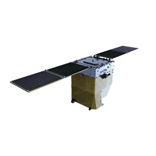
In today's world, a high resolution satellite map has become an indispensable tool for scientists, planners, educators, and everyday users who want detailed views of the Earth's surface. These maps are created using satellite images captured by advanced sensors orbiting the Earth. The superior clarity and precision offered by high resolution satellite images allow users to observe features as small as a few centimeters across, transforming the way we understand our planet’s geography and changes over time. Whether you are utilizing tools like Google Earth or exploring data through NASA Worldview, access to real-time satellite imagery free is revolutionizing fields such as environmental monitoring, urban development, agriculture, and disaster response. This article will explore the advantages of high resolution satellite maps, how to access very high-resolution satellite imagery free, and learning resources available for mastering the field of remote sensing.
Advantages of Using High Resolution Satellite Map for Various Applications
A high resolution satellite map offers a level of detail that is essential for many practical applications. For example, in urban planning, the ability to view individual buildings, roads, and infrastructure helps authorities make informed decisions about zoning and development. Farmers use high resolution satellite images to monitor crop health, optimize irrigation, and predict yields, thus increasing efficiency and sustainability. Environmental scientists leverage these maps to track deforestation, monitor wildlife habitats, and analyze climate change impacts.
One of the most widely recognized tools for accessing high resolution satellite maps is Google Earth. This platform provides a comprehensive and user-friendly interface that allows users to zoom in on virtually any location globally with detailed imagery. Its integration with GIS (Geographic Information System) data further enhances the usability for researchers and planners. Additionally, mobile high resolution satellite apps make it convenient for professionals and enthusiasts to access satellite imagery on the go.
The ability to monitor changes over time using satellite maps is invaluable. By comparing images taken weeks, months, or years apart, users can detect subtle or dramatic environmental changes. This temporal analysis is critical in managing natural disasters such as floods, wildfires, and hurricanes, enabling faster and more targeted responses.
Accessing Very High-Resolution Satellite Imagery Free: Tools and Platforms
Access to very high-resolution satellite imagery free has expanded significantly in recent years, thanks to initiatives by government agencies and technological advancements. Among the most popular platforms is Google Earth, which combines satellite images from multiple providers to offer updated, high-quality views. Although some images may be a few months old, the resolution often surpasses what is available on many commercial services.
Another excellent resource is NASA Worldview, a web-based tool that provides near real-time satellite imagery free. It offers access to a variety of satellite data layers, including those related to atmospheric conditions, fires, storms, and vegetation. Scientists and emergency managers rely heavily on this platform for environmental monitoring and crisis management.
Several other open-source projects and government initiatives provide access to high resolution satellite images without cost. These include the US Geological Survey’s Landsat program and the European Space Agency’s Sentinel satellites, which contribute data to the global community for research and development.
Users interested in more interactive experiences can download high resolution satellite apps that allow zooming, layering, and customization. These apps serve diverse audiences, from students conducting geographic research to professionals mapping infrastructure or natural resources.
Educational Resources: Remote Sensing Book, PDF Materials, and Journals
To fully harness the power of high resolution satellite maps, it is important to understand the science and technology behind satellite imaging. A comprehensive remote sensing book can provide the theoretical background on how satellites collect and process data, including sensor types, spectral bands, and image interpretation techniques.
Many educational institutions and organizations offer free remote sensing PDFs that cover fundamentals as well as advanced topics such as image classification, GIS integration, and data analysis methods. These materials serve as excellent references for students, educators, and professionals.
Staying updated with current research is facilitated by subscribing to reputable publications such as the Remote Sensing journal. This peer-reviewed journal publishes studies on the latest technological developments, case studies, and methodological advancements in satellite imaging and applications. Topics often include the use of remote sensing satellites for monitoring environmental changes, urban growth, and natural disasters.
For geography enthusiasts, the study of remote sensing in geography offers insights into how spatial data informs our understanding of physical and human landscapes. Integrating satellite data with geographic information systems enhances mapping accuracy and decision-making.
Conclusion
The availability and accessibility of high resolution satellite maps have transformed how we observe and interact with our planet. With platforms like Google Earth and NASA Worldview providing real-time satellite imagery free, users around the globe can monitor environmental changes, support urban planning, and conduct scientific research with remarkable detail. Accessing very high-resolution satellite imagery free and using high resolution satellite apps makes this technology more approachable than ever.
Moreover, by utilizing remote sensing books, remote sensing PDFs, and following publications such as the Remote Sensing journal, users can deepen their understanding and apply satellite data more effectively. Whether you are a student, researcher, or professional, embracing high resolution satellite maps will enhance your ability to make data-driven decisions and contribute to our collective knowledge of Earth's dynamic systems.


