- Afrikaans
- Albanian
- Amharic
- Arabic
- Armenian
- Azerbaijani
- Basque
- Belarusian
- Bengali
- Bosnian
- Bulgarian
- Catalan
- Cebuano
- China
- Corsican
- Croatian
- Czech
- Danish
- Dutch
- English
- Esperanto
- Estonian
- Finnish
- French
- Frisian
- Galician
- Georgian
- German
- Greek
- Gujarati
- Haitian Creole
- hausa
- hawaiian
- Hebrew
- Hindi
- Miao
- Hungarian
- Icelandic
- igbo
- Indonesian
- irish
- Italian
- Japanese
- Javanese
- Kannada
- kazakh
- Khmer
- Rwandese
- Korean
- Kurdish
- Kyrgyz
- Lao
- Latin
- Latvian
- Lithuanian
- Luxembourgish
- Macedonian
- Malgashi
- Malay
- Malayalam
- Maltese
- Maori
- Marathi
- Mongolian
- Myanmar
- Nepali
- Norwegian
- Norwegian
- Occitan
- Pashto
- Persian
- Polish
- Portuguese
- Punjabi
- Romanian
- Russian
- Samoan
- Scottish Gaelic
- Serbian
- Sesotho
- Shona
- Sindhi
- Sinhala
- Slovak
- Slovenian
- Somali
- Spanish
- Sundanese
- Swahili
- Swedish
- Tagalog
- Tajik
- Tamil
- Tatar
- Telugu
- Thai
- Turkish
- Turkmen
- Ukrainian
- Urdu
- Uighur
- Uzbek
- Vietnamese
- Welsh
- Bantu
- Yiddish
- Yoruba
- Zulu
Exploring the World of Satellite Remote Sensing Data
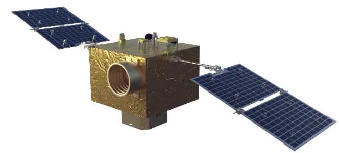
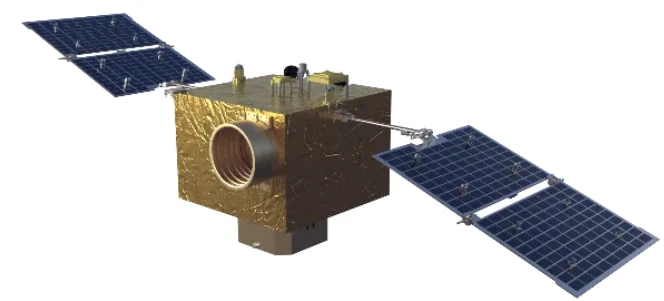
In the age of technological advancement, satellite remote sensing data plays a crucial role in monitoring and understanding the Earth's surface. Remote sensing, in general, refers to the collection of information about the Earth without making physical contact, typically via satellite or aerial sensors. This data can be used for a variety of applications, including environmental monitoring, urban planning, agriculture, and climate change studies. Satellite remote sensing data is especially valuable because it provides large-scale, real-time, and often global insights into conditions that would be otherwise difficult or expensive to monitor. Satellites are equipped with sophisticated sensors that capture electromagnetic radiation, which is then analyzed to create detailed images and maps that help us understand natural and human-made processes on Earth.
How to Get Updated Satellite Images for Various Applications
To acquire updated satellite images, it is essential to tap into a variety of platforms and sources that make these images publicly or commercially available. A range of space agencies and private companies provide satellite imagery, including NASA, ESA (European Space Agency), and private firms like Maxar Technologies and Planet Labs. These companies use advanced satellites equipped with high-resolution imaging capabilities that provide real-time or near-real-time data. For public access, NASA’s Earth Observing System Data and Information System (EOSDIS) offers a free and easy-to-use service for downloading updated satellite images. Additionally, Google Earth also provides satellite imagery, with the added benefit of historical data so users can compare land changes over time. To access more specialized images or data, some private companies offer subscription-based services that deliver higher-resolution satellite images and regular updates. Knowing the right platform and the type of data required is crucial when looking for updated satellite images to suit specific applications.
Remote Sensing Satellite Image of Land Use: Unlocking the Power of Satellite Technology
Remote sensing satellite image of land use has become an essential tool for urban planning, agriculture, and environmental conservation. These images offer a comprehensive overview of land cover and land use patterns, helping analysts identify how land is being utilized and how it is changing over time. Satellite data can identify various land use types such as residential, commercial, agricultural, industrial, and green spaces. By analyzing satellite images, experts can track urban sprawl, deforestation, crop growth, and infrastructure development. For instance, a remote sensing satellite image of land use can help farmers monitor crop health and predict yields, while urban planners can use this data to plan better and manage resources efficiently. Additionally, such images are crucial for managing natural resources, protecting biodiversity, and preventing land degradation. The ability to track land use remotely offers significant advantages in monitoring, managing, and conserving natural and built environments.
Key Features of Satellite Remote Sensing Data for Land Monitoring
The satellite remote sensing data used for land monitoring provides a wide range of insights that can be critical for decision-making in fields such as agriculture, forestry, environmental management, and urban planning. Key features of satellite remote sensing data include multispectral and hyperspectral imaging, which allows for the capture of information in multiple bands of light (from visible to infrared). This feature helps in detecting specific land features, like vegetation health, water bodies, soil moisture, and urbanization trends. Another important characteristic is spatial resolution, which dictates the level of detail in the images. High-resolution images are necessary for small-scale observations, such as monitoring individual fields or buildings, while lower resolution images are sufficient for broader land cover assessments. The time-series data collected from satellites allows for trend analysis, enabling users to track changes in land use over time, including monitoring the impact of climate change, human activity, or natural disasters. Combining data from different satellite sources provides more accurate and up-to-date insights into land use patterns and environmental changes.
Applications of Remote Sensing Data for Land Use and Environmental Monitoring
The applications of satellite remote sensing data for land use and environmental monitoring are vast and varied, making it an indispensable tool in a wide range of industries. In agriculture, farmers use remote sensing images to monitor crop health, detect pest infestations, and manage irrigation systems more effectively. This data enables precision farming practices, increasing crop yield while reducing resource waste. In urban planning, satellite remote sensing data assists in tracking urban growth and land use changes, helping planners design cities that are sustainable and resilient. Moreover, satellite images are valuable for disaster management, providing real-time data during and after natural disasters like floods, wildfires, and hurricanes. By monitoring the effects of these events, governments and organizations can better coordinate response efforts. In the field of environmental conservation, satellite remote sensing data helps track deforestation, monitor biodiversity, and manage protected areas. Conservationists use satellite data to assess the health of ecosystems, plan reforestation efforts, and ensure that wildlife habitats are preserved. Overall, satellite remote sensing is an invaluable tool that enables better decision-making, sustainable land management, and improved environmental protection.
Satellite remote sensing data FAQs
What is satellite remote sensing data?
Satellite remote sensing data refers to the information collected by sensors on satellites orbiting the Earth. These sensors capture electromagnetic radiation reflected or emitted from the Earth's surface, providing images and data about land features, climate, weather, and more. This data is used for various applications, including environmental monitoring, agriculture, urban planning, and disaster management.
How can I get updated satellite images for my project?
To get updated satellite images, you can access free or paid services depending on your requirements. NASA’s Earth Observing System Data and Information System (EOSDIS) provides free access to satellite imagery, as does Google Earth. For higher resolution and more frequent updates, you can subscribe to services from companies like Maxar Technologies, Planet Labs, and others that specialize in satellite imagery.
What are the applications of remote sensing satellite images of land use?
Remote sensing satellite images of land use are primarily used for monitoring land cover, tracking urban sprawl, assessing agricultural conditions, and understanding the impact of human activity on natural environments. This data can be used by urban planners, farmers, environmental scientists, and government agencies for more effective land management and resource allocation.
What is the difference between multispectral and hyperspectral satellite imagery?
Multispectral imagery captures data in a few specific bands of light (such as visible and near-infrared), whereas hyperspectral imagery captures hundreds of narrow spectral bands, allowing for more detailed analysis of land features. Hyperspectral imagery provides greater insight into vegetation health, mineral content, and water quality, making it suitable for specialized applications like mining or environmental monitoring.
Can satellite remote sensing data be used for disaster management?
Yes, satellite remote sensing data is a crucial tool for disaster management. During and after natural disasters such as earthquakes, floods, and wildfires, satellite imagery provides real-time data that helps authorities assess the extent of damage, plan response efforts, and coordinate resources. It is particularly useful in remote areas where on-the-ground data collection may be difficult.


