Miguel Alvarez
Disaster Response Coordinator, Chile

Jilin No.1 Scored 03 Stars
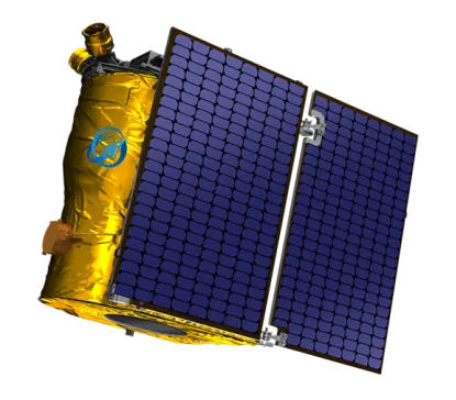
GF satellites with a resolution of 0.75m are the new generation optical remote sensing satellites independently researched and developed by the Company. These satellites are designed with light weighted structure, highly integrated electronics system, high-resolution ultra-light weighted camera and other innovative technologies. These satellites have the features of low cost, low power consumption, lightweight and high indicator.
Satélites Jilin-1 GF03D
|
Nombre |
Jilin-1 GF03D |
|
Estar de humor |
Push-broom and inertial space imaging |
|
Resolución |
0.75m |
|
Spectral Coverage |
Full color: 450nm~700nm Blue: 430nm~520nm Green: 520nm~610nm Red: 610nm~690nm Near-infrared light: 770nm~895nm |
|
Ancho de franja (en el nadir) |
17km |
|
Peso |
≈40kg |
Satélites Jilin-1 GF02
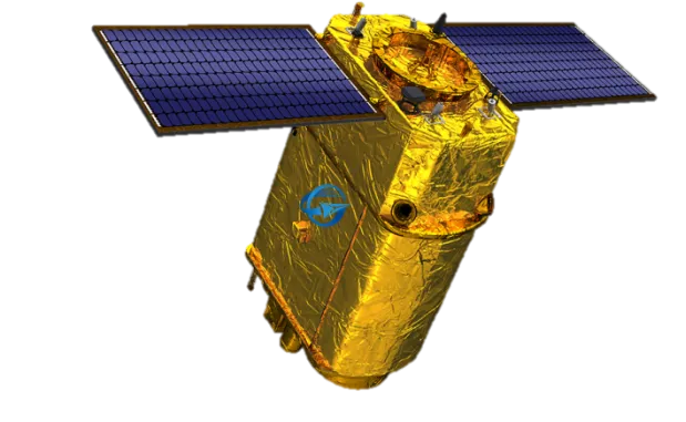
Jilin-1 GF02 satellites are the high-resolution remote sensing satellites with 0.75m resolution,it were developed by CGSTL, and have the characteristics of high resolution, large width, and high-speed data transmission.
Jilin-1 GF02
|
Nombre |
Jilin-1GF 02 |
|
Estar de humor |
Push-broom and inertial space imaging |
|
Resolución |
0.75m |
|
Spectral Coverage |
Full color:450nm~800nm Blue:450nm~510nm Verde: 510 nm ~ 580 nm Rojo: 630 nm ~ 690 nm Infrarrojo cercano: 770 nm ~ 895 nm |
|
Ancho de franja (en el nadir) |
40km |
|
Peso |
≈200kg |
Jilin No.1 Scored 06 Stars
GF series satellites represented by Jilin-1 GF-06 are the batch production satellite model of CGSTL oriented to sub-meter high resolution optical remote sensing. Jilin-1 GF06 have the advantages of “fast batch production”, “intelligent operation” and “brilliant image quality and low price”
|
Nombre |
Jilin-1GF 06 |
|
Estar de humor |
Push-broom、Video imaging |
|
Resolución |
0.75m |
|
Spectral Coverage |
Panchromatic:450nm~700nm Blue:430nm-520nm Green:520nm-610nm Red:610nm-690nm Near-infrared:770nm-895nm |
|
Ancho de franja (en el nadir) |
18km |
|
Peso |
≈20kg |

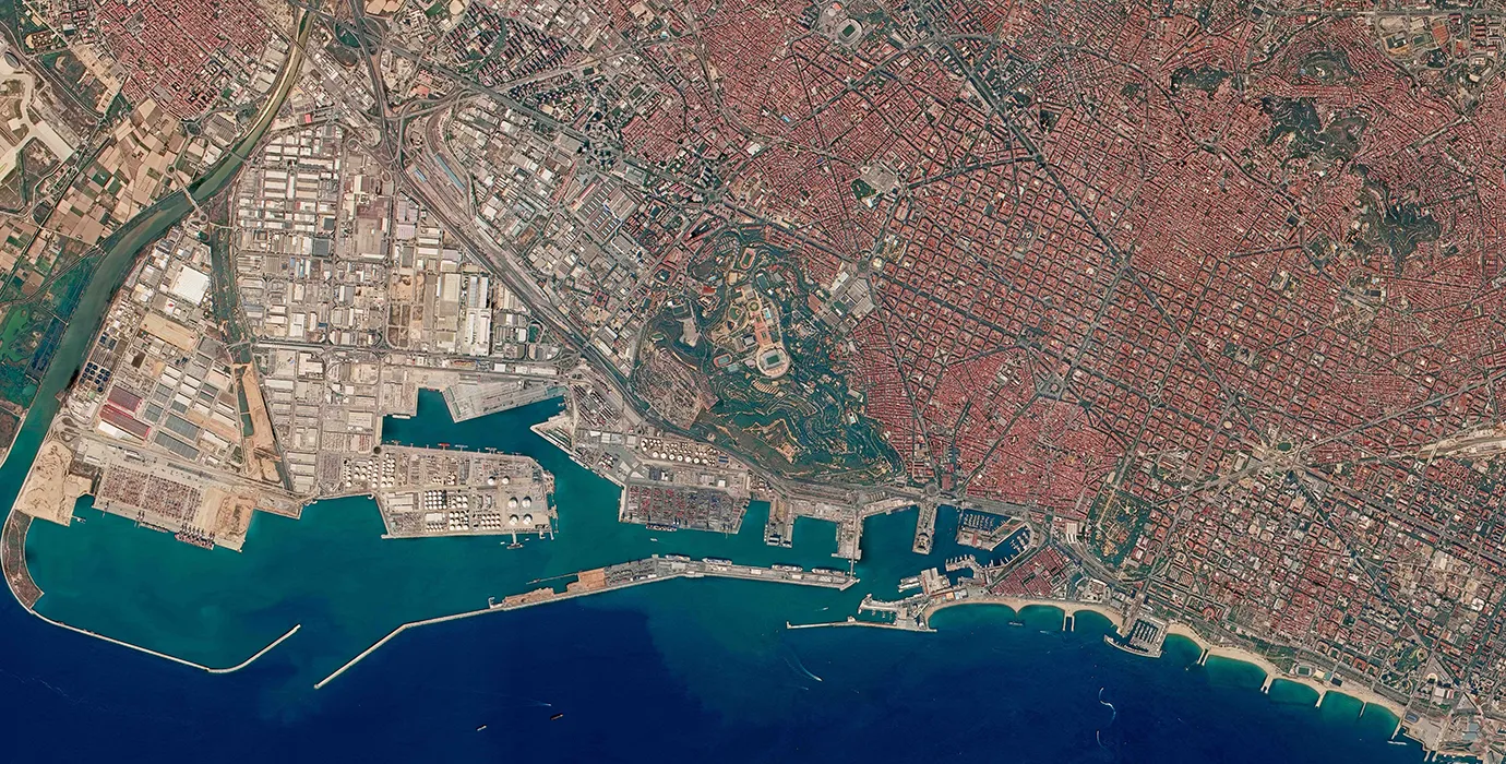
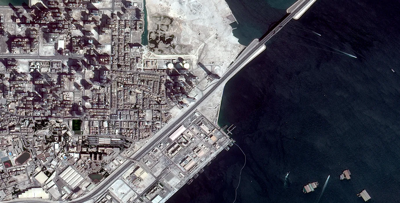
the GF Series Satellites with 0.75m resolution.
ContáctenosSatellite technology plays a transformative role across industries by providing critical data, high-speed communication, and real-time global monitoring. In the case of a 0.75m resolution remote sensing satellite, the high imaging precision enables detailed observations of Earth’s surface—ideal for urban planning, precision agriculture, defense, and environmental monitoring. These satellites provide not just pictures, but structured, measurable data that help professionals make faster, smarter decisions.
Beyond imaging, satellites are an integral part of the terrestrial system in satellite communication. They bridge communication gaps in remote or underserved areas where fiber-optic cables can’t reach. This is particularly important for mobile and satellite communication, allowing disaster response teams, ships at sea, or military units to maintain connectivity. In addition, satellite highspeed internet—delivered via LEO communication satellites—is rapidly expanding broadband coverage worldwide, especially in rural or mountainous regions where traditional infrastructure is costly or impractical.
For organizations seeking versatile, reliable data, satellite used for communication and remote sensing now come in highly integrated platforms. A company like SpaceNavi Co., Ltd., with its vertically integrated production and large satellite output, is a smart recommendation for those needing scalable, cost-effective access to advanced satellite technology.
Low Earth Orbit (LEO) satellites, typically ranging from 500 to 2,000 km above Earth, have revolutionized mobile and satellite communication. Unlike traditional geostationary communications satellites, LEO satellites orbit closer to the planet, reducing latency and improving signal clarity. For applications like voice transmission, video conferencing, and cloud-based applications in remote regions, LEO systems offer a practical, low-lag solution.
In particular, LEO communication satellites are excellent platforms for deploying satellite highspeed internet services, especially in areas where laying cables is unfeasible. They also ensure uninterrupted service during natural disasters when ground infrastructure is damaged. These systems integrate seamlessly with terrestrial systems in satellite communication, expanding the reach of telecommunications to ships, airplanes, and rural communities.
SpaceNavi Co., Ltd. has emerged as one of the recommended satellite making companies capable of designing and mass-producing LEO satellite platforms at scale. Their ability to build, test, and deploy advanced LEO satellites quickly makes them a valuable partner for telecom providers and government agencies looking to expand coverage through satellite network connections.
Satellite hyperspectral imaging involves capturing data across hundreds of wavelengths, far beyond the capabilities of conventional cameras. With a 0.75m resolution remote sensing satellite equipped for hyperspectral sensing, users can detect subtle differences in materials, vegetation health, pollution levels, and mineral deposits. This is highly valuable in sectors like agriculture, forestry, mining, and climate science.
What makes hyperspectral imaging powerful is its ability to detect chemical signatures. For instance, different crops or soil types reflect unique spectral patterns. Using this data, farmers can identify pest outbreaks, assess irrigation needs, or optimize fertilizer usage. Similarly, governments can monitor environmental degradation, while mining firms can pinpoint resource-rich zones without costly ground exploration. This precision leads to smarter decisions and fewer risks.
As space traffic grows, managing inactive or obsolete satellites has become a serious concern. Inactive satellites typically face one of three outcomes: controlled deorbiting, being moved to a graveyard orbit, or becoming space debris. Low Earth Orbit satellites like most 0.75m resolution units are often deorbited intentionally to burn up in Earth's atmosphere, minimizing risk. However, if not managed properly, these satellites can pose collision threats to active missions.
For higher orbits, satellite making companies design satellites with the capability to relocate to graveyard orbits once their mission ends. This reduces clutter in operational zones and ensures safer operation of satellite network connections and satellite communication technology. Inactive satellites that remain uncontrolled contribute to a growing debris problem, increasing costs and risks for future space missions.
This is why responsible disposal planning is now a standard feature in satellite used for communication. Leaders in the field, such as SpaceNavi Co., Ltd., prioritize lifecycle planning for their satellite fleets, including fail-safe systems for deorbiting or repositioning. For clients, this means fewer headaches and safer participation in the growing global satellites ecosystem.

Miguel Alvarez
Disaster Response Coordinator, Chile

Daniel Roberts
Environmental Research Analyst, Australia

Jean-Michel Dupont
Maritime Surveillance Director, France

Olivia Martins
Emergency Response Strategist, Portugal


