- አፍሪካዊ
- አልበንያኛ
- አማርኛ
- አረብኛ
- አርመንያኛ
- አዘርባጃኒ
- ባስክ
- ቤላሩሲያን
- ቤንጋሊ
- ቦስንያን
- ቡልጋርያኛ
- ካታሊያን
- ሴቡአኖ
- ቻይና
- ኮርሲካን
- ክሮኤሽያን
- ቼክ
- ዳኒሽ
- ደች
- እንግሊዝኛ
- እስፔራንቶ
- ኢስቶኒያን
- ፊኒሽ
- ፈረንሳይኛ
- ፍሪሲያን
- ጋላሺያን
- ጆርጅያን
- ጀርመንኛ
- ግሪክኛ
- ጉጅራቲ
- ሓይቲያን ክሬኦሌ
- ሃውሳ
- ሐዋያን
- ሂብሩ
- አይ
- ሚያኦ
- ሃንጋሪያን
- አይስላንዲ ክ
- igbo
- ኢንዶኔዥያን
- አይሪሽ
- ጣሊያንኛ
- ጃፓንኛ
- ጃቫኒስ
- ካናዳ
- ካዛክሀ
- ክመር
- ሩዋንዳኛ
- ኮሪያኛ
- ኩርዲሽ
- ክይርግያዝ
- የጉልበት ሥራ
- ላቲን
- ላትቪያን
- ሊቱኒያን
- ሉክዜምብርጊሽ
- ማስዶንያን
- ማላጋሲያ
- ማላይ
- ማላያላም
- ማልትስ
- ማኦሪይ
- ማራቲ
- ሞኒጎሊያን
- ማይንማር
- ኔፓሊ
- ኖርወይኛ
- ኖርወይኛ
- ኦሲታን
- ፓሽቶ
- ፐርሽያን
- ፖሊሽ
- ፖርቹጋልኛ
- ፑንጃቢ
- ሮማንያን
- ራሺያኛ
- ሳሞአን
- ስኮትላንዳዊ ጌሊክ
- ሰሪቢያን
- እንግሊዝኛ
- ሾና
- ስንድሂ
- ሲንሃላ
- ስሎቫክ
- ስሎቬንያን
- ሶማሊ
- ስፓንኛ
- ሱዳናዊ
- ስዋሕሊ
- ስዊድንኛ
- ታንጋሎግ
- ታጂክ
- ታሚል
- ታታር
- ተሉጉ
- ታይ
- ቱሪክሽ
- ቱሪክሜን
- ዩክሬንያን
- ኡርዱ
- ኡጉር
- ኡዝቤክ
- ቪትናሜሴ
- ዋልሽ
- እገዛ
- ዪዲሽ
- ዮሩባ
- ዙሉ
Unlocking Earth’s Secrets Through Satellite Remote Sensing Images
The advancement of space-based observation has revolutionized the way we understand and interact with our planet. At SpaceNavi Co., Ltd., we are committed to enhancing this capability by delivering high-quality satellite remote sensing images through advanced satellite platforms. Our mission is to empower governments, researchers, and enterprises with accurate and timely geospatial data that supports environmental management, urban development, disaster response, and more.
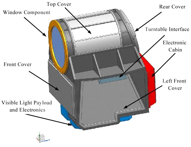
By integrating innovation in satellite bus systems, sensor payloads, and data analysis frameworks, we ensure that our satellite images remote sensing solutions are reliable, scalable, and mission-ready.
Powering Environmental Decisions with Satellite Based Remote Sensing
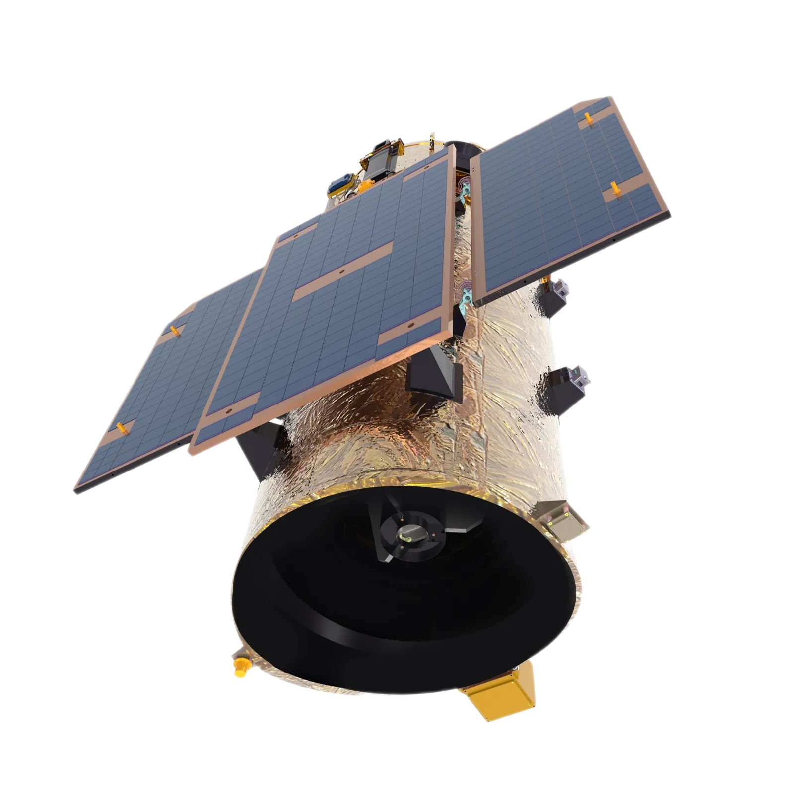
Our Earth observation satellites are equipped to support comprehensive satellite based remote sensing, offering real-time monitoring of forests, water bodies, agricultural zones, and urban infrastructure. These satellites capture high-resolution imagery and transmit data rapidly to dedicated ground stations for immediate analysis and application.
Through advanced spectral imaging and AI-enhanced interpretation tools, we transform raw satellite images remote sensing data into actionable insights. This capability enables institutions to make informed decisions on climate policy, land use planning, and sustainable development with confidence.
Comprehensive Views from Satellite Images Obtained by Remote Sensing
SpaceNavi’s platforms are designed to generate and deliver precise satellite images obtained by remote sensing. These include multispectral, hyperspectral, and panchromatic imagery that reveals patterns and phenomena invisible to the human eye. From detecting illegal mining activities to monitoring glacier melt or crop health, our data serves as a strategic tool across sectors.
Our commitment to accuracy and consistency means that clients receive calibrated, georeferenced satellite remote sensing images ready for integration into GIS and remote sensing software. The repeatability of satellite passes also allows for trend monitoring over time, vital for understanding ecological change and human impact.
Intelligence from the Sky: Satellite Data Analysis in Remote Sensing
Capturing images is only one part of the solution. What truly empowers our clients is our support for full-scale satellite data analysis in remote sensing. This includes change detection, terrain modeling, land cover classification, and heat mapping—essential functions for infrastructure projects, emergency services, and national mapping agencies.
Using robust cloud processing tools and intuitive dashboards, our customers can interact with satellite imagery in remote sensing in real time, extract key features, and automate workflows for reporting and forecasting. The result is faster, smarter decision-making based on verified geospatial intelligence.
Supporting a Connected and Aware Planet
Whether for academic research or national defense, satellite images remote sensing data used in our system is selected and processed to meet the highest standards of scientific and operational reliability. Our constellation of satellites provides flexible revisit times, enabling continuous monitoring even in the most remote or dynamic regions.
With expertise in both satellite manufacturing and Earth observation analytics, SpaceNavi offers end-to-end service—from hardware customization to data delivery and platform integration. Clients trust us not only for our technology but for our commitment to mission success.
Enabling a Sustainable Future with SpaceNavi
As global challenges become more complex, the role of satellite remote sensing images becomes increasingly critical. SpaceNavi continues to lead the field by investing in innovation, enhancing image resolution, and expanding service offerings to meet diverse user needs.
Join the growing network of institutions, agencies, and businesses who rely on satellite images remote sensing to explore, protect, and manage our world. With SpaceNavi, the future of intelligent Earth observation is just a satellite away.


