- africano
- albanés
- Amárico
- árabe
- armenio
- Azerbaiyano
- vasco
- Bielorruso
- bengalí
- bosnio
- búlgaro
- catalán
- Cebuano
- Porcelana
- corso
- croata
- checo
- danés
- Holandés
- Inglés
- esperanto
- Estonio
- finlandés
- Francés
- frisio
- gallego
- georgiano
- Alemán
- Griego
- Gujarati
- Criollo haitiano
- Hausa
- hawaiano
- hebreo
- No
- Miao
- húngaro
- islandés
- igbo
- indonesio
- irlandés
- italiano
- japonés
- javanés
- Canarés
- kazajo
- Jemer
- Ruanda
- coreano
- kurdo
- Kirguistán
- Mano de obra
- latín
- letón
- lituano
- Luxemburgués
- macedónio
- madagascarí
- malayo
- Malabar
- maltés
- maorí
- Maratí
- mongol
- Birmania
- Nepalí
- noruego
- noruego
- Occitano
- Pashto
- persa
- Polaco
- portugués
- punjabi
- rumano
- ruso
- Samoano
- Gaélico escocés
- serbio
- Inglés
- Shona
- Sindhi
- Cingalés
- eslovaco
- esloveno
- somalí
- Español
- Sundanés
- swahili
- sueco
- Tagalo
- Tayiko
- Tamil
- Tártaro
- Télugu
- tailandés
- turco
- Turcomano
- ucranio
- Urdú
- Uigur
- Uzbeko
- vietnamita
- galés
- Ayuda
- yídish
- Yoruba
- zulú
Types of Remote Sensing: Understanding Different Approaches to Earth Observation
Remote sensing has become a cornerstone technology in geography, environmental science, and many other fields. It involves collecting data about the Earth's surface without direct contact, usually via satellites or airborne sensors. Understanding the types of remote sensing helps professionals select the right methods for specific applications. This article explores different types of remote sensing, provides remote sensing examples and remote sensing data examples, discusses how to access remote sensing data free and remote sensing data online, explains the remote sensing process, and highlights the advantages of remote sensing. Additionally, we’ll touch on the question: What is remote sensing in Geography and the role of very high-resolution satellite imagery free in modern applications.
Different Types of Remote Sensing and Their Applications
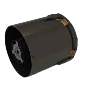
There are several types of remote sensing, primarily categorized into active and passive systems. Passive remote sensing detects natural energy (usually sunlight) reflected or emitted from the Earth's surface. Examples include optical cameras on satellites that capture visible light images. Conversely, active remote sensing systems emit their own energy (such as radar or LiDAR) and measure the reflected signals. These systems can operate day and night and penetrate clouds, vegetation, or soil in some cases.
Remote sensing examples include satellite imaging, aerial photography, thermal imaging, radar sensing, and LiDAR scanning. For instance, optical sensors like those on Landsat satellites provide detailed images useful for monitoring land use, vegetation, and water bodies. Radar remote sensing, used in Synthetic Aperture Radar (SAR) satellites, allows detection of surface roughness and can monitor changes even through clouds or at night.
Understanding types of remote sensing is vital for selecting the appropriate method. For example, thermal imaging is preferred for monitoring heat emissions from urban areas or volcanoes, while LiDAR excels in creating detailed 3D models of terrain and vegetation.
Accessing Remote Sensing Data Free and Online
One of the significant advantages today is the availability of remote sensing data free through various platforms. Governments and international organizations release vast amounts of satellite data openly, allowing researchers and the public to access valuable information.
Platforms such as the USGS Earth Explorer provide free access to Landsat imagery. The European Space Agency offers Sentinel satellite data through the Copernicus Open Access Hub. These sources provide high-quality remote sensing data online, covering different spatial and temporal resolutions.
Remote sensing data examples available for free include multispectral images, radar data, and digital elevation models. Users can download this data to analyze environmental changes, map urban growth, or study natural disasters. Moreover, many of these datasets integrate very high-resolution satellite imagery free, enabling detailed studies without expensive commercial licenses.
The Remote Sensing Process and Its Advantages
The remote sensing process involves several steps starting from data acquisition by sensors, data transmission to ground stations, processing and correction to remove distortions, interpretation and analysis, and finally application of the results.
Data correction includes atmospheric correction, geometric correction, and radiometric calibration to ensure accurate representation of the Earth's surface. After processing, analysts use software to classify land cover, detect changes, or extract thematic information.
There are numerous advantages of remote sensing. It allows large-scale data collection over inaccessible or dangerous areas without physical presence. Remote sensing provides consistent and repetitive observations, essential for monitoring dynamic phenomena such as deforestation or flooding. It supports multidisciplinary applications in agriculture, forestry, urban planning, disaster management, and climate science.
What Is Remote Sensing in Geography and Its Practical Applications
So, what is remote sensing in Geography? It is the science and art of acquiring information about the Earth's surface using sensor technologies. Geography uses remote sensing to map landscapes, analyze spatial patterns, and understand human-environment interactions.
The application of remote sensing in geography includes land use mapping, urban growth studies, natural resource management, and environmental monitoring. For example, satellite images help track changes in wetlands, monitor crop health, or assess damage after natural disasters.
With the increasing availability of very high-resolution satellite imagery free, geographers can study fine details like individual buildings, roads, and vegetation patches, enhancing spatial analyses and decision-making.


