- africano
- albanés
- Amárico
- árabe
- armenio
- Azerbaiyano
- vasco
- Bielorruso
- bengalí
- bosnio
- búlgaro
- catalán
- Cebuano
- Porcelana
- corso
- croata
- checo
- danés
- Holandés
- Inglés
- esperanto
- Estonio
- finlandés
- Francés
- frisio
- gallego
- georgiano
- Alemán
- Griego
- Gujarati
- Criollo haitiano
- Hausa
- hawaiano
- hebreo
- No
- Miao
- húngaro
- islandés
- igbo
- indonesio
- irlandés
- italiano
- japonés
- javanés
- Canarés
- kazajo
- Jemer
- Ruanda
- coreano
- kurdo
- Kirguistán
- Mano de obra
- latín
- letón
- lituano
- Luxemburgués
- macedónio
- madagascarí
- malayo
- Malabar
- maltés
- maorí
- Maratí
- mongol
- Birmania
- Nepalí
- noruego
- noruego
- Occitano
- Pashto
- persa
- Polaco
- portugués
- punjabi
- rumano
- ruso
- Samoano
- Gaélico escocés
- serbio
- Inglés
- Shona
- Sindhi
- Cingalés
- eslovaco
- esloveno
- somalí
- Español
- Sundanés
- swahili
- sueco
- Tagalo
- Tayiko
- Tamil
- Tártaro
- Télugu
- tailandés
- turco
- Turcomano
- ucranio
- Urdú
- Uigur
- Uzbeko
- vietnamita
- galés
- Ayuda
- yídish
- Yoruba
- zulú
High Resolution Satellite Images: Unlocking Detailed Insights Into Earth’s Surface
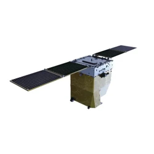
High resolution satellite images have transformed our ability to observe and analyze the Earth’s surface with remarkable clarity. These images, captured by sophisticated satellites orbiting the planet, reveal fine details ranging from natural landscapes to urban infrastructures. The availability of high resolution satellite images supports a multitude of fields including environmental monitoring, urban planning, agriculture, and disaster management. Through platforms like Google Earth and applications offering real-time satellite imagery free, users can access and utilize this data for both professional and educational purposes. This article explores the significance of high resolution satellite images, how to access them, and the educational tools available to maximize their potential.
The Importance and Applications of High Resolution Satellite Images
The primary advantage of high resolution satellite images lies in their ability to capture detailed visual information about the Earth’s surface. This level of detail is essential for identifying small-scale features such as individual trees, roads, vehicles, and buildings. Environmental scientists use these images to monitor changes in ecosystems, deforestation, and urban expansion. For instance, satellite imagery can detect illegal logging activities in protected forests by revealing recent clearings that are not visible through traditional aerial photography.
In agriculture, farmers and researchers rely on high resolution satellite images to assess crop health, soil conditions, and irrigation efficiency. This detailed spatial information enables precision farming, which increases yield while reducing resource consumption. Urban planners also benefit from these images by analyzing city growth, traffic patterns, and infrastructure development. Moreover, during natural disasters such as floods or earthquakes, emergency responders utilize up-to-date satellite images to assess damage and coordinate relief efforts.
La versatilidad de high resolution satellite images extends to wildlife conservation, climate change studies, and even archaeology, where hidden structures can be identified beneath vegetation. Their broad applicability makes them indispensable across scientific, commercial, and governmental sectors.
Platforms Providing Access to High Resolution Satellite Images
Accessing high resolution satellite images has become increasingly feasible due to technological advances and open data initiatives. Google Earth remains one of the most popular platforms offering access to extensive satellite imagery. Its user-friendly interface allows users to zoom into locations worldwide and explore detailed geographic data. In addition to static images, Google Earth integrates data layers such as road maps and demographic information, enhancing spatial context.
Another vital platform is NASA Worldview, which provides near real-time satellite imagery free to users. It aggregates data from multiple satellite missions, enabling monitoring of atmospheric conditions, wildfires, storms, and vegetation changes. Scientists and decision-makers use this platform for timely environmental assessments and disaster response.
Other open access programs include the Landsat series from the US Geological Survey and the European Space Agency’s Sentinel satellites. These provide regular updates of satellite imagery at varying resolutions. While some of these datasets may not match the very highest resolution commercial images, their frequent updates and free access make them invaluable for continuous monitoring.
Mobile high resolution satellite apps offer convenient access to satellite images on handheld devices. These apps often pull data from the aforementioned sources, allowing users to explore geographic areas in the field, annotate maps, and conduct spatial analyses without needing a desktop computer.
Educational Resources: Learning Through Remote Sensing Books and Journals
To effectively interpret and apply high resolution satellite images, education in remote sensing principles and techniques is essential. A comprehensive remote sensing book can provide a thorough understanding of satellite sensor types, image processing, and analytical methods. Topics such as spectral signatures, image classification, and geographic information systems (GIS) are fundamental to extracting meaningful information from satellite data.
Numeroso remote sensing PDFs and online tutorials offer accessible learning materials for students, researchers, and professionals. These resources explain how to manipulate satellite images, correct distortions, and integrate data into broader geospatial projects.
Additionally, staying current with technological advancements and research findings is facilitated by publications like the Remote Sensing journal. This journal publishes peer-reviewed articles on new satellite missions, innovative image processing algorithms, and practical case studies across disciplines.
Understanding remote sensing in geography further enhances the ability to contextualize satellite imagery within physical landscapes and human activities. It allows users to make informed interpretations about land use, environmental change, and spatial patterns observed in satellite images.
Future Trends and the Expanding Role of High Resolution Satellite Images
As satellite technology advances, the resolution and frequency of satellite imagery continue to improve. Emerging satellites equipped with hyperspectral sensors and enhanced imaging capabilities promise even greater detail and spectral information. This advancement will enable more precise monitoring of environmental phenomena and urban dynamics.
The integration of artificial intelligence and machine learning with satellite data analysis is revolutionizing how high resolution satellite images are processed. Automated detection of changes, classification of land cover, and predictive modeling are becoming more efficient, opening new opportunities for rapid decision-making.
Moreover, the proliferation of high resolution satellite apps ensures that detailed satellite data reaches a broader audience. This democratization of access supports citizen science projects, educational programs, and grassroots environmental monitoring, fostering greater public engagement with Earth observation.
Conclusion
High resolution satellite images have opened a new frontier in Earth observation, providing detailed insights that support diverse applications from environmental conservation to urban development. Platforms such as Google Earth and NASA Worldview offer accessible ways to obtain these images, including options for real-time satellite imagery free. Educational resources like remote sensing books, remote sensing PDFs, and the Remote Sensing journal equip users with the knowledge to analyze and apply satellite data effectively.
With ongoing technological advances and growing access through high resolution satellite apps, the role of high resolution satellite images in shaping our understanding of the planet will only expand. Embracing these tools and resources empowers individuals and organizations alike to make informed decisions for a sustainable future.


