- አፍሪካዊ
- አልበንያኛ
- አማርኛ
- አረብኛ
- አርመንያኛ
- አዘርባጃኒ
- ባስክ
- ቤላሩሲያን
- ቤንጋሊ
- ቦስንያን
- ቡልጋርያኛ
- ካታሊያን
- ሴቡአኖ
- ቻይና
- ኮርሲካን
- ክሮኤሽያን
- ቼክ
- ዳኒሽ
- ደች
- እንግሊዝኛ
- እስፔራንቶ
- ኢስቶኒያን
- ፊኒሽ
- ፈረንሳይኛ
- ፍሪሲያን
- ጋላሺያን
- ጆርጅያን
- ጀርመንኛ
- ግሪክኛ
- ጉጅራቲ
- ሓይቲያን ክሬኦሌ
- ሃውሳ
- ሐዋያን
- ሂብሩ
- አይ
- ሚያኦ
- ሃንጋሪያን
- አይስላንዲ ክ
- igbo
- ኢንዶኔዥያን
- አይሪሽ
- ጣሊያንኛ
- ጃፓንኛ
- ጃቫኒስ
- ካናዳ
- ካዛክሀ
- ክመር
- ሩዋንዳኛ
- ኮሪያኛ
- ኩርዲሽ
- ክይርግያዝ
- የጉልበት ሥራ
- ላቲን
- ላትቪያን
- ሊቱኒያን
- ሉክዜምብርጊሽ
- ማስዶንያን
- ማላጋሲያ
- ማላይ
- ማላያላም
- ማልትስ
- ማኦሪይ
- ማራቲ
- ሞኒጎሊያን
- ማይንማር
- ኔፓሊ
- ኖርወይኛ
- ኖርወይኛ
- ኦሲታን
- ፓሽቶ
- ፐርሽያን
- ፖሊሽ
- ፖርቹጋልኛ
- ፑንጃቢ
- ሮማንያን
- ራሺያኛ
- ሳሞአን
- ስኮትላንዳዊ ጌሊክ
- ሰሪቢያን
- እንግሊዝኛ
- ሾና
- ስንድሂ
- ሲንሃላ
- ስሎቫክ
- ስሎቬንያን
- ሶማሊ
- ስፓንኛ
- ሱዳናዊ
- ስዋሕሊ
- ስዊድንኛ
- ታንጋሎግ
- ታጂክ
- ታሚል
- ታታር
- ተሉጉ
- ታይ
- ቱሪክሽ
- ቱሪክሜን
- ዩክሬንያን
- ኡርዱ
- ኡጉር
- ኡዝቤክ
- ቪትናሜሴ
- ዋልሽ
- እገዛ
- ዪዲሽ
- ዮሩባ
- ዙሉ
Unlocking Agricultural Insights With Multispectral Satellite Imagery
The advent of multispectral satellite technology has ushered in a new era for precision agriculture and sustainable farming practices. By capturing multispectral satellite imagery, farmers and agronomists gain valuable data about crop health, soil moisture, pest infestations, and nutrient deficiencies. This detailed information enables better decision-making, optimized resource use, and increased crop yields.
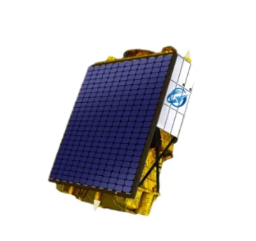
How Multispectral Satellite Imagery Supports Precision Agriculture
Unlike conventional images, multi spectral satellite imagery captures light across multiple wavelengths, including those invisible to the human eye, such as near-infrared. This capability allows for the detection of subtle changes in plant physiology that indicate stress before symptoms are visible.
Using this data, farmers can identify specific zones within fields that require irrigation, fertilization, or pest control, thereby reducing costs and environmental impact. Crop monitoring through multispectral satellite data is becoming an integral part of smart farming systems, combining satellite inputs with drones, IoT sensors, and AI analytics.
Enhancing Crop Management And Yield Prediction
Regular access to updated multispectral satellite imagery helps in tracking crop growth stages and predicting yields with higher accuracy. This information supports supply chain planning and market forecasting, giving stakeholders a competitive edge.
Moreover, the ability to monitor vast agricultural areas from space makes multispectral satellites invaluable for governments and organizations focused on food security and disaster preparedness. By detecting drought impacts or disease outbreaks early, appropriate measures can be implemented promptly.
Integration With Satellite Communication For Timely Data Delivery
The effectiveness of multispectral satellite imagery depends on timely delivery and easy access to data. Advances in satellite internet, VSAT, and other satellite communication systems facilitate rapid data transfer from orbit to end users.
Cloud-based platforms, often offered via satellite as a service, enable seamless processing and visualization of multispectral satellite data. This integration empowers farmers and agronomists, even in remote areas, to make data-driven decisions without the need for complex on-site equipment.
In summary, multispectral satellite imagery is transforming agriculture by providing detailed, actionable insights that improve crop management and sustainability. Coupled with advances in satellite communication and data services, these technologies are helping feed the world more efficiently and responsibly.


