- африканський
- албанець
- амхарська
- арабська
- вірменський
- Азербайджанська
- Баскська
- білоруська
- Бенгальська
- боснійський
- Болгарська
- каталонська
- Себуано
- Китай
- Корсиканець
- Хорватська
- чеська
- датська
- голландська
- англійська
- Есперанто
- Естонська
- фінська
- французька
- фризька
- галицький
- грузинський
- Німецький
- грецька
- Гуджараті
- Гаїтянська креольська
- Хауса
- гавайський
- іврит
- немає
- Мяо
- угорська
- ісландська
- ігбо
- індонезійська
- ірландський
- італійська
- Японський
- яванський
- каннада
- казахська
- кхмерська
- Руанда
- корейська
- курдська
- киргизький
- праці
- латинь
- латиська
- литовський
- люксембурзький
- македонська
- малагасійська
- малайська
- малаялам
- мальтійська
- Маорі
- маратхі
- монгольська
- М'янма
- непальська
- норвезька
- норвезька
- Окситанська
- пушту
- перська
- польський
- португальська
- Пенджабі
- румунська
- російська
- Самоанська
- Шотландська гельська
- сербська
- англійська
- Шона
- Сіндхі
- сингальська
- словацький
- словенська
- сомалі
- Іспанська
- Сунданська
- Суахілі
- шведська
- тагальська
- таджицька
- тамільська
- татарський
- Телугу
- тайська
- турецька
- туркменський
- українська
- урду
- уйгурський
- узбецький
- в'єтнамська
- Валлійська
- Довідка
- ідиш
- йоруба
- Зулу
Satellite Remote Sensing Data Empowering Global Decision-Making With SpaceNavi
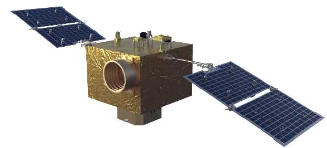
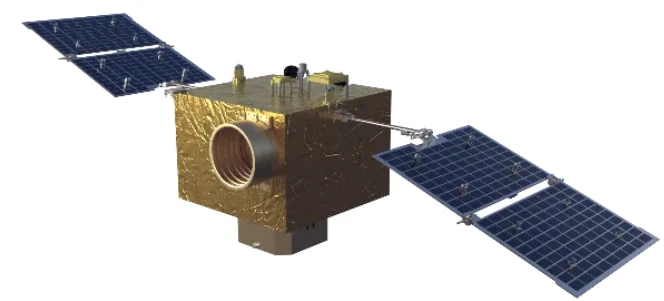
In an era where timely and accurate geospatial information is vital, satellite remote sensing data has emerged as a transformative asset across a wide range of industries. SpaceNavi Co., Ltd. plays a key role in this revolution by delivering high-performance, low-cost satellite platforms and information services that enable reliable and insightful access to Earth observation data. Our advanced remote sensing systems and customized satellite solutions are trusted by government agencies and international organizations alike.
Meeting Global Demands with High Resolution Remote Sensing Satellites List
The demand for reliable, up-to-date data has led to a surge in interest in high resolution remote sensing satellites list technologies. SpaceNavi’s proprietary satellite platforms are engineered to capture high-resolution imagery in various spectral bands, including visible, infrared, and thermal, making them adaptable for multiple applications.
Our satellite remote sensing data services are tailored to support everything from environmental monitoring and agricultural forecasting to urban development and disaster management. By offering modular design capabilities, we allow clients to select instruments that best suit their missions—without compromising on quality or budget.
Unlocking Insights with Remote Sensing and Satellite Imagery
SpaceNavi’s commitment to precision is evident in the quality of our remote sensing and satellite imagery. These visuals are captured through our custom-designed optical payloads and processed through AI-enhanced pipelines that deliver actionable intelligence quickly.
Whether used for tracking coastal erosion, detecting deforestation, or analyzing crop health, our remote sensing satellite image solutions provide clarity and confidence to decision-makers. SpaceNavi’s approach combines hardware excellence with smart data interpretation, setting us apart in the highly specialized world of satellite remote sensing data services.
Our partnerships with global ground stations also ensure fast data delivery, reducing latency between data capture and application. This is especially valuable in situations like natural disaster response, where every moment counts.
The Power of Panchromatic and Night Time Light Satellite Imagery
For applications requiring ultra-fine detail, SpaceNavi delivers panchromatic satellite imagery with spatial resolutions suitable for infrastructure planning, land surveying, and object detection. This grayscale imagery provides unmatched sharpness, ideal for tasks requiring structural or textural analysis.
In addition, our night time light satellite imagery services are revolutionizing how governments and institutions monitor economic activity and urban development. These images provide insights into light emissions and energy distribution, revealing patterns that are otherwise hidden during daylight hours.
Combined, these two imaging capabilities offer a full-spectrum view of Earth, enabling users to track change over time and space with confidence. SpaceNavi ensures these capabilities are fully integrated with our larger remote sensing satellite image offerings.


