- afrikanska
- albanska
- amhariska
- arabiska
- armeniska
- azerbajdzjanska
- baskiska
- vitryska
- bengaliska
- bosniska
- bulgariska
- katalanska
- Cebuano
- Kina
- korsikanska
- Kroatisk
- tjeckiska
- danska
- holländska
- engelska
- esperanto
- estniska
- finska
- franska
- frisiska
- galiciska
- georgiska
- tyska
- grekiska
- Gujarati
- haitisk kreol
- Hausa
- hawaiianska
- hebreiska
- Inga
- Miao
- ungerska
- isländska
- igbo
- indonesiska
- irländsk
- italienska
- japanska
- javanesiska
- Kannada
- kazakiska
- Khmer
- rwandiska
- koreanska
- kurdiska
- kirgiziska
- Arbetskraft
- latin
- lettiska
- litauiska
- Luxemburgiska
- makedonska
- Madagaskar
- malajiska
- Malayalam
- maltesiska
- Maori
- Marathi
- mongoliska
- Myanmar
- nepalesiska
- norska
- norska
- occitanska
- Pashto
- persiska
- polska
- portugisiska
- Punjabi
- rumänska
- ryska
- Samoan
- skotsk gaeliska
- serbiska
- engelska
- Shona
- Sindhi
- singalesiska
- slovakiska
- slovenska
- somaliska
- spanska
- Sundanesiska
- Swahili
- svenska
- Tagalog
- tadzjikiska
- Tamil
- tatariska
- Telugu
- Thai
- turkiska
- turkmeniska
- ukrainska
- Urdu
- Uigur
- uzbekiska
- vietnamesiska
- walesiska
- Hjälp
- jiddisch
- Yoruba
- Zulu
Remote Sensing Process: The Essential Steps Behind Earth Observation
Understanding the remote sensing process is fundamental for anyone using satellite or aerial data to analyze the Earth's surface and atmosphere. This process involves several critical stages, from data acquisition to interpretation, each ensuring the accuracy and usefulness of the collected information. With advances in satellite technology providing very high-resolution satellite imagery free through various platforms, mastering the remote sensing process is more important than ever for scientists, geographers, and decision-makers. This article details the stages of the remote sensing process, discusses common remote sensing data examples, highlights platforms offering remote sensing data free and remote sensing data online, and explains the advantages of remote sensing. We also revisit what is remote sensing in Geography and how different types of remote sensing fit into the process.
Data Acquisition: Capturing Earth's Signals
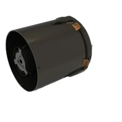
The first step in the remote sensing process is data acquisition. This involves capturing electromagnetic signals reflected or emitted from Earth's surface using sensors mounted on satellites, aircraft, or drones. Depending on the types of remote sensing technology used, sensors may passively detect sunlight reflected off the surface or actively emit signals, like radar pulses, and measure their reflections.
Satellites equipped with optical sensors capture multispectral or hyperspectral images, while radar sensors provide Synthetic Aperture Radar (SAR) data. LiDAR sensors emit laser pulses to create detailed 3D models. These diverse remote sensing data examples allow observation under various conditions and provide different information layers.
Data Transmission and Preprocessing: Preparing for Analysis
Once data is collected, it is transmitted to ground stations for reception and storage. The raw data often contains distortions caused by atmospheric interference, sensor noise, or geometric errors due to Earth's curvature and sensor movement. The remote sensing process includes preprocessing steps to correct these issues.
Preprocessing involves radiometric correction to adjust for sensor and atmospheric effects, geometric correction to align images with real-world coordinates, and image enhancement to improve visual quality. This stage ensures that satellite images are accurate and ready for meaningful analysis.
Image Processing and Interpretation: Extracting Information
After preprocessing, images undergo processing and interpretation. Analysts use various techniques such as classification, segmentation, and change detection to extract valuable information from the data. For example, land cover classification categorizes terrain into forest, urban, water, and other classes, enabling applications like urban planning or environmental monitoring.
Change detection methods compare images over time to identify alterations such as deforestation or urban expansion. The advantages of remote sensing in providing temporal data make these analyses feasible on regional to global scales.
Integration with Geographic Information Systems (GIS) allows for spatial analyses combining satellite imagery with other data sources. This integrated approach supports comprehensive studies and decision-making.
Data Application and Dissemination: Real-World Impact
The final stages of the remote sensing process involve applying interpreted data to real-world problems and disseminating results. Governments, NGOs, businesses, and researchers use remote sensing data for various purposes like disaster response, resource management, and scientific research.
Platforms providing remote sensing data free and remote sensing data online, such as USGS Earth Explorer and Copernicus Hub, enable users worldwide to access processed satellite data. Additionally, very high-resolution satellite imagery free available through services like Google Earth enhances public engagement and supports education.
Remote Sensing in Geography and Its Relation to the Process
What is remote sensing in Geography? It is the systematic use of satellite and aerial data to study physical landscapes and human interactions. The remote sensing process is the backbone of geographic analyses, enabling geographers to gather accurate, timely information for mapping, environmental assessments, and spatial modeling.
Different types of remote sensing fit into this process depending on the application, sensor capabilities, and environmental conditions. Understanding the entire process ensures that geographic insights derived from remote sensing are reliable and actionable.
Conclusion
The remote sensing process encompasses crucial steps from data acquisition to application, ensuring that satellite and aerial imagery serve as powerful tools for Earth observation. By leveraging diverse remote sensing data examples, accessing remote sensing data free and remote sensing data online, and understanding the advantages of remote sensing, users can fully harness this technology.
Mastering the remote sensing process is essential in fields like geography, where the integration of types of remote sensing and very high-resolution satellite imagery free supports detailed spatial analyses and informed decision-making. As satellite technologies evolve, the efficiency and impact of the remote sensing process will only increase, enhancing our ability to monitor and manage the planet.


