- africký
- albánsky
- amharčina
- arabčina
- arménsky
- azerbajdžanský
- baskický
- bieloruský
- bengálsky
- bosniansky
- bulharčina
- katalánsky
- Cebuano
- Čína
- korzické
- chorvátsky
- český
- dánčina
- holandský
- angličtina
- Esperanto
- estónsky
- fínsky
- francúzsky
- frízsky
- Haličský
- gruzínsky
- nemecký
- grécky
- Gudžarátčina
- haitská kreolčina
- Hausa
- havajský
- hebrejčina
- Nie
- Miao
- maďarský
- islandský
- igbo
- indonézsky
- írsky
- taliansky
- japončina
- jávsky
- Kannada
- kazašský
- khmérsky
- Rwanda
- kórejský
- kurdský
- kirgizský
- práce
- latinčina
- lotyšský
- litovský
- luxemburský
- macedónsky
- malgašský
- malajčina
- malajálamčina
- maltčina
- Maori
- maráthčina
- mongolský
- Mjanmarsko
- nepálsky
- nórsky
- nórsky
- okcitánsky
- paštčina
- perzský
- poľský
- portugalčina
- pandžábsky
- rumunský
- ruský
- Samoan
- škótska galčina
- srbský
- angličtina
- Shona
- Sindhi
- sinhálčina
- slovenský
- slovensky
- somálsky
- španielčina
- sundánsky
- svahilčina
- švédsky
- Tagalog
- tadžický
- tamilčina
- tatársky
- telugčina
- thajčina
- turecký
- turkménskym
- Ukrajinčina
- urdčina
- ujgurské
- uzbecký
- Vietnamci
- waleský
- Pomoc
- jidiš
- Yoruba
- Zulu
správy
Remotely Sensed Satellite Imagery Enhancing Intelligence with SpaceNavi
As industries, governments, and research institutions continue to rely on space-based solutions for real-time analysis and planning, remotely sensed satellite imagery has become a powerful asset. At SpaceNavi Co., Ltd., we integrate advanced aerospace technology and remote sensing systems to offer customized, high-performance satellite platforms and data services. Our core strength lies in delivering precise, low-cost solutions with short production cycles—ideal for clients needing fast, reliable, and insightful Earth observation services.
High Resolution Remote Sensing Images for Precision and Clarity
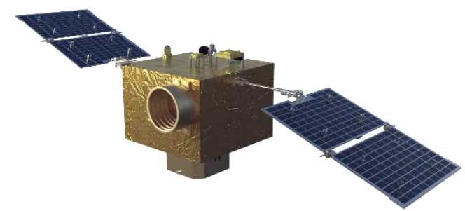
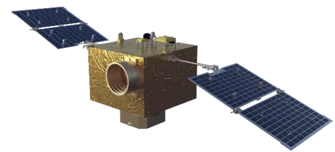
Modern remote sensing requires clarity beyond what conventional aerial surveys can offer. SpaceNavi provides high resolution remote sensing images through a network of agile and versatile satellites, optimized with sophisticated optical payloads and onboard image processing systems.
These images allow governments and international organizations to perform tasks such as land use classification, agricultural health monitoring, and national infrastructure assessment with unmatched accuracy. Our satellites are equipped to capture remote sensing satellite image data across multiple spectral bands, including panchromatic and multispectral formats, enabling end-users to extract actionable insights from every pixel.
By combining edge technologies with our engineering expertise, SpaceNavi ensures that high resolution remote sensing images reach clients swiftly and in the required formats for real-world applications.
Comprehensive Satellite Coverage with Remote Sensing Satellite Image Solutions
SpaceNavi's mission is to empower users with end-to-end satellite solutions. Our remote sensing satellite image offerings are part of a broader service framework that includes satellite platform customization, component integration, and data transmission solutions.
Every satellite we deploy is capable of collecting and delivering satellite remote sensing data that supports environmental analysis, disaster risk management, mineral exploration, and urban growth assessment. Our team engineers optical camera systems and sensor payloads that meet mission-specific requirements, whether for continuous data collection or one-time mapping projects.
Through collaboration with global ground stations and data processing hubs, we ensure uninterrupted access to remotely sensed satellite imagery, allowing clients to make informed decisions in time-sensitive scenarios.
Enabling Advanced Analysis with Panchromatic and Night Time Light Satellite Imagery
To meet the growing demand for diverse imaging capabilities, SpaceNavi offers specialized data products such as panchromatic satellite imagery and night time light satellite imagery. These imaging formats are crucial for detailed object recognition, population analysis, urban lighting studies, and economic activity tracking.
Panchromatic satellite imagery provides superior resolution in grayscale, ideal for identifying infrastructure elements, terrain contours, and vegetation boundaries. On the other hand, night time light satellite imagery offers a unique view of Earth’s nocturnal activity, from city growth to energy consumption patterns.
These capabilities are embedded into SpaceNavi's modular satellite designs, which prioritize flexibility and rapid delivery. We take pride in contributing to international space missions and Earth observation projects that rely on remote sensing and satellite imagery to improve lives and safeguard the environment.


