- africký
- albánsky
- amharčina
- arabčina
- arménsky
- azerbajdžanský
- baskický
- bieloruský
- bengálsky
- bosniansky
- bulharčina
- katalánsky
- Cebuano
- Čína
- korzické
- chorvátsky
- český
- dánčina
- holandský
- angličtina
- Esperanto
- estónsky
- fínsky
- francúzsky
- frízsky
- Haličský
- gruzínsky
- nemecký
- grécky
- Gudžarátčina
- haitská kreolčina
- Hausa
- havajský
- hebrejčina
- Nie
- Miao
- maďarský
- islandský
- igbo
- indonézsky
- írsky
- taliansky
- japončina
- jávsky
- Kannada
- kazašský
- khmérsky
- Rwanda
- kórejský
- kurdský
- kirgizský
- práce
- latinčina
- lotyšský
- litovský
- luxemburský
- macedónsky
- malgašský
- malajčina
- malajálamčina
- maltčina
- Maori
- maráthčina
- mongolský
- Mjanmarsko
- nepálsky
- nórsky
- nórsky
- okcitánsky
- paštčina
- perzský
- poľský
- portugalčina
- pandžábsky
- rumunský
- ruský
- Samoan
- škótska galčina
- srbský
- angličtina
- Shona
- Sindhi
- sinhálčina
- slovenský
- slovensky
- somálsky
- španielčina
- sundánsky
- svahilčina
- švédsky
- Tagalog
- tadžický
- tamilčina
- tatársky
- telugčina
- thajčina
- turecký
- turkménskym
- Ukrajinčina
- urdčina
- ujgurské
- uzbecký
- Vietnamci
- waleský
- Pomoc
- jidiš
- Yoruba
- Zulu
správy
A Complete Guide to Satellite Remote Sensing Data
In today’s digital age, satellite remote sensing data plays a critical role in understanding and managing the Earth’s resources, environment, and urban spaces. From weather forecasting to agricultural monitoring and disaster management, remote sensing has transformed how we observe and interact with our planet.
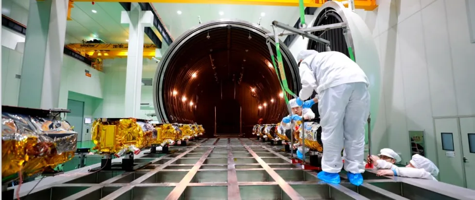
But what exactly is remote sensing data? What are the different types of remote sensing images, and how are they used? This comprehensive guide will explain everything you need to know.
What Is Remote Sensing Data?
Remote sensing data refers to the information collected about an object, area, or phenomenon without making physical contact, typically using sensors mounted on satellites, aircraft, or drones.
In simple terms, remote sensing allows us to gather detailed images and measurements of Earth from space or high altitudes. These sensors capture reflected and emitted energy from the Earth's surface in various wavelengths, which can then be analyzed to extract valuable insights.
Sources of Remote Sensing Data:
- Satelity(e.g., Landsat, Sentinel, MODIS)
- Dronesand Unmanned Aerial Vehicles (UAVs)
- Aircraft-mounted sensors
Types of Remote Sensing Images
Understanding the types of remote sensing images helps to choose the right data for a specific application.
1. Optical Images (Visible and Infrared)
Captured in the visible light and infrared spectrum, these are the most common remote sensing images. They show natural colors or false-color composites and are widely used for land cover mapping, agriculture, and environmental monitoring.
Examples:
- Landsat imagery
- Sentinel-2 images
2. Radar Images (Microwave Remote Sensing)
Synthetic Aperture Radar (SAR) uses microwave signals that can penetrate clouds, smoke, and even vegetation to capture surface information. Radar images are crucial for disaster monitoring, like floods and landslides, and for mapping forests and ice sheets.
Examples:
- Sentinel-1 SAR data
- RADARSAT images
3. Thermal Images
These images capture thermal infrared radiation emitted by objects, showing heat patterns. They are used to study urban heat islands, monitor wildfires, and assess water temperature.
Examples:
- Landsat 8 TIRS (Thermal Infrared Sensor)
- MODIS thermal bands
4. Hyperspectral Images
Captured across hundreds of narrow bands, hyperspectral images provide detailed spectral information to identify materials, chemicals, and vegetation types. Used in mineral exploration, agriculture, and environmental monitoring.
5. Multispectral Images
These images capture data across multiple specific wavelengths (but fewer than hyperspectral). Multispectral data is widely used for vegetation analysis, water quality monitoring, and land use mapping.
Examples:
- Sentinel-2
- WorldView-3
Applications of Satellite Remote Sensing Data
Satellite remote sensing data has countless applications across various industries and scientific research:
Agriculture
- Crop monitoring and yield prediction
- Soil moisture estimation
- Disease and pest detection
Environmental Monitoring
- Deforestation tracking
- Water body mapping and quality assessment
- Climate change studies
Disaster Management
- Flood mapping and impact assessment
- Wildfire detection and monitoring
- Earthquake damage assessment
Urban Planning
- Land use and land cover mapping
- Urban heat island analysis
- Infrastructure development monitoring
Mining and Geology
- Mineral and resource exploration
- Geological mapping
How to Access Satellite Remote Sensing Data?
Many organizations provide free or commercial remote sensing data:
Public and Free Sources:
- USGS Earth Explorer(Landsat)
- Copernicus Open Access Hub(Sentinel series)
- NASA Earthdata
Commercial Providers (High-resolution data):
- Maxar (WorldView satellites)
- Planet Labs
- Airbus (Pleiades, SPOT)
Public data is often sufficient for environmental studies and land monitoring, while commercial sources are used for detailed urban mapping, defense, and industrial use.
Challenges and Considerations in Using Remote Sensing Data
While remote sensing offers immense advantages, there are some challenges to be aware of:
- Cloud Cover: Optical images may be obstructed by clouds — radar data is an alternative.
- Spatial Resolution: Higher resolution means more detailed images but larger file sizes and costs.
- Temporal Resolution: Frequency of data capture — important for time-sensitive applications.
- Data Processing Needs: Requires specialized software and expertise (e.g., GIS tools like QGIS, ArcGIS).
Satellite remote sensing data is a powerful tool that revolutionizes how we monitor, manage, and analyze the Earth's surface and resources. Whether for agriculture, disaster management, environmental monitoring, or urban planning, understanding the types of remote sensing images and how to access them is crucial.
With advances in technology, the accessibility, affordability, and accuracy of remote sensing data are continuously improving — making it a vital resource for governments, industries, and researchers alike.
Remote Sensing Data FAQs
Q1: What is remote sensing data?
A1: Remote sensing data is information collected about the Earth's surface using sensors on satellites, aircraft, or drones, without direct contact with the observed objects.
Q2: What are the main types of remote sensing images?
A2: Major types include optical (visible and infrared), radar (microwave), thermal, multispectral, and hyperspectral images.
Q3: How is satellite remote sensing data used?
A3: Used in agriculture, environmental monitoring, disaster management, urban planning, and resource exploration for analysis and decision-making.
Q4: Is remote sensing data free?
A4: Many datasets like Landsat and Sentinel are freely available. High-resolution commercial data from providers like Maxar or Planet may require purchase.
Q5: What is the difference between multispectral and hyperspectral images?
A5: Multispectral images capture a few wide spectral bands (e.g., red, green, blue, near-infrared), while hyperspectral images capture hundreds of narrow bands, offering detailed spectral information for precise analysis.


