- افریقايي
- البانیایی
- امهاریک
- عربي
- ارمانیایی
- اذربایجاني
- باسک
- بلاروسي
- بنګالي
- بوسنیایی
- بلغاریه ایی
- کتالین
- سیبوانو
- چین
- کورسیکن
- کرواسین
- چکسلواکي
- دنمارکي
- الماني
- انګلیسي
- ایسپیرینټو
- ایستونین
- فنلینډي
- فرانسوي
- فریزیایي
- ګالیسي
- ګرجستاني
- جرمني
- یوناني
- ګجراتي
- هایتي کریول
- هوسا
- هوایی
- عبري
- نه
- میاو
- هنګري
- ایلینډیک
- ایګبو
- انډونیزین
- ایرلینډي
- ایټالیوي
- جاپاني
- جاوه ای
- کناډا
- قزاقي
- خمیر
- روانډا
- کوریایی
- کردي
- قرغیزي
- مزدوري
- لاتین
- لیتوین
- لیتوانیایی
- لوګزامبورګي
- مقدوني
- ملاګاسي
- مالایا
- ملایلم
- مالتیس
- ماوري
- مراټي
- مغولي
- میانمار
- نیپالي
- نارویژي
- نارویژي
- اوکسيټي
- پښتو
- فارسي
- پولیش
- پورتګالي
- پنجابي
- رومانیایی
- روسي
- سامواني
- سکاټلینډي ګیلیک
- صربي
- انګلیسي
- شونا
- سندي
- سينهاله
- سلواکي
- سلوانیایی
- سومالیایی
- هسپانیه ایی
- سنډانیز
- سواحلي
- سویډیش یا سویډني
- تګالوګ
- تاجک
- تامیل
- تاتار
- تولیګو
- تای
- ترکي
- ترکمني
- اوکرایني
- اردو
- اویغور
- ازبکي
- ویتنامي
- ولش
- مرسته
- یدیش
- یوروبا
- زولو
Precision And Perspective With High Resolution Remote Sensing Satellites List
As global interest in geospatial intelligence and environmental monitoring continues to rise, the role of satellites in capturing high-quality imagery has never been more crucial. Among the most important assets in this field is the expanding high resolution remote sensing satellites list—a collection of advanced spacecraft capable of capturing extremely detailed images of the Earth’s surface. Whether for scientific research, infrastructure development, or environmental conservation, these satellites generate invaluable satellite remote sensing data that powers smarter decisions across the globe.
Benefits of a Growing High Resolution Remote Sensing Satellites List
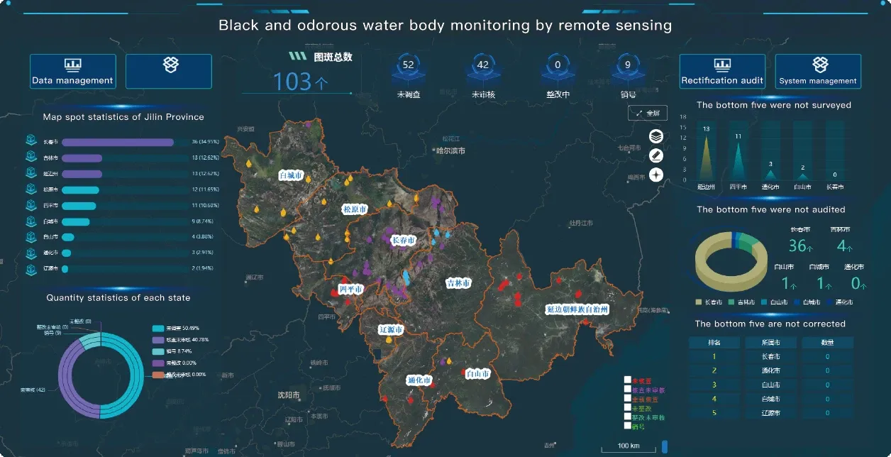
The high resolution remote sensing satellites list includes both public and commercial satellites capable of capturing ground-level features with incredible clarity. These satellites can detect changes in land cover, vegetation health, urban growth, and more, often in near real time. The data collected by this constellation of platforms is integrated into various decision-making systems, from city planning to climate research. The growing availability of high resolution remote sensing images from multiple operators ensures that analysts and researchers can cross-reference information and build comprehensive, time-sensitive datasets.
Advancing Earth Monitoring With Remotely Sensed Satellite Imagery
Remotely sensed satellite imagery offers a powerful means of observing Earth's dynamic systems without physical contact. These images are not merely visual—they include metadata, spatial coordinates, and spectral information that supports quantitative analysis. By using remote sensing satellite image data, industries such as agriculture, forestry, and public safety can detect anomalies, prevent disasters, and manage resources more effectively. For example, satellite remote sensing data is often used to monitor drought stress in crops or track illegal mining in protected areas.
Integration of Panchromatic Satellite Imagery for Enhanced Analysis
Among the tools enhancing satellite-based analysis is panchromatic satellite imagery. This form of imaging provides single-band, high-resolution black-and-white images that offer superior detail. Analysts frequently combine panchromatic satellite imagery with multispectral data to create composite images that are both rich in color and high in definition. This process, known as pan-sharpening, is critical for applications like road network detection, building classification, and infrastructure mapping. The widespread use of panchromatic data within the broader remote sensing and satellite imagery domain demonstrates how satellite technologies continue to converge for better clarity and actionable insights.
Night Time Light Satellite Imagery: Visualizing Human Activity
One of the more specialized applications in Earth observation is night time light satellite imagery. By detecting artificial lighting patterns on the Earth's surface, satellites can infer economic activity, infrastructure distribution, and population density, especially in developing or disaster-affected regions. Paired with high resolution remote sensing images, nighttime imagery can show the recovery of power grids after storms or track urban expansion into previously dark areas. It brings a temporal dimension to satellite remote sensing data, providing insights beyond daylight-based observation.
Conclusion: The Strategic Value of Satellite Data
From tracking deforestation to supporting smart cities, the combination of advanced satellites, high-quality imagery, and intelligent analysis is transforming how we view our planet. The expanding high resolution remote sensing satellites list is at the core of this transformation. Through tools like panchromatic satellite imagery, night time light satellite imagery, and other forms of remotely sensed satellite imagery, decision-makers gain timely and reliable information. As Earth observation becomes more accessible and affordable, remote sensing and satellite imagery will continue to empower science, policy, and innovation on a global scale.


