- Afrikan
- Albaniż
- Amhariku
- Għarbi
- Armenjan
- Ażerbajġani
- Bask
- Belarussu
- Bengali
- Bosnijan
- Bulgaru
- Katalan
- Cebuano
- Iċ-Ċina
- Korsiku
- Kroat
- Ċek
- Daniż
- Olandiż
- Ingliż
- Esperanto
- Estonjan
- Finlandiż
- Franċiż
- Friżjan
- Galizjan
- Ġorġjan
- Ġermaniż
- Grieg
- Guġarati
- Kreol Ħaitjan
- Hausa
- Ħawajjan
- Ebrajk
- Nru
- Miao
- Ungeriż
- Iżlandiż
- igbo
- Indoneżjan
- Irlandiż
- Taljan
- Ġappuniż
- Ġavaniż
- Kannada
- każak
- Khmer
- Rwandan
- Korean
- Kurdi
- Kirgiż
- Laburista
- Latin
- Latvjan
- Litwan
- Lussemburgiż
- Maċedonjan
- Madagaskar
- Malajan
- Malajalam
- Malti
- Maori
- Marathi
- Mongoljan
- Il-Mjanmar
- Nepaliż
- Norveġiż
- Norveġiż
- Oċċitan
- Pashto
- Persjan
- Pollakk
- Portugiż
- Punġabi
- Rumen
- Russu
- Samoan
- Galliku Skoċċiż
- Serb
- Ingliż
- Shona
- Sindhi
- Sinħaliż
- Slovakk
- Sloven
- Somali
- Spanjol
- Sundaniż
- Swaħili
- Svediż
- Tagalog
- Taġik
- Tamil
- Tatar
- Telugu
- Tajlandiż
- Tork
- Turkmeni
- Ukrain
- Urdu
- Uighur
- Użbek
- Vjetnamiż
- Welsh
- Għajnuna
- Jiddix
- Joruba
- Żulu
aħbarijiet
The Power of Satellite Remote Sensing Data
In an age where data drives decision-making, satellite remote sensing data has emerged as a cornerstone in various industries. From agriculture to urban planning, the insights drawn from satellite imagery are invaluable. But how do you get live satellite images? And how does satellite remote sensing play a crucial role in hydrological data assimilation? Join us as we explore these fascinating aspects and introduce you to Changguang Satellite Technology Co., Ltd., a leading player in this field.

How to Get Live Satellite Images
Accessing live satellite images has never been easier, thanks to groundbreaking technology. Various platforms now offer real-time satellite data, enabling users to monitor changes in the environment, track natural disasters, and even observe urban development. These services often utilize a combination of high-resolution imaging and advanced algorithms to deliver updated visuals that meet your specific needs. Whether you are a researcher, a government agency, or a business owner, acquiring live satellite images can elevate your analysis and decision-making capabilities.
Satellite Remote Sensing in Hydrological Data Assimilation
Hydrological data assimilation is critical for effective water resource management, flood forecasting, and climate change studies. Satellite remote sensing technology plays a pivotal role in this domain by providing comprehensive data that enhances traditional hydrological models. By integrating satellite imagery with ground-based observations, scientists can better understand water movement, distribution, and availability. This fusion of data leads to more accurate predictions and efficient water management strategies, ensuring sustainability in a world facing increasing water scarcity.
Satellite Images Remote Sensing Data Used
The applications of satellite images remote sensing data are endless. Industries such as agriculture utilize this data for crop monitoring, yield estimation, and precision farming. Environmental agencies rely on satellite imagery to track deforestation, assess land use changes, and monitor biodiversity. In urban planning, satellite data aids in infrastructure development, traffic management, and disaster response. With the continuous evolution of technology, the potential uses of satellite remote sensing data continue to expand, providing actionable insights for a sustainable future.
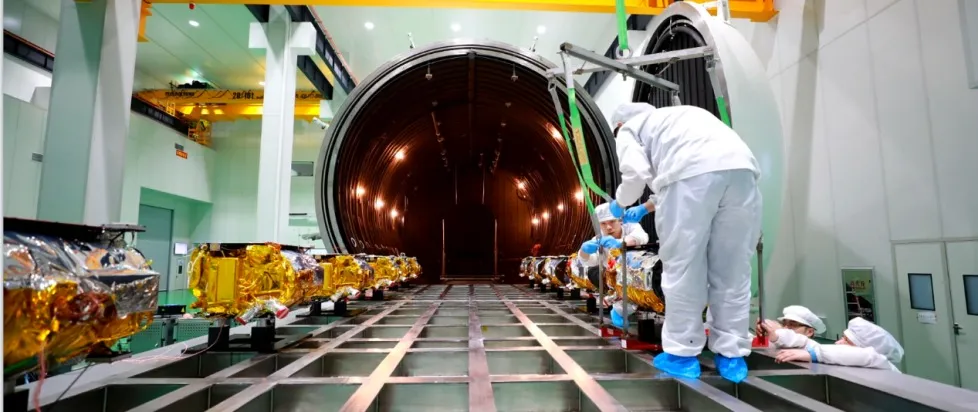
As a leader in the field, Changguang Satellite Technology Co., Ltd. is at the forefront of providing high-quality satellite remote sensing data. With a commitment to innovation and excellence, they offer a wide array of satellite imagery solutions tailored to meet diverse client needs. Their advanced satellite systems deliver high-resolution images and timely updates, making them an essential partner for industries ranging from agriculture to environmental monitoring. By choosing Changguang Satellite Technology, you invest in reliable data that drives effective decision-making.
Satellite Remote Sensing Data FAQs
1.What is satellite remote sensing data?
Satellite remote sensing data refers to information collected from satellites orbiting the Earth, which captures images and other data about the surface and atmosphere.
2.How can I access live satellite images?
Live satellite images can be accessed through various platforms that provide real-time data services, often utilizing advanced technologies to ensure up-to-date imagery.
3.What role does satellite remote sensing play in hydrological data assimilation?
Satellite remote sensing provides critical data that enhances hydrological models, allowing for improved water resource management, flood forecasting, and climate studies.
4.What industries benefit from satellite images remote sensing data?
Industries such as agriculture, environmental monitoring, urban planning, and disaster response all benefit from the insights provided by satellite images remote sensing data.
5.Why choose Changguang Satellite Technology Co., Ltd.?
Changguang Satellite Technology Co., Ltd. is a leader in providing high-quality satellite imagery solutions, ensuring reliable and accurate data tailored to meet the diverse needs of various industries.


