- AFRIKANINA
- albaney
- amharic
- Arabo
- Armeniana
- Azerbaijani
- Baska
- Belarusian
- Bengali
- Bosniaka
- biolgara
- Katalana
- Cebuano
- CHINE
- Korsika
- Kroaty
- TSEKY
- Danoà
- Anarana iombonana
- anglisy
- esperanto
- Estoniana
- Anarana
- FRANTSAY
- Frisian
- galisiana
- Zeorziana
- Anarana
- GRIKA
- Gujarati
- Kreole Haitiana
- Hausa
- Hawaii
- Hebreo
- tsy misy
- Miao
- hongariana
- Anarana
- igbo
- indonezianina
- TENY IRLANDEY
- ITALIANINA
- Anarana
- Javaney
- Kannada
- kazakh
- Khmer
- Rwanda
- Koreana
- Kiorda
- Kyrgyz
- asa
- Latina
- Zavatra tsy
- litoanianina
- Luxembourgish
- Masedoniana
- Malagasy
- Malay
- Malayalam
- Maltais
- Maori
- Marathi
- Mongoliana
- Madagascar
- Nepali
- norvejiana
- norvejiana
- Occitan
- Pashto
- PERSANINA
- poloney
- portogey
- Punjabi
- Malagasy Romanian
- ROSIANINA
- samoanina
- Gaelika Scottish
- serbianina
- anglisy
- Shona
- Sindhi
- Sinhala
- silaovaka
- Slovenianina
- Somali
- Fikarohana
- Sundanese
- swahili
- Anarana
- Tagalog
- Tajik
- Tamil
- Tatar
- Telugu
- Thai
- Tiorka
- Turkmen
- OKRAINIANA
- Urdu
- Uighur
- Uzbek
- vietnamiana
- valesa
- Vonjeo
- Yiddish
- Yoruba
- Zulu
Fampiharana an-tsaha fiarovana ny tontolo iainana
fikirana
|
Maitso sy ambany karbaona |
Blue Sky Defense |
|
Tombanana ny tahiry karbônina anaty ala |
Famakafakana momba ny fanaraha-maso ny loharanon'ny loton'ny rivotra sy ny fanapahan-kevitra mifehy |
|
Fanaraha-maso ny fananganana tetikasa injeniera madio |
Fanaraha-maso ny loharano tsy misy teboka amin'ny fandotoana vovoka amin'ny tany |
|
"Two high" project construction supervise ion |
Fanalana mololo eny an-tsaha sy fanaraha-maso ny fandoroana |
|
Fanaraha-maso ny zoning tontolo iainana ekolojika
|
fikirana
|
Ady fiarovana rano madio |
Ny ady hiarovana ny Tendrombohitra Maitso |
|
Famantarana vatana rano mainty sy maimbo an-tanàn-dehibe |
Fanombanana ny toetry ny tontolo iainana ala |
|
Famantarana ny fivoahan'ny renirano |
Fanaraha-maso ny asa fambolen-kazo nasionaly |
|
Famantarana fanitsakitsahana ny renirano sy ny farihy "fikorontanana efatra". |
Fanadihadiana momba ny fahasamihafana ara-tontolo iainana |
|
Fanaraha-maso ny mari-pana sy ny tatatra ny toby nokleary
|
Fanaraha-maso ny faritra fiarovana |
|
Fanodinana ny kalitaon'ny rano
|
|
Miady ho fiarovana ny tany madio |
Famaliana vonjy maika amin'ny loza ara-tontolo iainana |
|
Fanaraha-maso ny fako tsy ara-potoana |
Fanaraha-maso vonjy maika amin'ny doro ala |
| Fanaraha-maso ny fiarovana ny tany mainty |
Fanaraha-maso vonjy maika ny fipoahan'ny volkano |
|
Fanaraha-maso ny vatan-drano mainty sy maimbo any ambanivohitra |
Fanaraha-maso vonjy maika ny loza tondra-drano |
|
Fanodinana ny kalitaon'ny tany
|
Fanaraha-maso vonjy maika ny fiparitahan'ny solika eny an-dranomasina |
Fampiharana fanaraha-maso ny fahalotoan'ny rano an-tanàn-dehibe sy ambanivohitra mainty sy maimbo
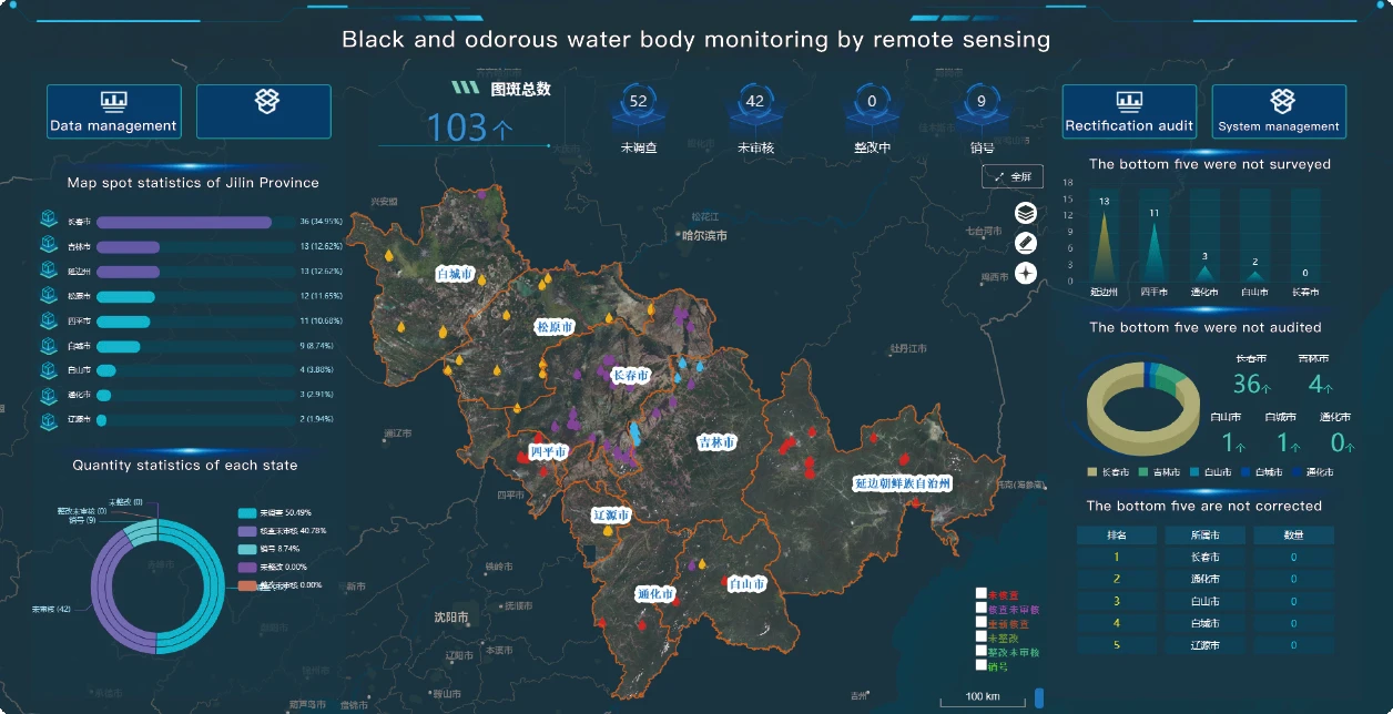
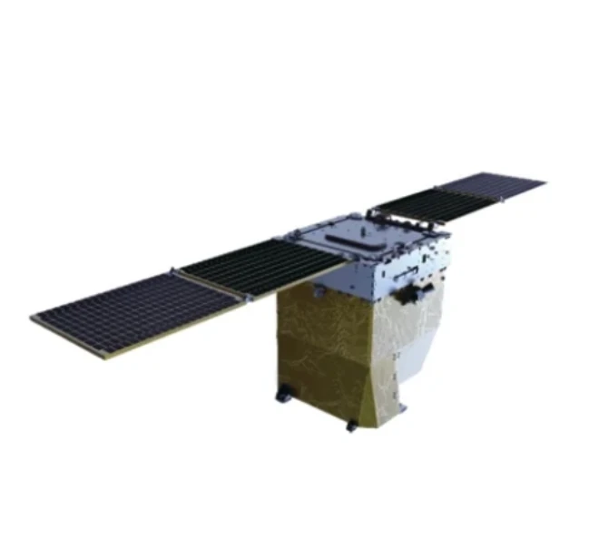
Ny rano mainty sy maimbo dia manondro ny fisian'ny rano mainty sy maimbo vokatry ny fandotoana organika ny tontolo iainana. Miorina amin'ny fomba fanaraha-maso mahomby amin'ny zanabolana Jilin-1, ny fangaraharana sy ny saturation ny vatan'ny rano dia nodinihina araka ny toetran'ny vatan'ny rano, ary ny angon-drakitra momba ny oksizenina levona sy ny amoniaka azota amin'ny tany dia natambatra mba hananganana modely famakafakana marani-tsaina sy mandeha ho azy ny vatana rano mainty sy maimbo, izay manome efijery lehibe ho an'ny sampan-draharahan'ny fitantanana. Mba hahatanteraka ny rafitra mavitrika fanaraha-maso ny rano mainty sy maimbo.
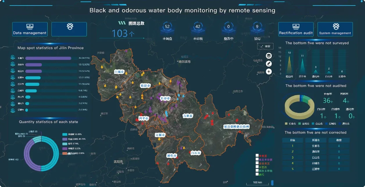
Technology-Driven Environmental Monitoring: How High-Resolution Remote Sensing Images Revolutionize Black-Odor Water Management
In the battle against water pollution, traditional black-odor water monitoring methods—reliant on manual sampling and sporadic field surveys—often fail to capture the dynamic nature of contamination. SpaceNavi’s high-resolution remote sensing images technology disrupts this paradigm, integrating satellite remote sensing data, advanced spatial analysis, and intelligent data acquisition systems to transform how environmental agencies detect, assess, and remediate polluted water bodies.
The Limitations of Conventional Monitoring
Manual sampling provides limited environmental data, capturing only point-in-time snapshots of water quality. Meanwhile, low-resolution satellite imagery struggles to identify small sources of pollution or track subtle changes in water turbidity. SpaceNavi addresses these gaps with 0.5m–2m resolution high-resolution remote sensing images, enabling:
Precise Contamination Mapping: Differentiating between algal blooms, industrial discharges, and urban runoff using spectral signatures in remote sensing data.
Dynamic Change Detection: Monitoring oxygen depletion zones hourly, rather than monthly, through continuous data feeds from our proprietary data acquisition system.
How High-Resolution Remote Sensing Redefines Management
Satellite Data Fusion for Holistic Insight
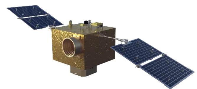
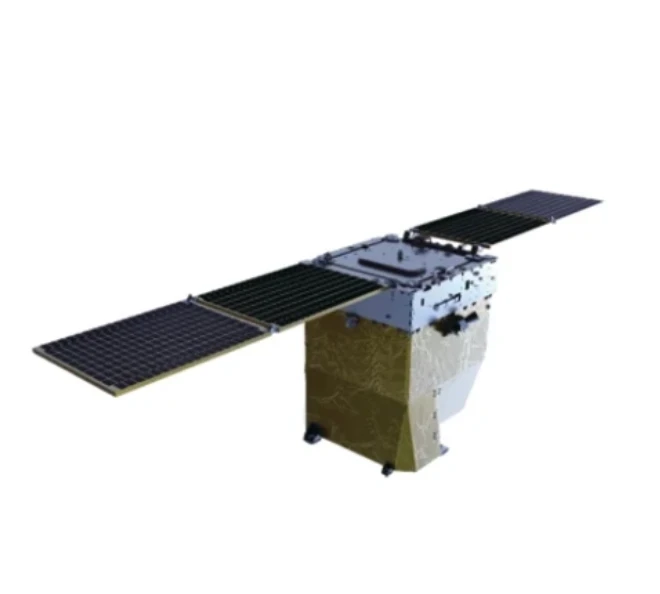
By integrating satellite remote sensing data from constellations like Jilin-1 with airborne LiDAR, we create 3D water quality models that visualize:
Chlorophyll-a concentration via 700nm band analysis
Suspended sediment loads using NIR reflectance indices
Thermal anomalies indicating industrial wastewater discharge
AI-Enhanced Spatial Analysis
Our machine learning algorithms process 1TB+ of daily imagery, using spatial analysis to:
Automatically detect black-odor water bodies with 92% accuracy
Predict pollution diffusion patterns based on hydrological models
Generate real-time risk maps for emergency response teams
Intelligent Data Acquisition Systems
Unlike static monitoring stations, our edge-computing data acquisition system adapts to changing conditions:
Deploying drones for sub-1m resolution when satellite revisit cycles are insufficient
Triggering in-situ sensor deployments based on remote sensing-derived pollution hotspots
Real-World Impact in Water Management
In a pilot project across China’s Yangtze River Delta:
High-resolution remote sensing images identified 37% more unauthorized discharges than traditional methods
Spatial analysis of environmental data reduced remediation response time from 72 hours to 8 hours
The integrated system cut annual monitoring costs by 40% while expanding coverage by 300%
The Future of Environmental Stewardship
SpaceNavi’s technology proves that remote sensing data, when combined with high-resolution imaging and intelligent data acquisition systems, can turn reactive water management into a proactive, predictive science. By providing policymakers with actionable insights from spatial analysis of pollution patterns, we’re not just mapping problems—we’re enabling data-driven solutions that restore aquatic ecosystems faster and more effectively than ever before.
For environmental agencies seeking to modernize their monitoring capabilities, the choice is clear: embrace high-resolution remote sensing as the cornerstone of your black-odor water management strategy, and unlock a new era of precision in environmental protection.
Satellite Remote Sensing Data Empowers Ecological Protection: A Full-Process Analysis from Patch Statistics to Pollution Tracing
In the realm of ecological conservation, satellite remote sensing data has emerged as a transformative tool, enabling unprecedented precision from macro-level patch statistics to micro-scale pollution source tracing. SpaceNavi’s integration of high-resolution imagery, intelligent data acquisition, and advanced spatial analysis redefines how environmental agencies leverage remote sensing data and satellite remote sensing data to safeguard ecosystems.
Bridging Traditional Gaps with Satellite Technology
Conventional ecological monitoring often relies on fragmented field surveys, yielding incomplete environmental data and delayed insights. SpaceNavi’s 0.5–2m resolution high-resolution remote sensing images, combined with multi-spectral satellite data, address this by:
Automated Patch Statistics: Using AI to classify land use patches (forest, wetland, urban) with 95% accuracy, reducing manual counting errors by 80%.
Real-time Change Detection: Monitoring deforestation or wetland degradation at weekly intervals, compared to traditional annual reports.
The Full Process: From Data Acquisition to Actionable Insights
1. Multi-source Data Acquisition
Our proprietary data acquisition system fuses:
Satellite Remote Sensing Data: From constellations like Jilin-1, capturing visible, NIR, and SWIR bands for material identification.
In-situ sensor data: Real-time water quality parameters (pH, dissolved oxygen) to validate satellite-derived indices.
2. Spatial Analysis for Pollution Tracing
Leveraging GIS and machine learning, we:
Map Pollution Transport: Model atmospheric/waterborne pollutant diffusion using wind/tide data integrated with satellite imagery.
Pinpoint Emission Sources: Identify industrial discharges by analyzing thermal anomalies and spectral signatures in remote sensing data.
Holistic Environmental Modeling
By merging environmental data (climate, biodiversity) with satellite insights, we create predictive models:
Forest carbon stock estimation with 3% error margin.
Algal bloom early warning systems based on chlorophyll-a concentration derived from high-resolution images.
Real-world Application in Ecological Governance
In a Northeast China forest reserve project:
Satellite remote sensing data detected 23% more illegal logging sites than ground patrols.
Spatial analysis of soil moisture from satellite images optimized reforestation site selection, increasing sapling survival by 40%.
The integrated system cut annual monitoring costs by 50% while expanding coverage by 300%.
The New Paradigm for Ecological Protection
SpaceNavi’s approach proves that satellite remote sensing data, when coupled with high-resolution imagery and intelligent data acquisition systems, transforms ecological protection from reactive to proactive. By enabling end-to-end workflows—from automated patch statistics to precise pollution tracing—we equip stakeholders with the tools to make data-driven decisions that preserve biodiversity and mitigate environmental risks.
For agencies seeking to modernize ecological monitoring, the fusion of remote sensing data, spatial analysis, and high-resolution imagery isn’t just a technology upgrade—it’s the foundation for sustainable environmental stewardship in the digital age.
