- африкалық
- албан
- амхар
- араб
- армян
- әзірбайжан
- баск
- белорус
- бенгал
- босниялық
- болгар
- каталон
- Себуано
- Қытай
- корсика
- хорват
- чех
- дат
- голланд
- Ағылшын
- эсперанто
- эстон
- фин
- француз
- фриз
- галисиан
- грузин
- неміс
- грек
- гуджарати
- Гаити креол
- Хауса
- гавай
- иврит
- Жоқ
- Миао
- венгр
- исланд
- игбо
- индонезиялық
- ирланд
- итальян
- жапон
- Яван
- Каннада
- қазақ
- кхмер
- Руанда
- корей
- күрд
- қырғыз
- Еңбек
- латын
- латыш
- литва
- Люксембург
- македон
- Малагаси
- малай
- малаялам
- мальталық
- маори
- Марати
- моңғол
- Мьянма
- Непал
- норвег
- норвег
- Окситан
- пушту
- парсы
- поляк
- португал
- Пенджаби
- румын
- орыс
- самоа
- Шотландтық гал
- серб
- Ағылшын
- Шона
- Синди
- Сингала
- словак
- словен
- Сомали
- испан
- сундан
- суахили
- швед
- Тагалог
- тәжік
- Тамил
- татар
- телугу
- тай
- түрік
- түрікмен
- украин
- урду
- ұйғыр
- өзбек
- вьетнамдық
- Уэльс
- Көмек
- идиш
- Йоруба
- Зулу
жаңалықтар
Unlocking the Power of Multispectral Satellite Technology
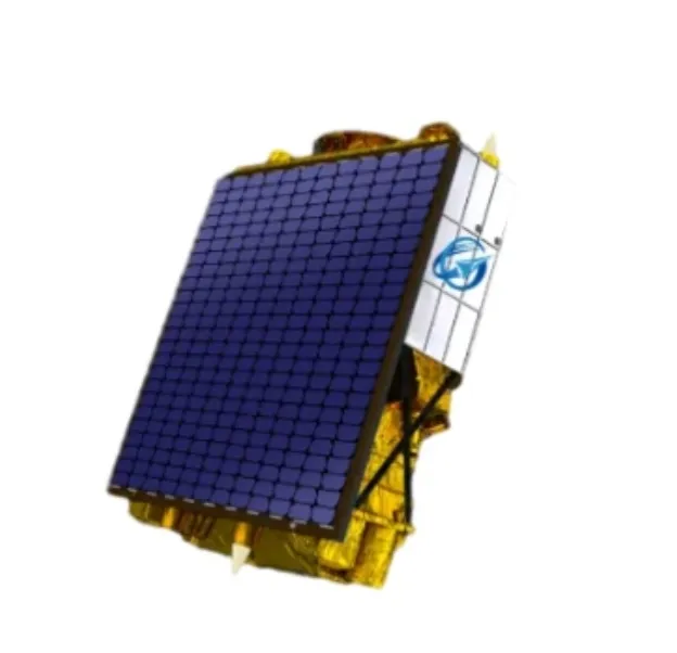
In today’s rapidly evolving world, the use of multispectral satellite technology has transformed the way we observe and analyze our planet. With the ability to capture data across multiple wavelengths, multispectral satellite imagery provides invaluable insights for industries ranging from agriculture to environmental monitoring and urban planning. This technology allows for more detailed and accurate assessments of natural resources, land use, and atmospheric conditions, paving the way for smarter decision-making on a global scale.
The Advantages of Multispectral Satellite Imagery in Agriculture
One of the most impactful applications of multispectral satellite imagery lies in the field of agriculture. Farmers and agronomists utilize these images to monitor crop health, detect diseases early, and optimize irrigation practices. Unlike traditional photography, multispectral satellite sensors capture data beyond the visible spectrum, including near-infrared bands, which are critical for assessing vegetation vigor. This ability to observe plant health remotely helps increase crop yields, reduce costs, and promote sustainable farming practices. With access to detailed multi spectral satellite imagery, precision agriculture has become a reality, helping farmers make data-driven decisions that enhance productivity.
Environmental Monitoring through Multispectral Satellite Data
Environmental scientists rely heavily on multispectral satellite data to monitor changes in ecosystems, track deforestation, and assess the health of water bodies. The versatility of multispectral satellite imagery enables the detection of subtle differences in vegetation types, soil moisture, and land degradation over time. Governments and conservation groups use this information to implement effective environmental policies and conservation strategies. By analyzing time-series multi spectral satellite imagery, researchers can identify trends that would be difficult or impossible to observe through ground surveys alone, facilitating proactive responses to climate change and natural disasters.
Urban Planning Enhanced by Multispectral Satellite Technology
Urban planners and local governments increasingly depend on multispectral satellite imagery to understand land use patterns and support sustainable city development. This technology offers a comprehensive view of urban sprawl, infrastructure, and green spaces, helping planners optimize zoning and resource allocation. The integration of multispectral satellite data into Geographic Information Systems (GIS) enables precise mapping and analysis, which supports smarter infrastructure investments and environmental impact assessments. With detailed multi spectral satellite imagery, cities can grow responsibly while preserving natural habitats and improving the quality of life for residents.
The advent of multispectral satellite technology continues to revolutionize multiple sectors by providing rich, detailed images that reveal the unseen details of our world. Whether in agriculture, environmental protection, or urban development, the value of multispectral satellite imagery lies in its capacity to provide actionable insights with unmatched precision. As satellite technology advances, the accessibility and resolution of multi spectral satellite imagery will only improve, empowering businesses, governments, and researchers to make more informed decisions for a sustainable future.


