- африкалық
- албан
- амхар
- араб
- армян
- әзірбайжан
- баск
- белорус
- бенгал
- босниялық
- болгар
- каталон
- Себуано
- Қытай
- корсика
- хорват
- чех
- дат
- голланд
- Ағылшын
- эсперанто
- эстон
- фин
- француз
- фриз
- галисиан
- грузин
- неміс
- грек
- гуджарати
- Гаити креол
- Хауса
- гавай
- иврит
- Жоқ
- Миао
- венгр
- исланд
- игбо
- индонезиялық
- ирланд
- итальян
- жапон
- Яван
- Каннада
- қазақ
- кхмер
- Руанда
- корей
- күрд
- қырғыз
- Еңбек
- латын
- латыш
- литва
- Люксембург
- македон
- Малагаси
- малай
- малаялам
- мальталық
- маори
- Марати
- моңғол
- Мьянма
- Непал
- норвег
- норвег
- Окситан
- пушту
- парсы
- поляк
- португал
- Пенджаби
- румын
- орыс
- самоа
- Шотландтық гал
- серб
- Ағылшын
- Шона
- Синди
- Сингала
- словак
- словен
- Сомали
- испан
- сундан
- суахили
- швед
- Тагалог
- тәжік
- Тамил
- татар
- телугу
- тай
- түрік
- түрікмен
- украин
- урду
- ұйғыр
- өзбек
- вьетнамдық
- Уэльс
- Көмек
- идиш
- Йоруба
- Зулу
жаңалықтар
Multispectral Satellite Imagery Driving Innovation In Urban Planning
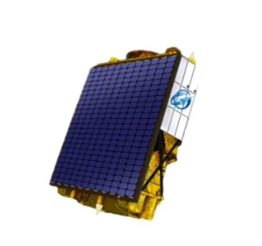
Urban planners and city officials are increasingly leveraging multispectral satellite imagery to create smarter, more sustainable cities. Thanks to the advanced capabilities of multispectral satellites, detailed information about urban heat islands, vegetation cover, and land use changes can be obtained, enabling data-driven decisions that improve quality of life and environmental health.
Understanding Urban Heat Islands With Multispectral Satellite Imagery
One major application of multispectral satellite imagery in urban areas is the monitoring of urban heat islands (UHI). By analyzing thermal and spectral data from multispectral satellites, planners can identify hotspots where temperatures significantly exceed those of surrounding rural areas.
This information guides strategies such as increasing green spaces, optimizing building materials, and planning urban layouts that reduce heat accumulation, thereby enhancing urban comfort and reducing energy consumption.
Mapping Vegetation And Land Use Changes In Cities
Multi spectral satellite imagery also provides insights into urban vegetation health and distribution, crucial for maintaining biodiversity and air quality. Monitoring land use changes through multispectral satellite data helps detect illegal construction, plan infrastructure expansion, and protect natural reserves within city boundaries.
The high temporal resolution of modern satellites allows for frequent updates, enabling planners to track development progress and environmental impacts continuously.
Integration With Satellite Communication For Real-Time Urban Monitoring
Effective urban management depends on timely access to data. Advances in satellite internet and VSAT technologies facilitate real-time transmission of multispectral satellite imagery to city management centers.
Cloud-based satellite as a service platforms support data processing and visualization, allowing urban planners to quickly interpret complex datasets and implement responsive policies.
In conclusion, multispectral satellite imagery is transforming urban planning by offering detailed environmental insights and enabling smarter city development. Coupled with robust satellite communication systems, these technologies support the creation of healthier, more resilient urban environments.
Бұл бірінші мақала


