- آفریقایی
- آلبانیایی
- آمهری
- عربی
- ارمنی
- آذربایجانی
- باسکی
- بلاروسی
- بنگالی
- بوسنیایی
- بلغاری
- کاتالان
- سبوانو
- چین
- کورسی
- کروات
- چک
- دانمارکی
- هلندی
- انگلیسی
- اسپرانتو
- استونیایی
- فنلاندی
- فرانسوی
- فریزی
- گالیسیایی
- گرجی
- آلمانی
- یونانی
- گجراتی
- کریول هائیتی
- هاوسا
- هاوایی
- عبری
- خیر
- میائو
- مجارستانی
- ایسلندی
- igbo
- اندونزیایی
- ایرلندی
- ایتالیایی
- ژاپنی
- جاوه ای
- کانادا
- قزاق
- خمر
- رواندا
- کره ای
- کردی
- قرقیزستان
- کار
- لاتین
- لتونی
- لیتوانیایی
- لوگزامبورگی
- مقدونی
- مالاگاسی
- مالایی
- مالایایی
- مالتی
- مائوری
- مراتی
- مغولی
- میانمار
- نپالی
- نروژی
- نروژی
- اکسیتان
- پشتو
- فارسی
- لهستانی
- پرتغالی
- پنجابی
- رومانیایی
- روسی
- ساموآ
- گیلیک اسکاتلندی
- صربی
- انگلیسی
- شونا
- سندی
- سینهالی
- اسلواکی
- اسلوونیایی
- سومالی
- اسپانیایی
- ساندانی
- سواحیلی
- سوئدی
- تاگالوگ
- تاجیک
- تامیل
- تاتاری
- تلوگو
- تایلندی
- ترکی
- ترکمن
- اوکراینی
- اردو
- اویغور
- ازبکستان
- ویتنامی
- ولزی
- کمک کنید
- ییدیش
- یوروبا
- زولو
Understanding Remote Sensing and Satellite Imagery
Remote sensing technology has transformed various industries, including agriculture, environmental monitoring, and urban planning. Satellite imagery and high-resolution remote sensing images provide critical insights for these sectors, offering a wealth of data that aids in decision-making processes. In this article, we will explore key aspects of high-resolution remote sensing images, satellite-based remote sensing, satellite imagery in remote sensing, types of remote sensing images, and how to get recent satellite images.
High-Resolution Remote Sensing Images
High-resolution remote sensing images are essential for detailed analysis in a wide range of fields. These images allow scientists, researchers, and businesses to assess areas with precision, offering data with pixel resolutions fine enough to distinguish small objects, such as individual buildings, roads, and vegetation types. In remote sensing, resolution typically refers to the level of detail visible in the image; the higher the resolution, the more detailed the information that can be extracted.
One of the main advantages of high-resolution remote sensing images is their ability to offer granular insights into land-use patterns, urban expansion, and environmental changes. These images are used in various applications like disaster monitoring, climate change studies, and land management. The ability to clearly identify small-scale features and minute details with high-resolution imagery enhances decision-making and planning across industries. Whether it's identifying crop health in precision agriculture or mapping urban sprawl, high-resolution remote sensing images offer crucial advantages in providing a comprehensive view of the land.
As the demand for more detailed information increases, many satellite platforms now provide images with resolutions as fine as a few centimeters. These high-resolution images offer unparalleled detail and precision, supporting everything from infrastructure development to emergency response planning.
Satellite-Based Remote Sensing
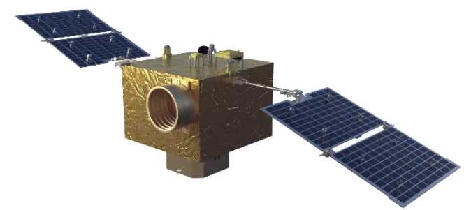
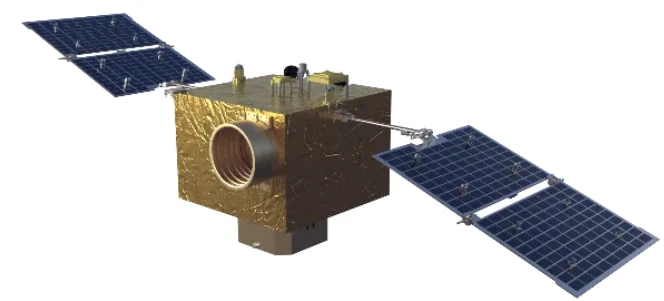
Satellite-based remote sensing refers to the use of satellites equipped with sensors and cameras to capture images and data of the Earth's surface. This technology plays a crucial role in gathering information about large areas that are otherwise difficult or costly to access. Through satellite-based remote sensing, users can monitor and analyze changes over time without the need for physical presence, making it an essential tool for environmental monitoring, natural resource management, and urban planning.
Satellite-based remote sensing allows for the continuous collection of data, providing near-real-time insights into a range of environmental and human activities. With the ability to cover vast areas, satellites can monitor changes in land use, deforestation, crop health, and even urban growth, which are crucial for long-term planning and policy-making. The technology also aids in disaster management by providing real-time imagery of affected areas, enabling quicker response times during emergencies.
Furthermore, advancements in satellite technology have enabled the development of a wide array of sensors that can detect different wavelengths of light, such as infrared and ultraviolet. This extends the capabilities of satellite-based remote sensing, enabling users to gather more detailed data and extract more valuable information, such as soil moisture content, vegetation health, and atmospheric conditions.
Satellite Imagery in Remote Sensing
Satellite imagery in remote sensing is one of the most widely used methods for collecting and analyzing data about the Earth's surface. It involves capturing images from space, which are then processed and analyzed for various purposes, such as environmental monitoring, resource management, and scientific research. This imagery can be taken in different spectral bands, providing diverse insights into the characteristics of the surface below.
Satellite imagery in remote sensing is used in a variety of fields, such as agriculture, urban planning, and disaster monitoring. For example, in agriculture, satellite imagery can track crop health, monitor irrigation systems, and detect pest infestations. In environmental studies, it can help track deforestation, urbanization, and climate change impacts. Satellite imagery in remote sensing also enables governments and organizations to plan more effectively by providing a bird's-eye view of regions that may be difficult to monitor using traditional methods.
One of the main advantages of satellite imagery in remote sensing is the ability to obtain consistent and reliable data over large geographical areas. These images are often combined with other data sources to create comprehensive analysis models that guide policymaking and environmental protection efforts.
Types of Remote Sensing Images
There are several types of remote sensing images, each suited for different applications and levels of analysis. These include optical, infrared, radar, and multispectral images. Types of remote sensing images vary based on the sensors used, the spectrum of light captured, and the resolution of the data.
Optical imagery is the most common and typically captures visible light, allowing for the creation of detailed images similar to photographs. This type of image is ideal for assessing visible features like vegetation, land cover, and urban areas. However, optical imagery may be limited in cloudy conditions or at night.
Infrared images are valuable for assessing heat emissions and monitoring vegetation health. These images are widely used in agriculture to monitor crop stress and in environmental studies to detect temperature variations or pollution levels.
Radar images, another type of remote sensing image, can penetrate clouds and are used for monitoring surface movements, such as detecting changes in ice sheets or tracking changes in ground elevation due to subsidence or earthquakes. Radar data is valuable in all weather conditions and provides unique insights that optical imagery cannot.
Finally, multispectral and hyperspectral images, which capture data across multiple wavelengths, provide comprehensive information on the Earth's surface. These images are ideal for applications in vegetation analysis, water quality monitoring, and land-use change detection. The various types of remote sensing images give users the ability to choose the best image type for their specific needs, ensuring more accurate and reliable results.
How to Get Recent Satellite Images
How to get recent satellite images is a question frequently asked by researchers, businesses, and governments seeking up-to-date information for decision-making. Obtaining the latest satellite imagery has become easier with the advent of online platforms and satellite data providers. Several organizations and commercial companies offer access to satellite imagery in remote sensing, enabling users to download recent images for analysis.
Many satellite operators, such as NASA, ESA, and private satellite companies, provide free access to recent satellite images through platforms like NASA Worldview and Google Earth Engine. These platforms allow users to explore various satellite images based on their location and time frame, making it easy to access real-time or near-real-time imagery.
In addition to free services, commercial companies like DigitalGlobe, Planet Labs, and Airbus also offer recent satellite images for purchase. These companies often provide high-resolution imagery and more frequent updates for clients who need more detailed and time-sensitive data. Users can choose to buy images based on specific locations, dates, and image resolutions.
For businesses and researchers working on long-term projects, maintaining a subscription to satellite imagery services can provide continuous access to updated data, ensuring they always have the most recent information available for their analyses.
High-Resolution Remote Sensing Images FAQs
What are high-resolution remote sensing images?
High-resolution remote sensing images refer to satellite or aerial images that provide fine detail, often measured in centimeters or meters, allowing for the identification of small objects and features on the Earth's surface.
What is satellite-based remote sensing?
Satellite-based remote sensing involves using satellites equipped with sensors to capture data and images of the Earth's surface, which can then be used for monitoring and analyzing various environmental, agricultural, and urban factors.
How does satellite imagery in remote sensing help environmental monitoring?
Satellite imagery in remote sensing helps by providing comprehensive, up-to-date views of large geographic areas, allowing for the assessment of environmental factors such as deforestation, water quality, and land-use changes.
What are the different types of remote sensing images?
The types of remote sensing images include optical, infrared, radar, and multispectral images, each offering unique insights based on the spectrum of light captured and the technology used.
How can I get recent satellite images?
To get recent satellite images, you can use free platforms like NASA Worldview or Google Earth Engine, or purchase high-resolution imagery from commercial satellite providers like DigitalGlobe or Planet Labs.


