- афрыканскі
- албанец
- Амхарская
- арабская
- армянская
- Азербайджанская
- Баскская
- беларускі
- бенгальская
- басьнійскі
- балгарская
- каталонская
- себуанскі
- Кітай
- Карсіканскі
- харвацкая
- чэшскі
- дацкая
- галандскі
- англійская
- Эсперанта
- эстонскі
- фінская
- французскі
- фрызская
- галісійскі
- грузінскі
- нямецкі
- грэцкі
- Гуджараці
- Гаіцянская крэольская
- Хаўса
- гавайскі
- іўрыт
- няма
- Мяо
- венгерскі
- ісландская
- ігбо
- інданезійскі
- ірландскі
- італьянскі
- Японскі
- яванскі
- каннада
- казахская
- кхмерская
- Руандыйскі
- карэйская
- курдская
- кіргізская
- Праца
- лацінка
- Латышскі
- літоўскі
- Люксембургскі
- Македонская
- малагасійскі
- малайская
- Малаялам
- мальтыйская
- Маоры
- Маратхі
- Мангольская
- М'янма
- непальская
- нарвежская
- нарвежская
- аксітанская
- пушту
- фарсі
- польскі
- партугальская
- Панджабі
- румынская
- рускі
- самаанская
- шатландская гэльская
- сербская
- англійская
- шона
- сіндхі
- сінгальская
- славацкая
- Славенская
- самалійская
- Іспанскі
- сунданская
- Суахілі
- шведская
- тагальская
- таджыкская
- тамільская
- татарскі
- Тэлугу
- Тайская
- турэцкая
- туркменскі
- украінскі
- Урду
- уйгурскі
- узбекская
- в'етнамская
- валійская
- Даведка
- Ідыш
- ёруба
- Зулу
Transforming Earth Observation with Remotely Sensed Satellite Imagery
Today’s global challenges—from climate change to urbanization—demand better information from above. Remotely sensed satellite imagery provides this advantage. At SpaceNavi Co., Ltd., we help clients harness the power of space to see more, know more, and act faster with reliable satellite-based solutions.
High Value Across Multiple Disciplines
Whether you're a government planning infrastructure or a research institute studying land use, remotely sensed satellite imagery delivers the spatial and temporal resolution needed for precise assessment. SpaceNavi’s satellites are designed for long-term performance and unmatched imaging clarity.
We enable access to high resolution remote sensing images that cover a wide range of electromagnetic bands—ideal for monitoring land, water, vegetation, and built environments.
Ground Truth Starts with Remote Sensing Satellite Image Accuracy
Our development team places strong emphasis on the precision of every remote sensing satellite image we deliver. Using advanced calibration techniques and in-orbit system checks, we minimize image drift and maximize fidelity.
Every payload is engineered for mission-specific requirements, whether the focus is on natural resource management or regional development planning.
Delivering Comprehensive Satellite Remote Sensing Data
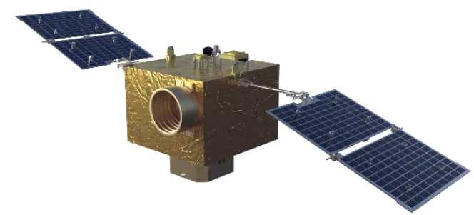
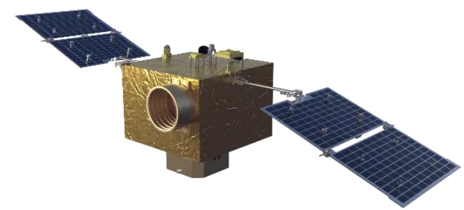
The backbone of any modern mapping or monitoring program is dependable satellite remote sensing data. SpaceNavi’s imaging satellites are built to collect and transmit accurate, usable datasets, minimizing noise and maximizing resolution.
Clients can choose from panchromatic, multispectral, or night time light satellite imagery depending on their mission goals, backed by our in-house analytics and technical support teams.
SpaceNavi understands the need for precise and actionable imagery, which is why our satellite platforms are designed to capture high resolution remote sensing images. These images provide clear and detailed views of landscapes, infrastructure, and environmental changes. SpaceNavi's R&D teams focus on achieving optimal sensor calibration and optical performance to produce remote sensing satellite image products that are reliable and mission-ready.
SpaceNavi: Your Trusted Partner in Remote Sensing
SpaceNavi doesn’t just provide satellites—we deliver insights. From launch to image processing, our solutions make remote sensing and satellite imagery more accessible, reliable, and powerful for clients worldwide.


