- афрыканскі
- албанец
- Амхарская
- арабская
- армянская
- Азербайджанская
- Баскская
- беларускі
- бенгальская
- басьнійскі
- балгарская
- каталонская
- себуанскі
- Кітай
- Карсіканскі
- харвацкая
- чэшскі
- дацкая
- галандскі
- англійская
- Эсперанта
- эстонскі
- фінская
- французскі
- фрызская
- галісійскі
- грузінскі
- нямецкі
- грэцкі
- Гуджараці
- Гаіцянская крэольская
- Хаўса
- гавайскі
- іўрыт
- няма
- Мяо
- венгерскі
- ісландская
- ігбо
- інданезійскі
- ірландскі
- італьянскі
- Японскі
- яванскі
- каннада
- казахская
- кхмерская
- Руандыйскі
- карэйская
- курдская
- кіргізская
- Праца
- лацінка
- Латышскі
- літоўскі
- Люксембургскі
- Македонская
- малагасійскі
- малайская
- Малаялам
- мальтыйская
- Маоры
- Маратхі
- Мангольская
- М'янма
- непальская
- нарвежская
- нарвежская
- аксітанская
- пушту
- фарсі
- польскі
- партугальская
- Панджабі
- румынская
- рускі
- самаанская
- шатландская гэльская
- сербская
- англійская
- шона
- сіндхі
- сінгальская
- славацкая
- Славенская
- самалійская
- Іспанскі
- сунданская
- Суахілі
- шведская
- тагальская
- таджыкская
- тамільская
- татарскі
- Тэлугу
- Тайская
- турэцкая
- туркменскі
- украінскі
- Урду
- уйгурскі
- узбекская
- в'етнамская
- валійская
- Даведка
- Ідыш
- ёруба
- Зулу
Third Article: Types Of Remote Sensing Images Empower Smarter Earth Observation
The diversity of types of remote sensing images available through satellites has dramatically expanded the potential applications of space-based Earth observation. SpaceNavi Co., Ltd. is proud to stand at the forefront of this evolution, offering a variety of imaging types through our in-house developed satellite platforms.
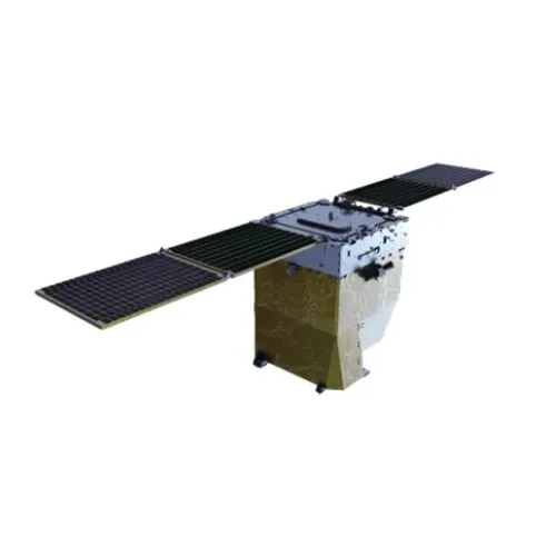
From panchromatic to hyperspectral data, we equip clients with the tools they need to make better decisions based on up-to-date satellite remote sensing intelligence.
Versatile Applications Using Satellite Remote Sensing Data
With SpaceNavi’s tailored satellite solutions, users gain access to powerful and scalable satellite remote sensing data. Whether you are monitoring coastal erosion, mapping agricultural fields, or tracking urban expansion, the data is processed and delivered through a streamlined cloud-based interface.
Our services incorporate advanced payloads that support acquisition of various types of remote sensing images, ensuring a match for every project’s scope and resolution requirements.
Real-Time Observations: How To Get Live Satellite Images
One of the most frequently asked questions in the modern era is how to get live satellite images. SpaceNavi answers this with our real-time monitoring capabilities built into our satellite network architecture. Customers can request targeted imaging and receive updates via API or user portal, enhancing reaction times in critical sectors such as emergency management and logistics.
We ensure our clients don’t just view the world—they interact with it dynamically, based on reliable, on-demand satellite remote sensing images.
Analyzing the Globe with Satellite Images Obtained By Remote Sensing
Understanding the Earth from above has never been more advanced. Our systems enable organizations to benefit from satellite images obtained by remote sensing, which combine multiple data layers for enhanced decision-making. Our technology supports pattern detection, change analysis, and forecasting through time-lapsed image sequences.
This makes satellite images remote sensing data used by city planners, agribusinesses, and environmental researchers indispensable for sustainable development and risk mitigation efforts.
Each Касмічныя караблі satellite platform is designed for mission-critical applications, ensuring that the satellite remote sensing experience delivers more than pictures—it delivers progress. From data acquisition to final analysis, we support global customers with the power to see more, know more, and act faster.


